
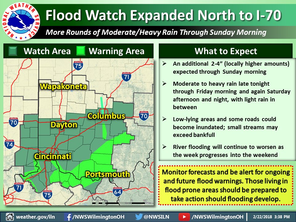
Torrential rains, a rising Ohio River to the highest level seen in years, weekend chances for severe weather, and an encore of winter eventually. No boredom in the weather department!

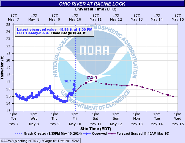
Despite the misprint, the Ohio River at Racine Lock on the Ohio-West Virginia border is projected to crest at a record high level of 60.5 feet:

| Current Convective Outlooks | |
|---|---|
Current Day 1 Outlook |
Forecaster: BUNTING/MEAD/COHEN Issued: 24/1627Z Valid: 24/1630Z – 25/1200Z Forecast Risk of Severe Storms: Enhanced Risk |
Current Day 2 Outlook |
Forecaster: DARROW Issued: 24/0440Z Valid: 25/1200Z – 26/1200Z Forecast Risk of Severe Storms: Enhanced Risk |
Current Day 3 Outlook |
Forecaster: DARROW Issued: 24/0702Z Valid: 26/1200Z – 27/1200Z Forecast Risk of Severe Storms: No Svr Tstms |
