
Flash Flood Watch
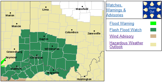
Flood Watch
National Weather Service Wilmington OH
902 PM EDT Mon Apr 2 2018

INZ050-058-059-066-073>075-080-KYZ089>100-OHZ060>063-070>073-
077>082-088-030915-
/O.NEW.KILN.FF.A.0001.180403T0400Z-180403T1600Z/
/00000.0.ER.000000T0000Z.000000T0000Z.000000T0000Z.OO/
Wayne-Fayette IN-Union IN-Franklin IN-Ripley-Dearborn-Ohio-
Switzerland-Carroll-Gallatin-Boone-Kenton-Campbell-Owen-Grant-
Pendleton-Bracken-Robertson-Mason-Lewis-Preble-Montgomery-Greene-
Fayette OH-Butler-Warren-Clinton-Ross-Hamilton-Clermont-Brown-
Highland-Adams-Pike-Scioto-
Including the cities of Richmond, Connersville, Liberty,
West College Corner, Brookville, Batesville, Milan, Versailles,
Lawrenceburg, Aurora, Rising Sun, Vevay, Carrollton, Warsaw,
Florence, Burlington, Oakbrook, Covington, Erlanger,
Independence, Newport, Alexandria, Owenton, Williamstown,
Crittenden, Dry Ridge, Falmouth, Butler, Augusta, Brooksville,
Mount Olivet, Maysville, Vanceburg, Tollesboro, Eaton, Camden,
Dayton, Kettering, Beavercreek, Fairborn, Xenia,
Washington Court House, Hamilton, Middletown, Fairfield, Oxford,
Mason, Lebanon, Springboro, Wilmington, Blanchester, Chillicothe,
Cincinnati, Milford, Georgetown, Mount Orab, Hillsboro,
Greenfield, West Union, Peebles, Waverly, Piketon, Portsmouth,
and Wheelersburg
902 PM EDT Mon Apr 2 2018

...FLASH FLOOD WATCH IN EFFECT FROM MIDNIGHT EDT TONIGHT THROUGH
TUESDAY MORNING...

The National Weather Service in Wilmington has issued a

* Flash Flood Watch for portions of Indiana, Kentucky, and Ohio,
  including the following areas, in Indiana, Dearborn, Fayette
  IN, Franklin IN, Ohio, Ripley, Switzerland, Union IN, and
  Wayne. In Kentucky, Boone, Bracken, Campbell, Carroll,
  Gallatin, Grant, Kenton, Lewis, Mason, Owen, Pendleton, and
  Robertson. In Ohio, Adams, Brown, Butler, Clermont, Clinton,
  Fayette OH, Greene, Hamilton, Highland, Montgomery, Pike,
  Preble, Ross, Scioto, and Warren.

* From midnight EDT tonight through Tuesday morning

* A warm front will lift northeast toward the Ohio Valley tonight.
  The front will continue north to the southern Great Lakes on
  Tuesday. Showers and thunderstorms will develop along and ahead
  of this front which will affect the region overnight into
  Tuesday morning. Rainfall amounts of 1 to 2 inches, with local
  higher amounts will be possible. This rainfall will fall on
  saturated soils, leading to the risk of flash flooding.

* Flash flooding, including the flooding of creeks and streams,
  will be possible with this rainfall event. Area rivers will
  likely see rises as well.

PRECAUTIONARY/PREPAREDNESS ACTIONS...

People in the watch area should keep an eye on the weather and be
prepared for immediate action should heavy rains and flooding
occur or a Flash Flood Warning be issued. Avoid low-lying areas,
and be careful when approaching highway dips and underpasses.

&&

$$
Hazardous Weather Outlook
National Weather Service Wilmington OH
409 PM EDT Mon Apr 2 2018

INZ058-059-066-073>075-080-KYZ089>100-OHZ070>073-077>082-088-032015-
Fayette IN-Union IN-Franklin IN-Ripley-Dearborn-Ohio-Switzerland-
Carroll-Gallatin-Boone-Kenton-Campbell-Owen-Grant-Pendleton-Bracken-
Robertson-Mason-Lewis-Butler-Warren-Clinton-Ross-Hamilton-Clermont-
Brown-Highland-Adams-Pike-Scioto-
409 PM EDT Mon Apr 2 2018

This Hazardous Weather Outlook is for East Central Indiana,
Southeast Indiana, Northeast Kentucky, Northern Kentucky, South
Central Ohio and Southwest Ohio.

.DAY ONE...This Afternoon and Tonight.

Heavy rain with embedded thunderstorms will move across the area late
tonight. Hail and flash flooding will be possible with these storms.

.DAYS TWO THROUGH SEVEN...Tuesday through Sunday.

Heavy rain with embedded thunderstorms will move across the area
early Tuesday morning. Hail and flash flooding will be possible with
these storms.

Gusty winds of up to 45 MPH will be possible Tuesday afternoon and
again late Tuesday night.

There is the potential for some thunderstorm development during the
late afternoon and into the evening hours. Threats with these storms
would be damaging winds, large hail, and isolated tornadoes. While
these storms are expected to be progressive in nature, any storms
that do development will have a flash flood threat due to saturated
grounds from previous heavy rainfall.

A line of storms is expected later Tuesday evening into early Tuesday
night. The main threat with these storms would be damaging winds,
however an isolated tornado cannot be ruled out.

.SPOTTER INFORMATION STATEMENT...

Spotter activation may be needed Tuesday into Tuesday evening.
