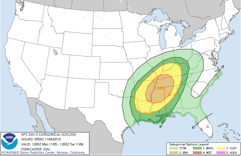
Day 2 Convective Outlook
NWS Storm Prediction Center Norman OK
1258 AM CDT Sun Nov 04 2018
Valid 051200Z – 061200Z
…THERE IS AN ENHANCED RISK OF SEVERE THUNDERSTORMS FROM THE LOWER MISSISSIPPI VALLEY INTO A PORTION OF THE TENNESSEE VALLEY…
…SUMMARY…
Numerous severe storms with potential for damaging wind and
tornadoes are expected Monday evening into the overnight from a
portion of the lower Mississippi Valley into the Tennessee and Ohio
Valleys.

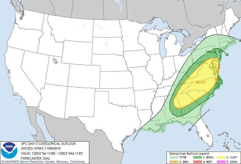
Day 3 Convective Outlook
NWS Storm Prediction Center Norman OK
0144 AM CST Sun Nov 04 2018
Valid 061200Z – 071200Z
…THERE IS A SLIGHT RISK OF SEVERE THUNDERSTORMS FROM A PORTION OF
THE SOUTHEAST STATES TO THE MIDDLE ATLANTIC REGION…
…SUMMARY…
A few strong to severe storms with locally strong wind gusts and
perhaps a couple of tornadoes will be possible from a portion of the
Southeast States to the Middle Atlantic region.


