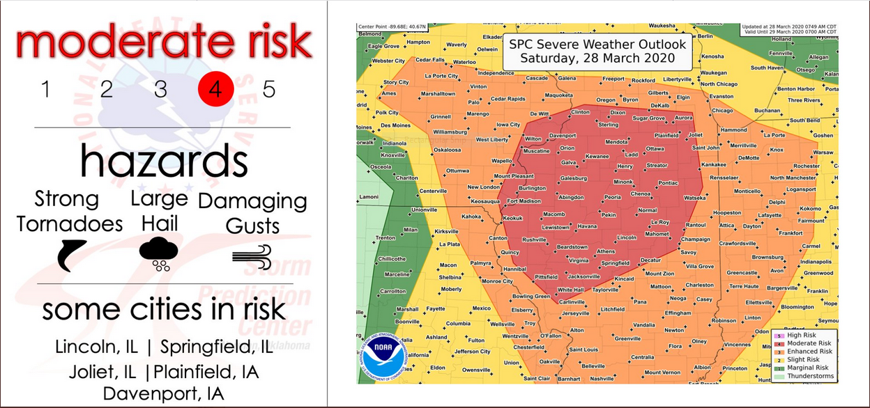
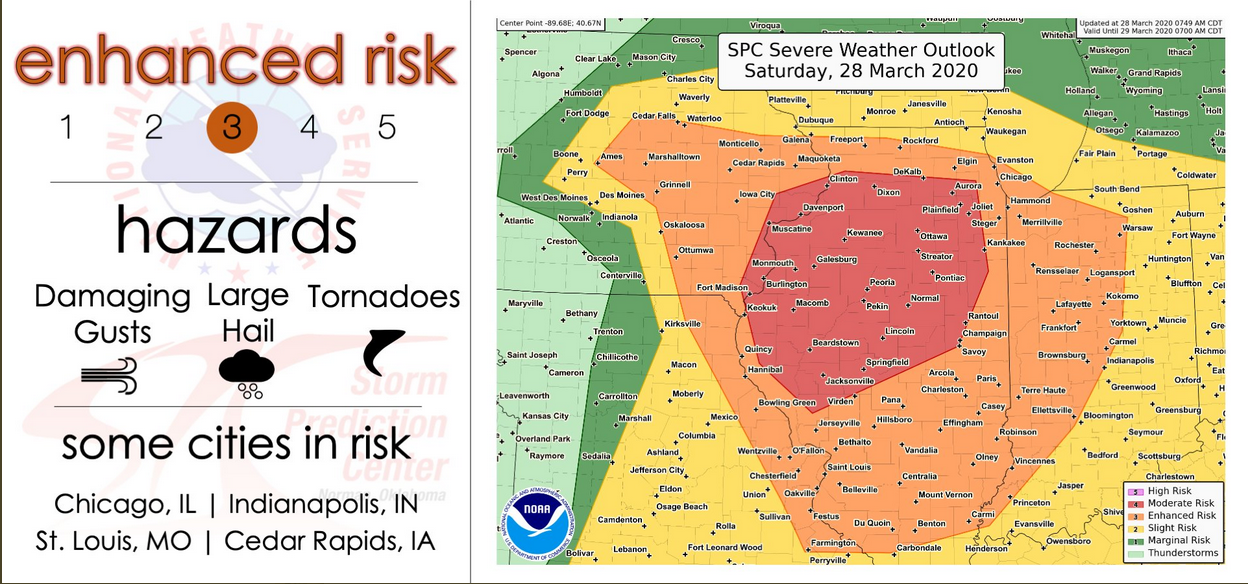
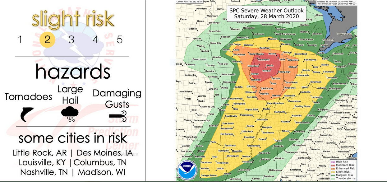
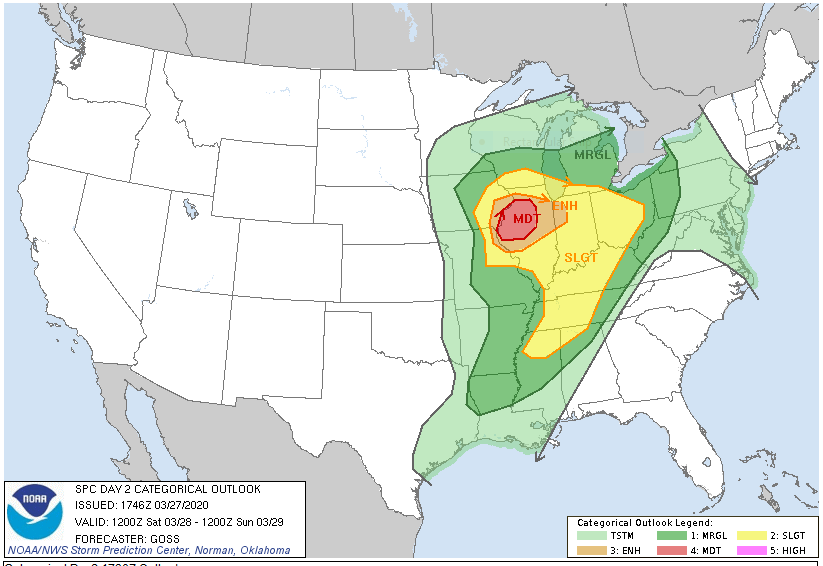
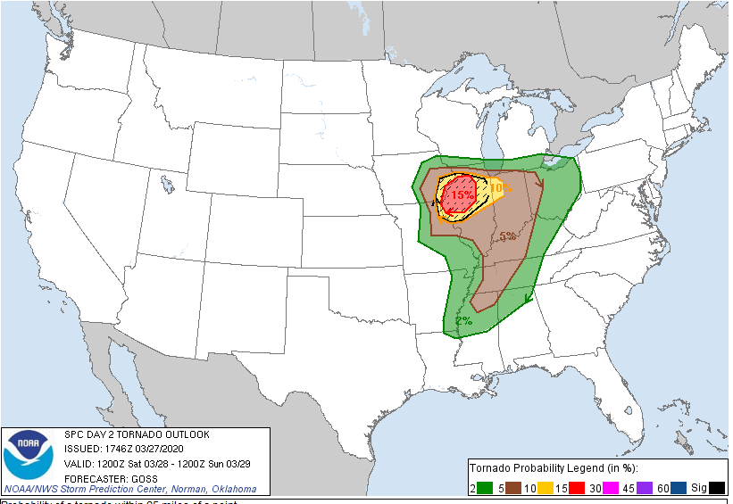
Mar 28, 2020 1300 UTC Day 1 Convective Outlook

Scattered thunderstorms are expected to form in episodic arcs from midday through this evening across parts of central/eastern IA, eastern MO, IL, and IN, moving northward to northeastward generally at 45-60 kt. This will include supercells with tornadoes (some long-tracked and significant at EF2+ damage levels), large and sometimes very large hail, and occasionally severe non-tornadic gusts. Given the fast storm motions, any tornadoes that do form may persist for nearly as many miles as minutes of time — at least, until supercells cross more than a short distance into what should be a very sharp warm-frontal zone.
–
This Hazardous Weather Outlook is for East Central Indiana,
Southeast Indiana, Northern Kentucky, Central Ohio, South Central
Ohio, Southwest Ohio and West Central Ohio:
.DAY ONE…Today and tonight.
Showers and thunderstorms will move across the area after midnight. There is the potential for a few storms to be severe with damaging straight-line winds the primary threat.
.DAYS TWO THROUGH SEVEN…Sunday through Friday.
Wind gusts of 40 to 50 mph are expected on Sunday.