A major dent in the Ohio valley drought and more rain is on the way. Ultimately, it will turn cold toward Halloween.

A lot has changed in Ohio valley moisture conditions in the past week.

A week ago drought covered a large amount of the midwest. Much of Indiana was in moderate drought as well as parts of northwest and southwest Ohio:
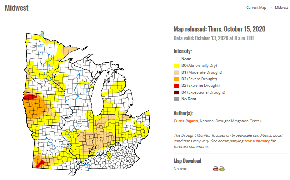
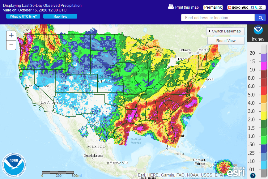
Over the past 7 days a large swath of one to as much as 5 inches of rain moved across the Ohio valley and the midwest:
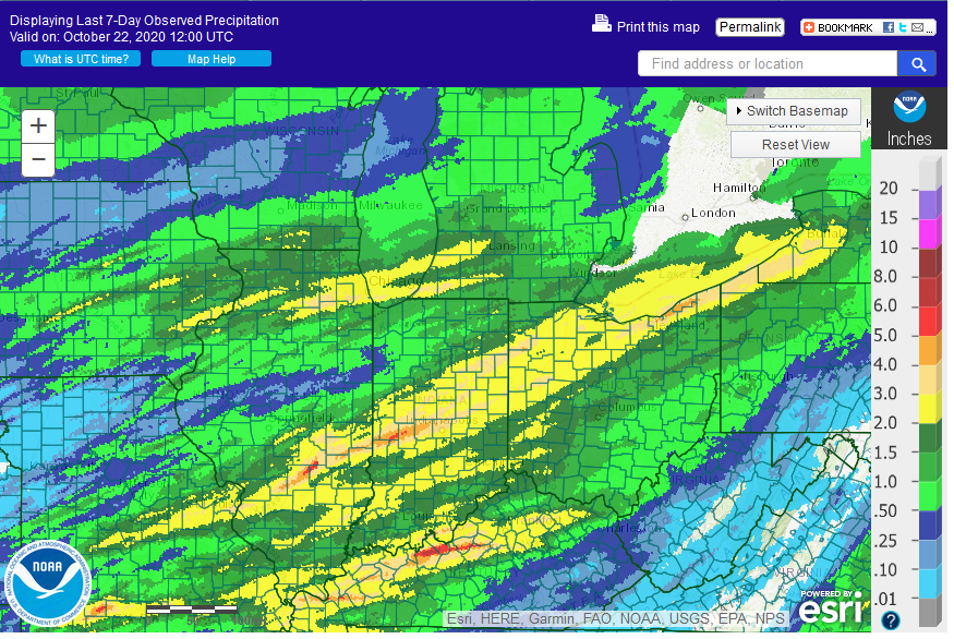
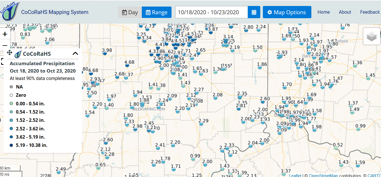
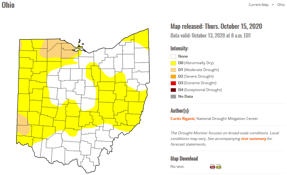
The new US Drought Monitor shows a significant decrease in drought extent and coverage. Much of the 7 day rainfall actually fell AFTER the recent drought monitor was compiled:
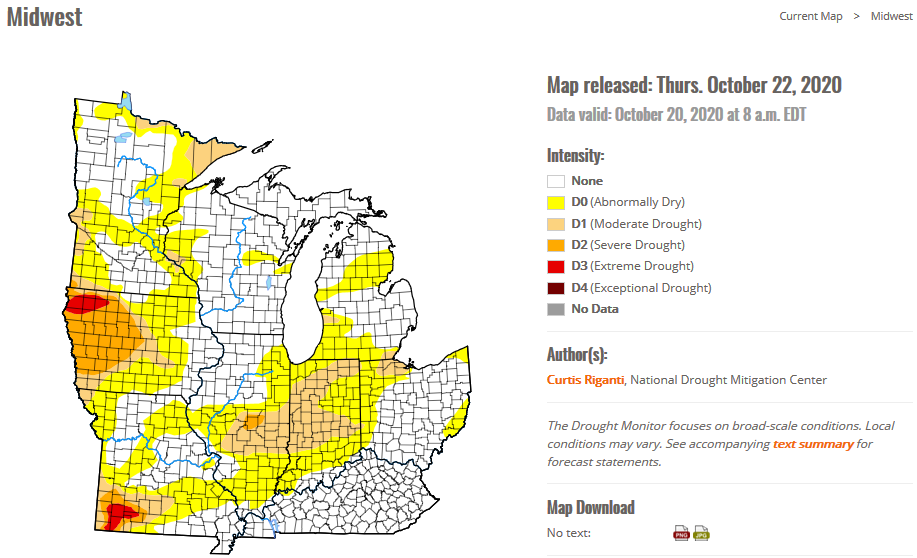
Much of Ohio had moved out of the dry category by the time the latest drought monitor was compiled on Tuesday and much of Indiana and Ohio that is still shown in drought had heavy rain and will likely be removed in the next drought monitor release.

More heavy rain is forecast in the next 7 days for the Ohio valley so I expect drought in the Ohio valley to be further eroded.

7 day Rainfall (melted snow) Forecast:

Day 11 image not available

By Halloween, cold and wet weather will prevail and it is not impossible that Cincinnati could see its first snowflakes of the season, kind of like last year. But that is over a week away. We’ll see how it all plays out.

Soil Moisture Condition Monitoring Weekly Report: Moderately Dry. Continued need to provide supplemental water to landscape trees and shrubs.

United States Drought Monitor

The latest drought monitor shows wide areas of drought in the western US, spreading eastward and encompassing parts of the midwest. There is serious drought in parts of New England. In Ohio, northwest Ohio has been in moderate drought and parts of southwest Ohio are now in moderate drought. National drought summary>>>

Station Number: OH-HM-24
Station Name: Cheviot 3.4 W
Report Date: 10/17/2020
Submitted: 10/17/2020 6:04 AM
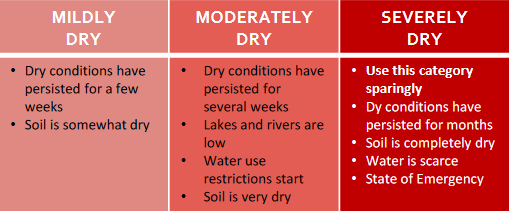
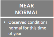
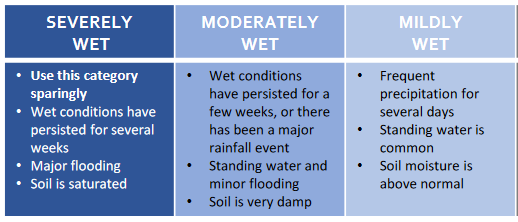
Scale Bar: Moderately Dry
Description:

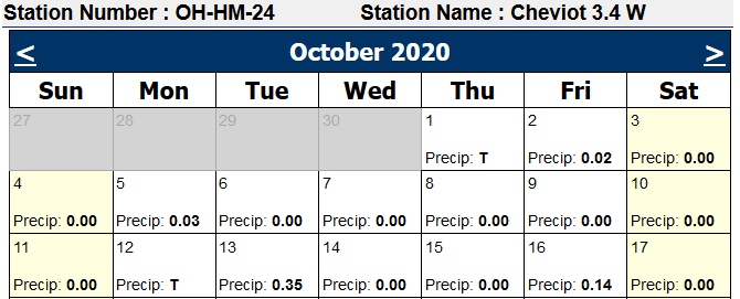
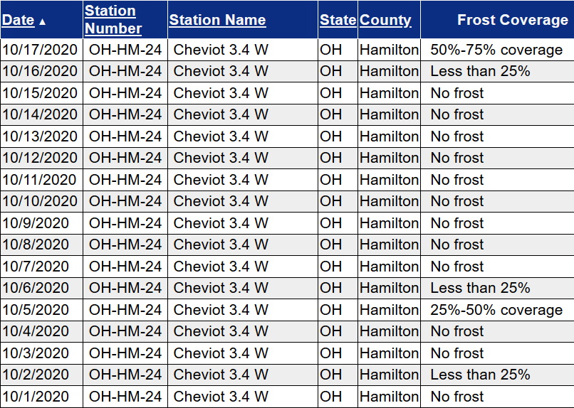
0.49 inches of rain in the past week with two rather small precipitation events. 0.54 inches of rain in October. Some improvement in surface moisture here but not a lot in the soil profile. Lawn is mostly green and little drought stress is noted. Cooler temperatures have slowed evaporation. Fall color is passing peak in many locations, quite early. Rainfall here has been a bit more generous over the past couple months than over much of the area. Dry conditions have persisted for weeks. Lakes and rivers are low. Continued need to provide supplemental water to landscape trees and shrubs, particularly in areas where rainfall was not as generous in the past few weeks.

Categories:
General Awareness
Agriculture
Business & Industry
Plants & Wildlife
Society & Public Health
Water Supply & Quality

This report is specifically for the Arbor Doctor’s location 3.4 miles west of Cheviot, OH, in the western suburbs of Cincinnati in southwest Ohio. This location is also an official cooperative observation site for the National Weather Service listed as Cheviot 3W.

What is the Condition Monitoring Report? See these links for more information:

Explanation of scale bar>>>

Search condition monitoring reports for the entire US>>>  

Interactive

Condition Monitoring

Static

Watershed Maps


Please remember to water…correctly!

Water once per week, one inch per week, under the entire branch spread, in the absence of rain, May through November. Either rainfall or your watering should equal the one inch per week. Put out a sprinkler and a straight sided soup can or rain gauge and measure one inch per week.


Drought:                                                                                                                     >>>


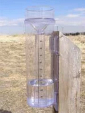
1-inch capacity rain gauge  >>>

Taylor rain gauge   >>>

Watering: How and when>>>

Watering Trees and Shrubs>>>


Soil Moisture Index:

Meteorological Versus Astronomical Seasons

Spring: March 1-May 31; Summer: June 1-August 31; Fall: September 1-November 30; Winter: December 1-February 28 (29)


You may have noticed that Arbor Doctor, meteorologists and climatologists define seasons differently from “regular” or astronomical spring, summer, fall, and winter. So, why do  meteorological and astronomical seasons begin and end at different times? Climatologically, the period July 14-21, the mid-point of meteorological summer, is the hottest week of the year and the period January 14-21, the mid-point of meteorological winter, is the coldest week of the year over much of the continental US including the Ohio valley.

Read more here>>>

U.S. Winter Outlook: Cooler North, warmer South with ongoing La Nina

A car drives on a snow-covered local road in suburban northwest Chicago in 2018.

NOAA’s winter forecast for the U.S. favors warmer, drier conditions across the southern tier of the U.S., and cooler, wetter conditions in the North, thanks in part to an ongoing La Nina. Forecasters at NOAA’s Climate Prediction Center — a division of the National Weather Service — are also closely monitoring persistent drought during the winter months ahead, with more than 45% of the continental U.S. now experiencing drought.

Read more here>>>