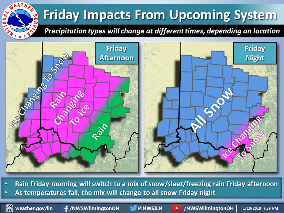
[7:54 PM] On Friday, we expect rain to change to a mix of freezing rain and sleet, before changing to snow. This changeover will happen at different times depending on your location. Everyone should be prepared for ice and snow accumulations Friday into Friday night.

[7:55 PM] Depending on the actual track and strength of the system, some areas will see heavier accumulations than others by Friday night. Stay tuned for further updates.
——————————————
This Hazardous Weather Outlook is for East Central Indiana,
Southeast Indiana, Northern Kentucky, Central Ohio, Southwest Ohio
and West Central Ohio.
.A low pressure system is forecast to move northeast from the
Tennessee Valley to the eastern Great Lakes Friday into Saturday.
Rain is expected to transition over to a wintry mix Friday afternoon
and then gradually change over to snow Friday night. Accumulating
snow will be likely along with some ice accumulation. Any slight
track differences with this system will have large implications on
the potential weather types and impacts. This weather event will have
to be watched carefully as the week progresses.
39.16°N 84.69°W (Elev. 801 ft)

