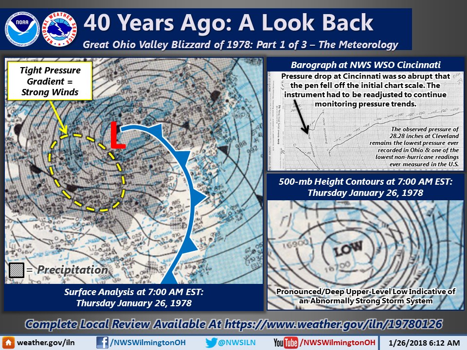
You may have heard of a potential snow in about a week in the Ohio Valley. The chance is there. It is MUCH too early for specifics. If you need advance notice, it is something to watch.
 This is the liquid precipitation outlook for the 6-7 day period. It shows a lot of moisture and temperatures will be getting colder. DO NOT MAKE THE MISTAKE OF ASSUMING THIS WILL ALL BE SNOW. It likely will not be.
This storm is leading in a pattern change, back to colder similar to what we saw in January in the east. Here is the 8-14 day temperature and precipitation outlook:
| Temperature
|
| Precipitation
|