40th Anniversary – Great Ohio Valley Blizzard of 1978

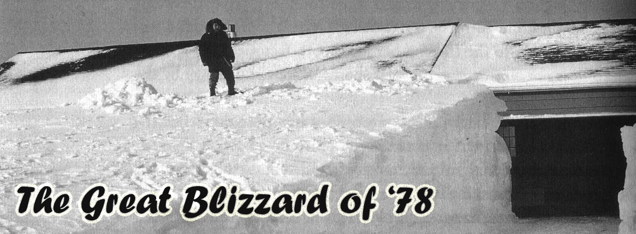
Several decades ago, the Ohio Valley and Great Lakes were paralyzed by one of the worst winter storms to ever sweep across the region. Transportation, schools, and businesses were shut down for days. The “Great Blizzard of 1978” dumped vast amounts of snow across the region and caused widespread near-hurricane strength wind gusts that heaped snow into enormous drifts. A legend to those who lived through it, this once-in-a-lifetime storm will always be the standard by which the severities of all future winter storms to hit this region are judged. Read more here>>>


Additional Details for CVG, CMH, and DAY.
Summary from NWS Akron, OH (Special Weather Statement from Feb 1, 1978)>>>
Summary from NWS Northern Indiana>>>
Summary from NWS Cleveland>>>
Summary from NWS Indianapolis>>>

Can Spring Be Far Behind?

It’s been a really cold winter. However, Silver Mapledespite that, we had a couple really warm days last week. Because of that, we have already accumulated 7-9 growing degree days in Cincinnati and 5 in Columbus. Silver maple comes into bloom at 34 degree days. This week is the coldest week of the winter. After this, we begin to slowly warm toward the first day of meteorological spring. We are already 7-9 growing degree days closer!

The GDD on 1/14 in previous years was:

    • 2017: 13
    • 2016: 2
    • 2015: 5
    • 2014: 2
    • 2013: 16
    • 2012: 8

Unlike the past few years, this year has been fairly consistently cold. High temperatures have been below freezing on 8 of 14 days. Lows have hit 0 or below 5 times, bottoming out at -7F. At least 1 inch of snow has been on the ground every day but 3 since Christmas Eve.

What are Growing Degree Days? Click here for more information>>>

Ohio State Phenology Calendar>>>

Winter Intermission May Be Followed By Quite The Encore

An extended January thaw is taking hold in the eastern United States. Much milder conditions will prevail and much snow will melt in the east as something insideous builds to the west, promising to bring a significant encore to the winter of 2018.

http://www.cpc.ncep.noaa.gov/products/predictions/814day/814temp.new.gif

Even 14 days out, warm air will prevail in the east while cold air prevails to the west.


8 to 14 Day Outlook - Precipitation Probability

This will not be a tranquil pattern, however. The same jet stream configuration bringing warm air to the east will drive a series of storms with abundant precipitation.

Winter storm watches are up in the plains and upper midwest as the first of a series of storms bring rain and snow to California and deepen the snow pack in the northern and north-central US. With a deep snow pack over so much of North America, computer models are pointing toward a return to winter in the east about 14-18 days out, a return which could rival the winter we have already seen. In the meantime, the weather will not be boring.