
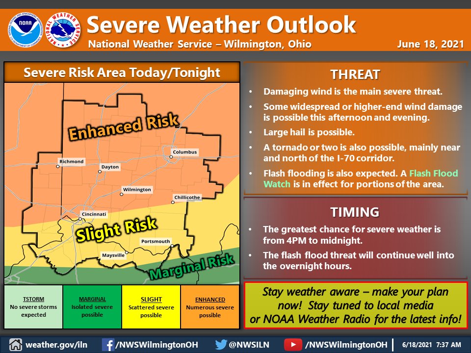
Scattered severe storms will be probable Friday across Illinois, Indiana, and Ohio. Severe gusts, possibly significant, will be capable of swaths of wind damage with the more intense storms. A couple of tornadoes are possible in addition to large hail.
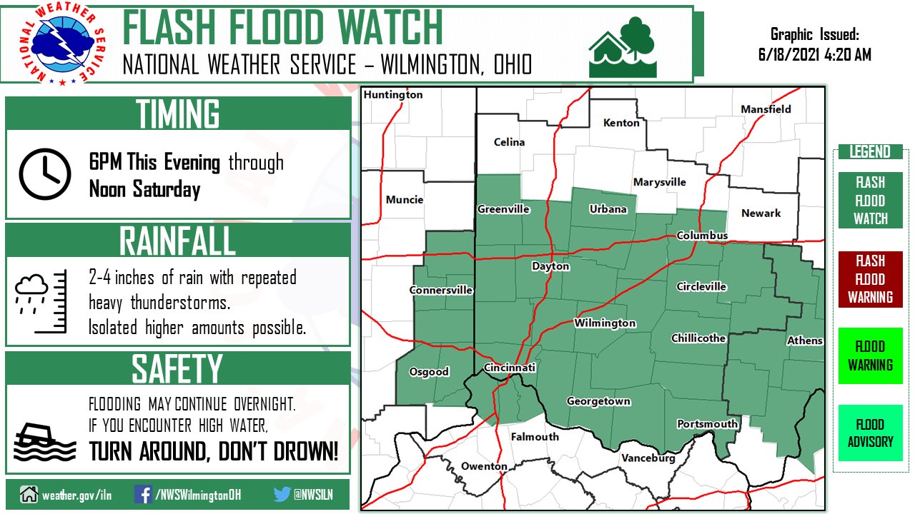
…FLASH FLOOD WATCH REMAINS IN EFFECT FROM THIS EVENING THROUGH SATURDAY MORNING…
The Flash Flood Watch continues for
* Portions of Indiana…Northern Kentucky and Ohio, including the
following counties, in Indiana, Dearborn, Fayette IN, Franklin IN,
Ohio, Ripley, Union IN and Wayne. In Northern Kentucky, Boone,
Campbell and Kenton. In Ohio, Adams, Brown, Butler, Champaign,
Clark, Clermont, Clinton, Darke, Fairfield, Fayette OH, Franklin
OH, Greene, Hamilton, Highland, Hocking, Madison, Miami,
Montgomery, Pickaway, Pike, Preble, Ross, Scioto and Warren.
* From this evening through Saturday morning.
* Showers and thunderstorms are expected to develop late this
afternoon and continue into the overnight hours. The rain will be
heavy at times with rainfall rates of 1 to 2 inches an hour
possible in some of the storms. In areas of repeated storms,
rainfall amounts of 2 to 4 inches will be possible.
PRECAUTIONARY/PREPAREDNESS ACTIONS…
People in the watch area should keep an eye on the weather and be
prepared for immediate action should heavy rains and flooding occur
or a Flash Flood Warning be issued. Avoid low-lying areas and be
careful when approaching highway dips and underpasses.
