Air Quality Cincinnati>>>
Air Quality NOAA Smoke Modeling>>>
Alaska Sea Ice NWS>>>
AmericanWx>>>, a weather-centric forum in which enthusiasts and meteorologists alike discuss model runs, observe the weather and simply socialize.
Avalanches: Eastern SierraAvalancheCenter
Avalanches: SierraAvalancheCenter | Backcountry Avalanche, Snow, and …
Aviation: Blancolirio Channel. Information, facts, observations, and informing the public.
Aviation: Captain Joe 
Aviation: FAA including Alaska and Canada
Aviation: Kathryn’s Report
Aviation: VASAviation. 
Aviation Safety Network
Aviation Weather
“Blizzard of ’78” in Southern New England>>>
Canadian Weather – EnvironmentCanada
Cloud Atlas 
CoCoRaHS! “Volunteers working together to measure precipitation across the nations”. 
–
–
CoCoRaHS Reports from Wilmington Forecast Area
CoCoRaHS Station Identifier Lookup
–
Contrail Science:
Dewpoint calculator>>>
.

.
Drought: Canada Drought Monitor>>>
Drought: US Drought Monitor>>>
Drought: Visual Drought Atlas
Duke Energy Outage Maps: Ohio, Kentucky, Indiana, Florida, Carolinas>>>
Earth Observatory Image of the Day
Eclipses
For Spacious Skies: Teach The Children To Look Up
Forest Fires. Active US fires information and maps. USDA forest service.
Fujita: Mr. Tornado ONE MAN’S PURSUIT TO UNDERSTAND THE DEADLIEST STORMS.
Geography : People need to be able to find their homes on a map:
Glossary, National Weather Service
GOES 16/17 Loop of the Day, hosted by our friends at CIRA (Cooperative Institute for Research in the Atmosphere)
Groundhog Day: 
Groundhog Day: 
Hamilton County Emergency Management Agency
Highs and Lows of Air Pressure
Global Patterns: Pacific/North American:
| El Niño-Southern Oscillation | Arctic & North Atlantic Oscillations | Pacific/North American Pattern | Pacific Decadal Oscillation | Interactions | Influence of Snowfall | Current Conditions |
Great lakes information and ice cover: 
Hurricanes:
- Worldwide Tropical Cyclone Centers>>>
- Canadian Hurricane Centre>>>
- Joint Typhoon Warning Center>>>
- National Hurricane Center>>>
- Other Tropical Cyclone Centers>>>
- WMO Severe Weather Info Centre>>>
Ice Accretion Measurement 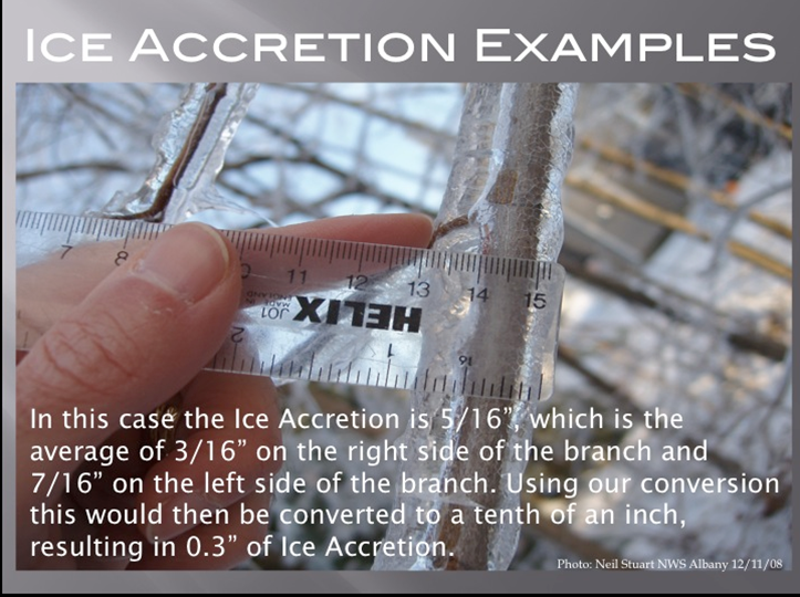
Indiana State Climate Office
Indianapolis Great Blizzard of 1978
International Weather
JetStream, the National Weather Service Online Weather School. This site is designed to help educators, emergency managers, or anyone interested in learning about weather and weather safety.
Kentucky Climate Center
Kentucky Mesonet
Kentucky Weather Center
Lake Mead Water Level>>>
Lake Oroville Water Level>>>
Lake Powell Water Level>>>
Lakes Online Water Levels for lakes across the country>>>
LeConte: http://www.highonleconte.com/blog-daily-posts
Lightning Science
MetEd, which is run by the University Corporation for Atmospheric Research. It features hundreds of free online educational lessons and allows you to enroll at your own pace.
Meteorological Versus Astronomical Seasons
Spring: March 1-May 31; Summer: June 1-August 31; Fall: September 1-November 30; Winter: December 1-February 28 (29)
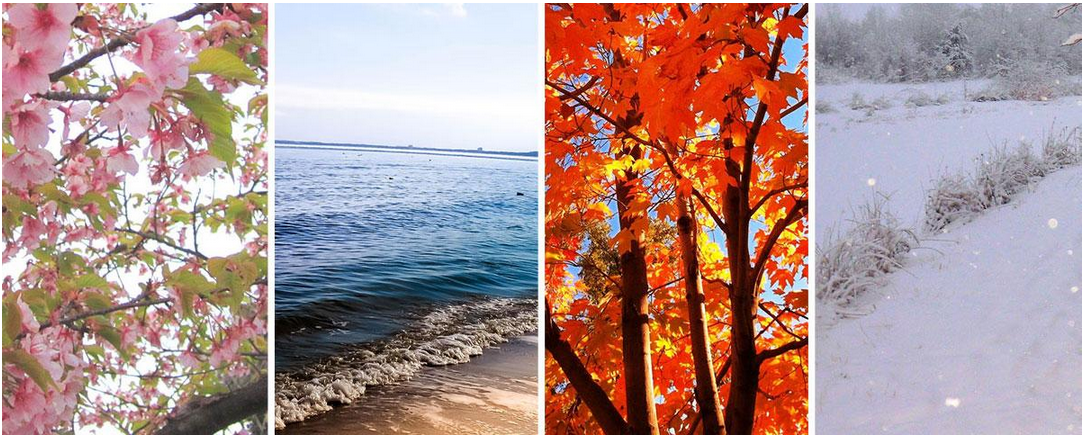
You may have noticed that Arbor Doctor, meteorologists and climatologists define seasons differently from “regular” or astronomical spring, summer, fall, and winter. So, why do meteorological and astronomical seasons begin and end at different times? Read more here>>>
–
Midwest Regional Climate Center>>>
Mount Washington, New Hampshire Observatory. Home of the World’s Worst Weather.
Mount Washington Observatory Observer Comments
mPING Real Time US Precipitation Reports
NOAA Weather Radio Cincinnati KIH42>>>
 https://www.weather.gov/iln/
 Mobile Friendly NWS ILN Link
NWS Glossary of Terms>>>
NWS Ohio River Forecast Center>>>
NWS Warning Decision Training Division>>>
NWS Wilmington OH Area CoCoRaHS Summary>>>
NWS Wilmington OH Area Cooperative Observer Reports (Ron Rothhaas is listed as Cheviot 3.4W by CoCoRaHS. This descripter is rounded to Cheviot 3W for the Cooperative Observer program)>>>
NWS Wilmington, Ohio Archived Event Summaries>>>
Ohio State Climate Office>>>

Ohio State Climate Office: Climate Maps of Ohio>>>
Ohio Winter of 1977>>>
Penn State’s online weather forecasting certificate>>>
Pivotal Weather>>>
Polar Vortex, What is it? 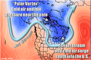
Real Time Ohio Traffic and Traffic Cameras
Real Time US lightning data 
Ryan Hall Y’all. Ryan Hall (y’all) is a youtuber and weather analyst based in eastern kentucky.
Seasons: What causes the seasons?
Severe Weather 101: Thunderstorms, Tornadoes, Floods, Lightning, Hail, Wind, Winter Weather
Severe Weather Event Summaries
Storm Reports | Monthly/Annual Summaries | Fatal Tornadoes
Trend Chart and Data | Radar Coverage Climatology | Online Severe Plot
Severe Thunderstorm Events Archive | SVR GIS Page
Snow Cover U.S. and Northern Hemisphere >>>
The Snow Booklet
–
Snowforecast.com
Snowplownews.com/
–
–
Soil Temperature Map
Sunrise and Sunset Calculator
Time: 
Tornadoes. Explanation of Enhanced Fujita Scale to rate tornado intensity>>>
Tornadoes: Joplin, MO EF5 report by Tim Marshall et al
———————————————————————————————–
Tornadoes: Super Outbreak of Tornadoes – April 3-4, 1974:
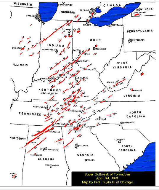
Map by Dr. T. Fujita, University of Chicago
Tornado number 43, the Saylor Park F5, is the only tornado I ever personally witnessed. I was in third grade. More information here>>>
—————————————————————————–
