Trick-or-Treat may dry out, at least some, in parts of Cincinnati metro but it will still be wet and windy. Heavy rain expected and then the first freeze of the season this weekend. Can’t rule out first snowflakes of the season either.

It appears that there is a glimmer of hope for trick-or-treaters on Halloween evening.

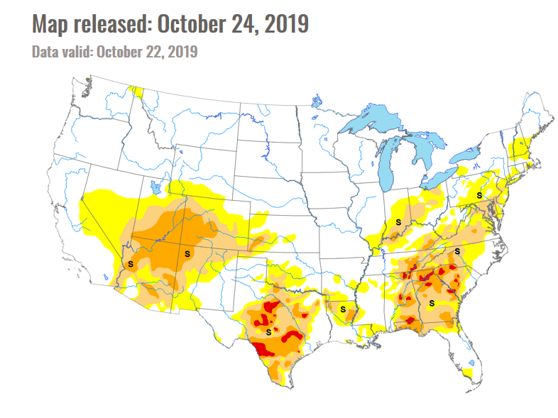
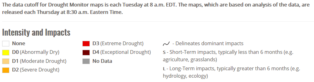
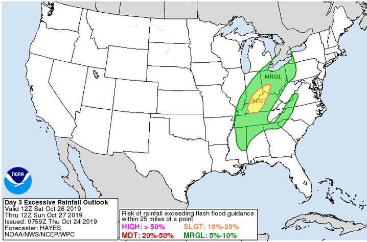
A vigorous weather system and strong cold front will bring copious rains to the Ohio valley Wednesday and Thursday.  1-2 inches of rain may accumulate in some areas, doing a number on lingering drought conditions.

3 day rainfall forecast:
Day 7 image not available

Rain will be heavy at times Wednesday and Thursday, with increasing winds. However, as we near trick-or-treat time on Halloween evening, which for many areas is from 6-8 PM, the rain may begin winding down while the wind picks up.

Here is the hourly wind and rain projection:

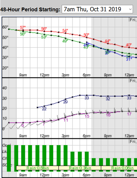
According to this current projection, which is subject to change, steady and heavy rain will be an almost certainty through 3PM on the 31st. From 3-6 PM, rain remains likely, then reduces to just a chance after 6PM.  The top graph is the wind, which is projected to be 15 mph gusting to over 30 mph.

This is a close call, and it is likely rain may be winding down but not totally ended during trick-or-treat. The most likely parts of the Cincinnati metro to dry out for trick-or-treat will be well northwest of I-71, while areas well southeast of I-71 are likely to see a continued deluge.

With the drier air, temperatures will begin to fall. While Halloween looks cool and windy, it looks like the coldest chill may hold off until a bit later. I can’t rule out a few snowflakes Halloween night, especially in west central Ohio, but no accumulation is expected.

By 7AM on November 1,  All Saints Day, temperatures are forecast to be in the 30’s with a stiff breeze. Saturday and Sunday morning will likely be visited by the first killing frost of the year with temperatures falling to the upper 20’s to low 30’s.

As always, it could be worst. There is a snowstorm in Denver, CO, and snow may extend to Milwaukee, WI, by the end of the week.


Soil Moisture Condition Monitoring Weekly Report: Moderately Dry

Station Number: OH-HM-24
Station Name: Cheviot 3.4 W
Report Date: 10/25/2019
Submitted: 10/25/2019 9:34 PM
Scale Bar: Moderately Dry
Description:

Soil moisture is absent. Only 0.04 inches of rain in the past 7 days and 1.07 inches of rain in October. Grass is somewhat green owing to enough rain to wet the surface and cool autumn temperatures. Unirrigated trees and shrubs are quite stressed and losses unirrigated trees planted this season have been observed. Dry conditions have been great for harvesting. The dry fall has also resulted in a reported excellent grape harvest for many.

Categories:
General Awareness
Agriculture
Plants & Wildlife

This report is specifically for the Arbor Doctor’s location 3.4 miles west of Cheviot, OH, in the western suburbs of Cincinnati in southwest Ohio. This location is also an official cooperative observation site for the National Weather Service listed as Cheviot 3W.

What is the Condition Monitoring Report? See these links for more information:

Explanation of scale bar>>>

Search condition monitoring reports for the entire US>>>

Please remember to water…correctly!

Water once per week, one inch per week, under the entire branch spread, in the absence of rain, May through November. Either rainfall or your watering should equal the one inch per week. Put out a sprinkler and a straight sided soup can or rain gauge and measure one inch per week.

11-inch capacity rain gauge  

Taylor rain gauge