Soil Moisture Condition Monitoring Weekly Report: Near Normal

Station Number: OH-HM-24
Station Name: Cheviot 3.4 W
Report Date: 11/30/2019
Submitted: 11/30/2019 7:15 AM
Scale Bar: Near Normal
Description:

1.45 inches of rain over the past week with rain ongoing this morning. Soil profile has finally moistened nicely. Before this morning’s rain started there was still minimal stream flow. Current rain is the second soaking rain of the week.

Categories: General Awareness
Agriculture
Plants & Wildlife

This report is specifically for the Arbor Doctor’s location 3.4 miles west of Cheviot, OH, in the western suburbs of Cincinnati in southwest Ohio. This location is also an official cooperative observation site for the National Weather Service listed as Cheviot 3W.

What is the Condition Monitoring Report? See these links for more information:

Explanation of scale bar>>>

Search condition monitoring reports for the entire US>>>

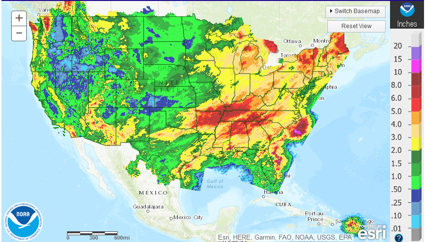
30 day accumulated liquid and melted precipitation:
Please remember to water…correctly!

Water once per week, one inch per week, under the entire branch spread, in the absence of rain, May through November. Either rainfall or your watering should equal the one inch per week. Put out a sprinkler and a straight sided soup can or rain gauge and measure one inch per week.

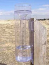
11-inch capacity rain gauge  

Taylor rain gauge   

NOAA ENSO Update: No ENSO? NOAA Still Issues Winter Outlook!

NOAA, ENSO, el nino
The climate trends, defined as the Optimum Climate Normals, for winter (December–February) temperatures across the United States. The trend is determined by taking the average winter temperatures over the last 15 years and subtracting the average winter temperatures from 1981-2010. NOAA Climate.gov image using data from the Climate Prediction Center.

This post was written by Mike Halpert and first appeared on the Climate.gov website

While I’ve usually written this post in October, this year we decided to wait until a month before winter (December–February) starts. In past years, we’ve asked if El Niño (or La Niña) will play a role in the winter’s outcome. This year is different, however, as ENSO-neutral is present and expected to persist through the winter and into the spring. So what does NOAA’s Climate Prediction Center (CPC) base their winter outlook on when ENSO-neutral is in the cards?

Read on to find out>>>

Major disruptive winter weather expected in parts of the US for Thanksgiving week. Ohio valley will see high winds Wednesday and heavy rain Thanksgiving weekend.

.
There are major disruptions to travel foreseen as we head into Thanksgiving week although thus far the Ohio valley appears to be only in store for some rain.
.
Winter weather is expected today, Sunday, in interior New England. That does not look like it will affect the big cities to any extent.
.
A major winter storm is aiming at Denver, Colorado and points north and east on Tuesday. This storm is forecast to produce a foot or more of snow and will cause major impacts to I-70, I-80  and I-25.
.
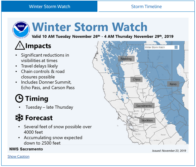
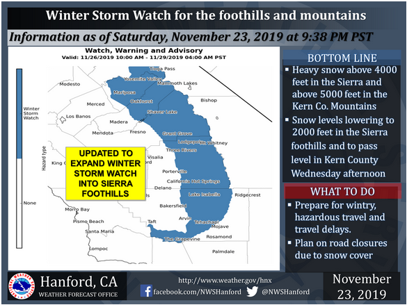
Another potent winter storm is aiming at the Sierra Nevada mountains of California as well as adjacent portions of northern California and Oregon right down to the coast, Nevada, and northwest Arizona. This storm looks like a whopper with feet of snow expected in the mountains. Road and interstate closures are very possible Tuesday into Thursday with snow lingering in the mountains into next weekend. Skiers will be ecstatic. The rest of you, not so much.
.
High winds are possible in the Ohio valley Wednesday and a big rain event is possible Thanksgiving weekend.
.
Day 9 image not available