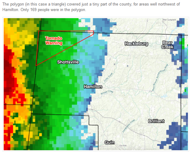
As expected, storms that moved across Alabama last night were mostly below severe limits, and there was little damage. The event was advertised here as a “low end” threat. I know that isn’t sexy, and isn’t what gets shared across social media, but we are here to tell the truth, and not hype up every thunderstorm event to get clicks and likes. There was only one tornado warning issued in the state, and the case is a bit curious due to the confusion surrounding the message. NWS Birmingham issued a tornado warning for the far northwest corner of Marion County at 5:28p CT.
Soil Moisture Condition Monitoring Weekly Report: Mildly Wet
Station Number: OH-HM-24
Station Name: Cheviot 3.4 W
Report Date: 12/28/2019
Submitted: 12/28/2019 6:45 AM
Scale Bar: Mildly Wet
Description:
No rain in the past 9 days. 2.66 inches of rain in December. Soil moisture drying has been slow, typical for winter.
Categories:
General Awareness
Agriculture
Plants & Wildlife
–
This report is specifically for the Arbor Doctor’s location 3.4 miles west of Cheviot, OH, in the western suburbs of Cincinnati in southwest Ohio. This location is also an official cooperative observation site for the National Weather Service listed as Cheviot 3W.
What is the Condition Monitoring Report? See these links for more information:
Winter Storm to bring heavy snow to the plains and heavy rain to the Mississippi and Ohio River basins and Great Lakes
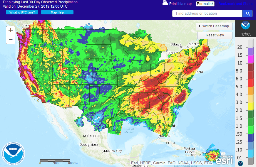
After a tranquil week of weather, things are ramping up for the weekend. A strong winter storm will bring snow for the central and northern plains and heavy rain to the Mississippi and Ohio River basins. Five day rainfall totals will be one to as much as 3 inches, as shown below:
Wintry weather is unlikely in the Ohio River basin either this weekend or on New Year Eve or Day. A slow cooling trend will ensue in the new year, ultimately resulting in more wintry conditions, but the transition will likely take a while.