Multiple rounds of rainfall Thursday through Friday will bring the potential for flooding. Some thunderstorms Thursday evening into Thursday night may reach severe limits. Damaging winds are forecast to be the primary severe weather threat. The threat for a few strong to severe storms may linger into Friday. Wind gusts of 35 to 40 mph are possible Friday.
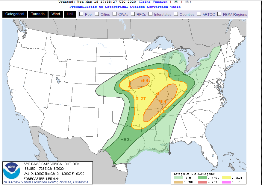
Widespread severe weather expected Thursday into Thursday night. Severe thunderstorms are expected from the lower Missouri Valley and Ozarks vicinity into the middle Mississippi and lower Ohio Valleys on Thursday. Damaging gusts, isolated large hail and tornadoes are possible, mainly during the afternoon into the evening hours.
Soil Moisture Condition Monitoring Weekly Report: Near Normal
Station Number: OH-HM-24
Station Name: Cheviot 3.4 W
Report Date: 3/14/2020
Submitted: 3/14/2020 6:55 AM
Scale Bar: Near Normal
Description:
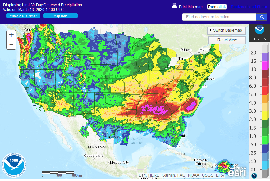
0.69 inches of rain in the past week and 1.05 inches of rain in March which is below normal, despite all the forecasts of heavy rains. Observed soil moisture conditions are as expected for this time of year.
Categories:
General Awareness
Agriculture
Plants & Wildlife
–
This report is specifically for the Arbor Doctor’s location 3.4 miles west of Cheviot, OH, in the western suburbs of Cincinnati in southwest Ohio. This location is also an official cooperative observation site for the National Weather Service listed as Cheviot 3W.
What is the Condition Monitoring Report? See these links for more information:
Soil Moisture Index:

Soil temperature map
Soil temperatures across the US.
Kentucky Mesonet including access to temperature, precipitation, soil temperature and soil moisture across Kentucky ![]()

