The weather pattern is ramping up in such a way that it’s looking like groundhog Punxsutawney Phil and the Arbor Doctor, with our forecasts of six more weeks of winter, will be looking pretty sweet while those other groundhogs will be pretty embarrassed. Some pretty nasty winter weather appears headed our way over the next two or three weeks. Don’t let those 60s fool you!
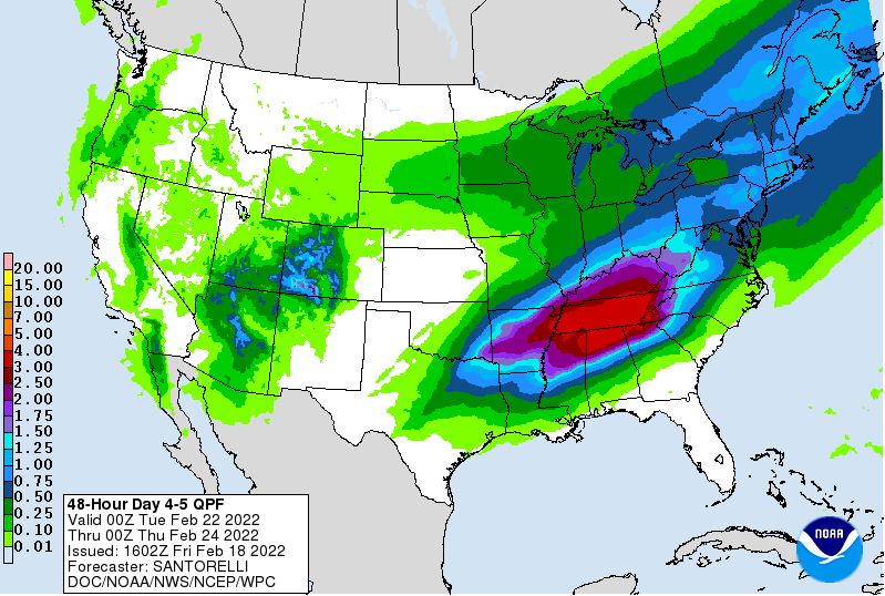
A large storm system early next week will bring mainly rain with an inch or more in Cincinnati and much more in the Tennessee valley. Chances for plowable snow or ice are very low with this storm in the Ohio valley.
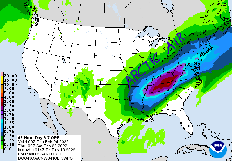
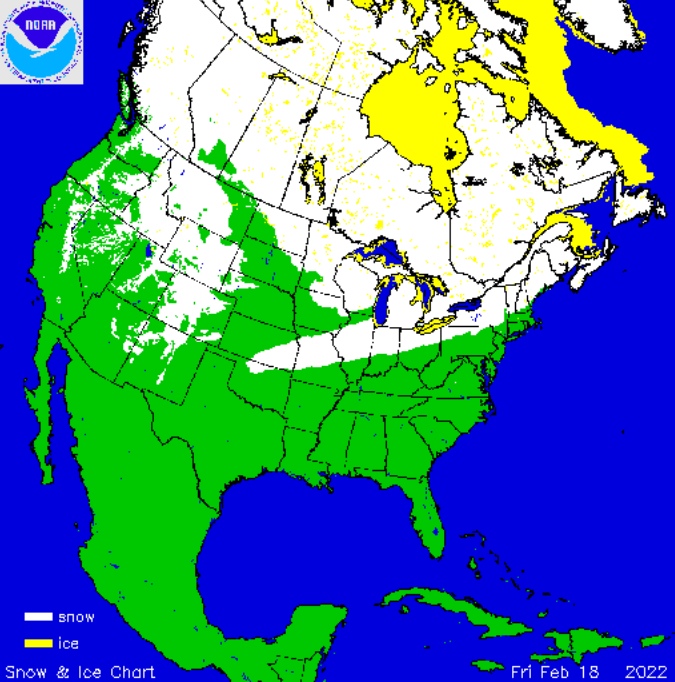
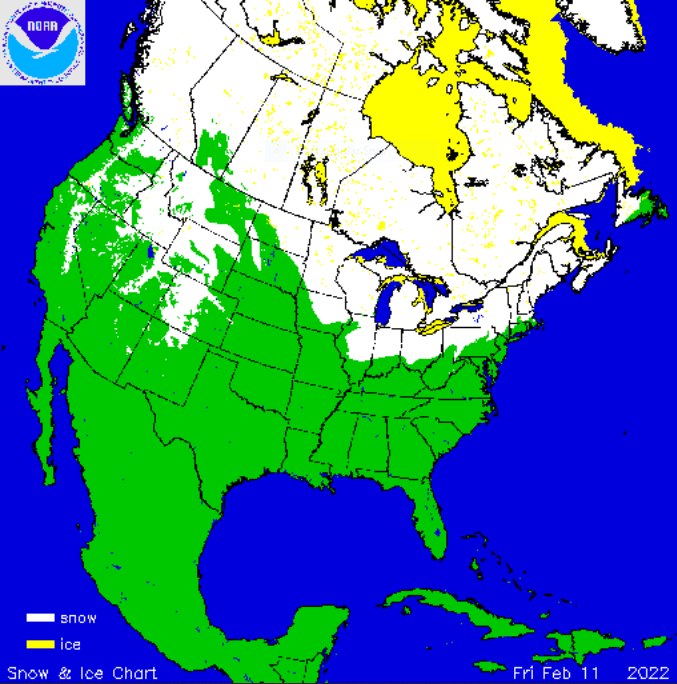
A second strong storm later next week will have arctic air to work with. A messy mix of frozen precipitation will accompany this system across parts of the Ohio valley. This could be a significant winter storm for someone but it is too early to pinpoint locations.
Chances for plowable snow and ice exist with this system but it is much to early to be specific. Snow and ice will likely be significant with this storm but the location is unknown at this time.
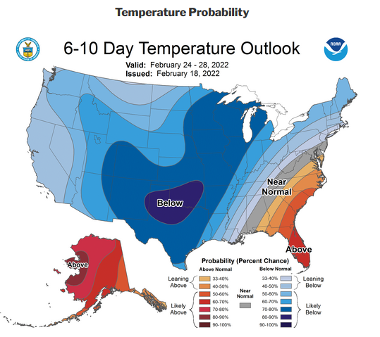
By next weekend, widespread arctic air will sink all the way south to Mexico and the gulf coast. This air mass will have originated in Siberia.
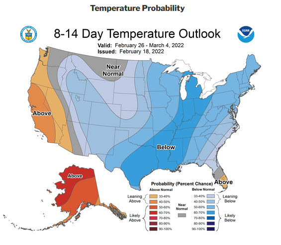
The cold air regime will continue into March and may be slow to give up.
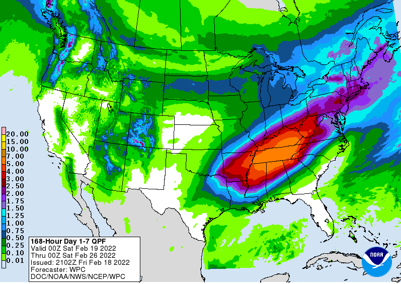
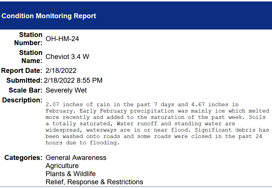
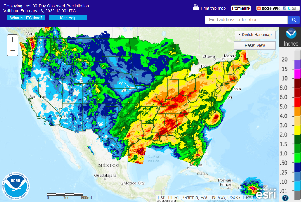
7 day rainfall and melted precipitation will be rather phenomenal in the Tennessee and parts of the Ohio valley so expect more flooding concerns.



 >>>
>>>