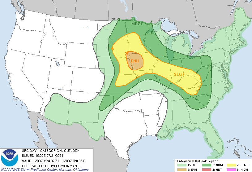
Slight risk in Cincinnati with enhanced risk in part of southeast Indiana.

|
Categorical Day1 1200Z Outlook
|
|||||||||||||||||||||
|
For the Cincinnati area, showers and storms are expected this evening into tonight. Some of
these storms may be strong to severe, with damaging winds being the
primary threat. A tornado or two will be possible.
For the entire treat area, numerous severe thunderstorms appear likely today across a large part of the lower/mid Mississippi Valley northward into the Midwest, and lower Ohio Valley. Several tornadoes with some strong, widespread damaging winds, some of which could be significant, and large to very large hail will likely occur.
