.
We said this winter would have its ups and downs and severe cold would come in waves.

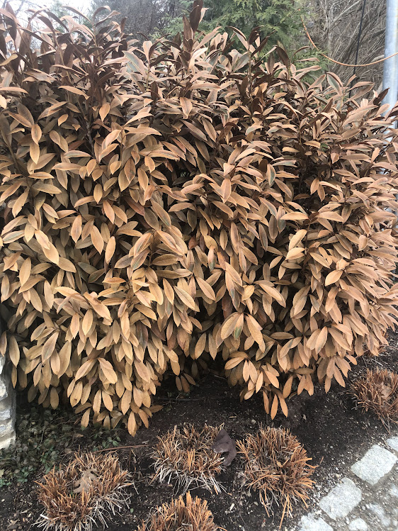
Severe cold damage to cherry laurel in Cincinnati from the Christmas cold wave. We have seen damage to many plants including Blue Atlas cedar, boxwoods, Japanese plum yew, and many others. Only time will tell the extent of damage.
Everyone saw the extreme cold, snow, and blizzard conditions around Christmas. After that, a dramatic and long lived thaw took place. January ended nearly 10 degrees ABOVE normal in Cincinnati and despite that snowfall at my Cheviot OH 3W location still totaled 9.2 inches which is also well ABOVE the monthly average.
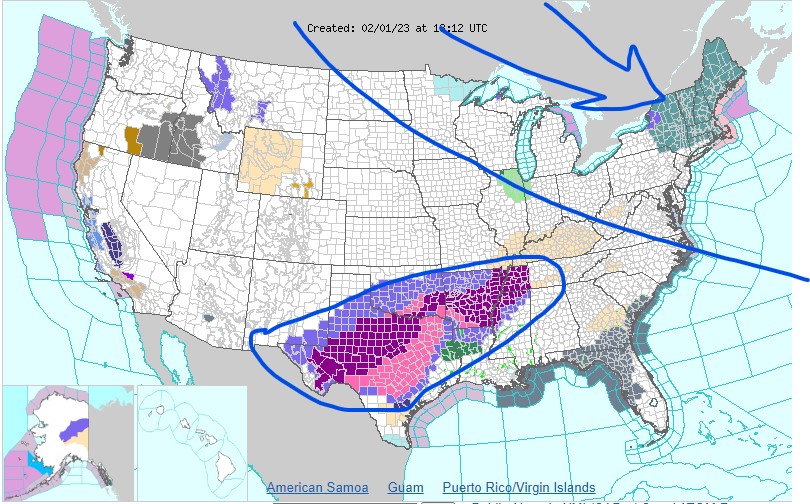
The next wave of Siberian cold is making its way south but for Cincinnati it will be a glancing blow to the northeast. New England will see lows this weekend of -15F to -30F with wind chills below -50F in spots. In the meantime, a stalled front to the south is producing a prolonged winter ice storm in Texas northeastward into western Tennessee.
Next week, another major thaw arrives in the east with much ABOVE normal temperatures but don’t think winter is over. We still have a full month of meteorological winter and even March can be bi-polar at times. For now, be thankful that the Ohio valley missed the extreme cold to the northeast and the ice storm to the southwest.
Temperature Probability

