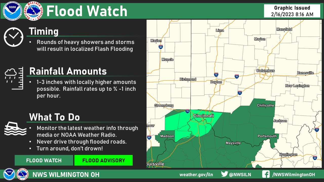
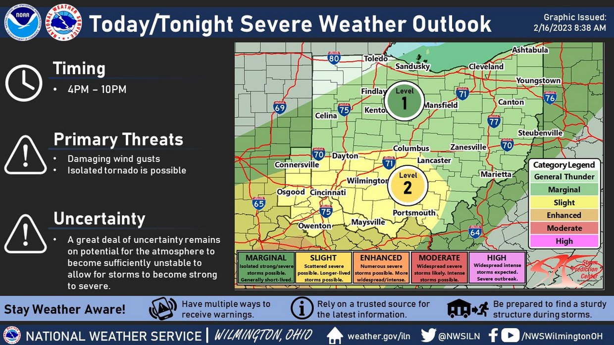
The severe threat this afternoon in Cincinnati is conditional. The morning heavy rain and clouds will limit instability. If Cincinnati breaks out into several hours of sunshine, the severe threat will be greater with some chance of a tornado. There is also a flooding threat due to the heavy rainfall.
|
|
|
|
|
|
Categorical Day1 1300Z Outlook
|
| Day 1 Risk |
Area (sq. mi.) |
Area Pop. |
Some Larger Population Centers in Risk Area |
| ENHANCED |
86,322 |
8,233,694 |
Nashville, TN…Birmingham, AL…Jackson, MS…Huntsville, AL…Clarksville, TN… |
| SLIGHT |
136,586 |
15,152,124 |
Columbus, OH…Memphis, TN…Cincinnati, OH…Louisville, KY…Lexington-Fayette, KY… |
| MARGINAL |
151,266 |
26,574,756 |
Indianapolis, IN…New Orleans, LA…Cleveland, OH…Atlanta, GA…Pittsburgh, PA… |
|
|
|
   SPC AC 161300

   Day 1 Convective Outlook
   NWS Storm Prediction Center Norman OK
   0700 AM CST Thu Feb 16 2023

   Valid 161300Z - 171200Z

   ...THERE IS AN ENHANCED RISK OF SEVERE THUNDERSTORMS FROM SOUTHERN
   MISSISSIPPI TO CENTRAL KENTUCKY...

   ...SUMMARY...
   Widely scattered severe thunderstorms are likely from the central
   Gulf Coast states northward into the Ohio Valley.  Strong tornadoes
   are most likely over Mississippi, Alabama and middle Tennessee.
|