January 2023 Weather and Climate Summary. Very warm but very snowy.

.

January snow covers a marginally hardy Weeping Blue Atlas cedar (Cedrus atlantica ‘Glauca Pendula’) turned brown by the severe Christmas cold snap. Unknown as to degree of any damage at this point. 

Regional Climate Report – January 2023>>>

January 12, 2023 — Severe Weather and Tornado>>>

January 22, 2023 — Winter Storm>>>

Car into a pole after mixed glaze, ice pellets, and light snow on the morning of the 31st.

Two catalpa (Catalpa speciosa) trees stand guard in Lebanon, Ohio.

Ohio champion katsuratree (Cercidiphyllum japonicum)

February 3, 2023 Soil Moisture, Drought, and Condition Monitoring Report. Near Normal conditions at Cheviot OH 3W. Spotty dry and long term moderate drought in west-central Ohio and east central Indiana. Drought conditions continue to diminish over much of the country except southeast coastal areas and northern Florida. Exceptional drought in central plains and small part of Oregon.

.

This report is specifically for the Arbor Doctor’s location 3.4 miles west of Cheviot, OH, in the western suburbs of Cincinnati in southwest Ohio. This location is also an official cooperative observation site for the National Weather Service listed as Cheviot 3W.

What is the Condition Monitoring Report? See these links for more information:

Explanation of scale bar>>>

30 Day Precipitation:

.

Ohio 30-Day Precipitation

.

Search condition monitoring reports for the entire US>>>  

Interactive

Condition Monitoring

Static

Watershed Maps


United States Weekly Drought Monitor

Click on the title or the graphic (above) to access the
U.S. Weekly Drought MonitorPDF Version of Graphic Adobe PDF Reader

United States Monthly Drought Outlook

Click on the title or the graphic (above) to access the
U.S. Monthly Drought OutlookPDF Version of Graphic Adobe PDF Reader

United States Seasonal Drought Outlook

Click on the title or the graphic (above) to access the
U.S. Seasonal Drought OutlookPDF Version of Graphic

Adobe PDF Reader

Other Drought links:


Please remember to water…correctly!

Water once per week, one inch per week, under the entire branch spread, in the absence of rain, May through November. Either rainfall or your watering should equal the one inch per week. Do not water if the soil is already moist. Put out a sprinkler and a straight sided soup can or rain gauge and measure one inch per week. Measure the rainfall which falls in your yard. Your trees don’t care what fell at the airport!

If burlap was left on new trees, it will repel water and the tree or shrub may die. Be sure burlap and twine are removed from the top of all root balls. If your landscaper disagrees, refer him or her to the American National Standards Institute (ANSI) industry standard for installation of landscape plants.

To the extent possible recycle fallen leaves back into the soil around the trees and maintain mulch around the trees to a radius of at least 3-5 feet. Keep mulch off trunks. Use a coarse textured mulch. Avoid triple shredded mulch. Aged arborist wood chips, mulched and composted leaves, pine bark, and pine straw are all good. Very finely ground mulches such as triple ground hardwood mulch are not beneficial and may inhibit moisture and oxygen exchange.

Drought: How Dry Seasons Affect Woody Plants                                                                                                                     >>>


1-inch capacity rain gauge  >>>

Taylor rain gauge   >>>

Watering: How and when>>>

Watering Trees and Shrubs>>>


Meteorological Versus Astronomical Seasons

Spring: March 1-May 31; Summer: June 1-August 31; Fall: September 1-November 30; Winter: December 1-February 28 (29)


You may have noticed that Arbor Doctor, meteorologists and climatologists define seasons differently from “regular” or astronomical spring, summer, fall, and winter. So, why do  meteorological and astronomical seasons begin and end at different times? Climatologically, the period July 14-21, the mid-point of meteorological summer, is the hottest week of the year and the period January 14-21, the mid-point of meteorological winter, is the coldest week of the year over much of the continental US including the Ohio valley.

Read more here>>>

Nearly half the country has had its coldest day by the first day of calendar winter. That is why meteorological winter makes the most sense.

The Next Wave of Siberian Air will be a glancing blow to the northeast for Cincinnati, then a big warm up, but then…???

.

We said this winter would have its ups and downs and severe cold would come in waves.

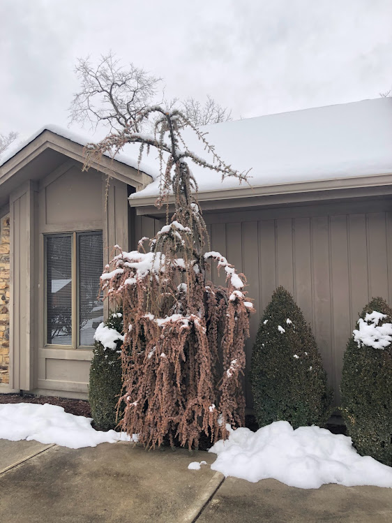
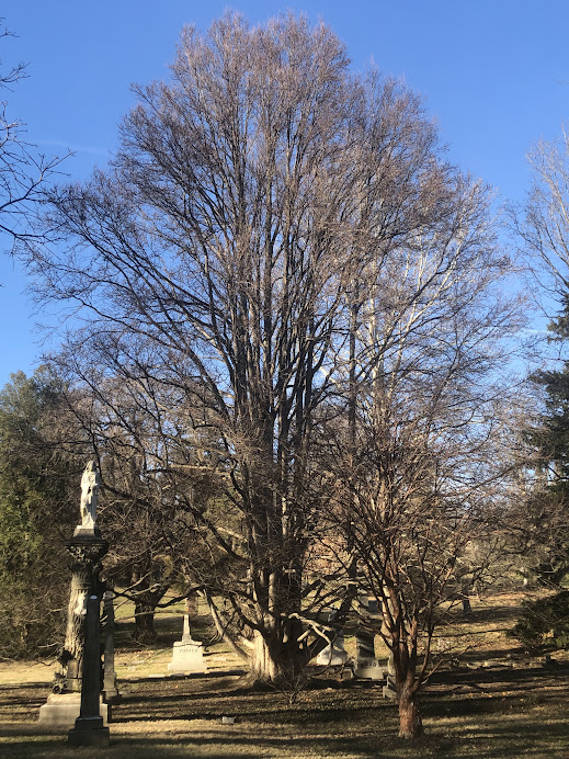
Severe cold damage to cherry laurel in Cincinnati from the Christmas cold wave. We have seen damage to many plants including Blue Atlas cedar, boxwoods, Japanese plum yew, and many others. Only time will tell the extent of damage.

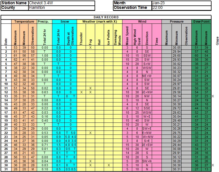
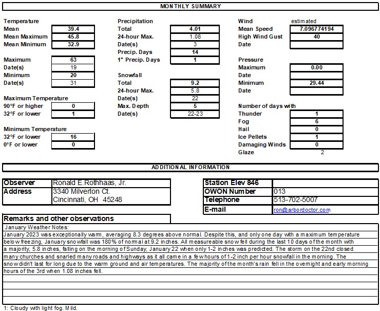
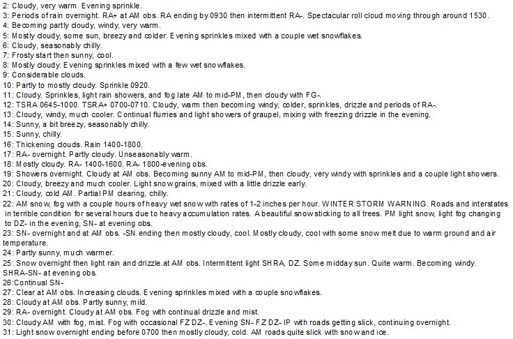
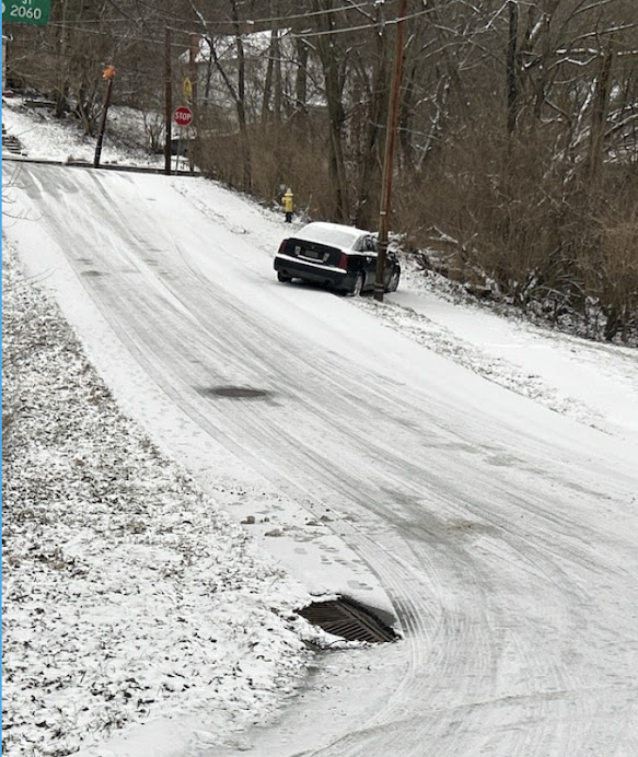
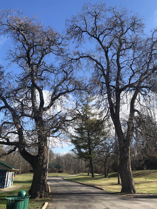
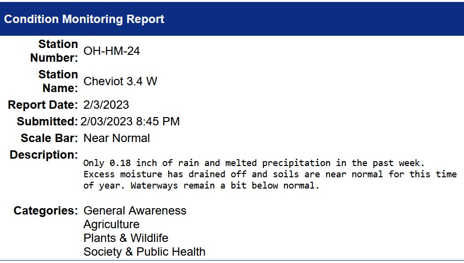
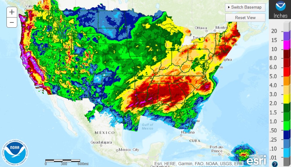
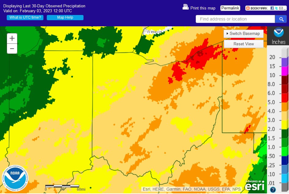
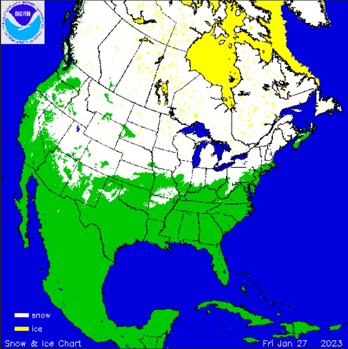
Everyone saw the extreme cold, snow, and blizzard conditions around Christmas. After that, a dramatic and long lived thaw took place. January ended nearly 10 degrees ABOVE normal in Cincinnati and despite that snowfall at my Cheviot OH 3W location still totaled 9.2 inches which is also well ABOVE the monthly average.

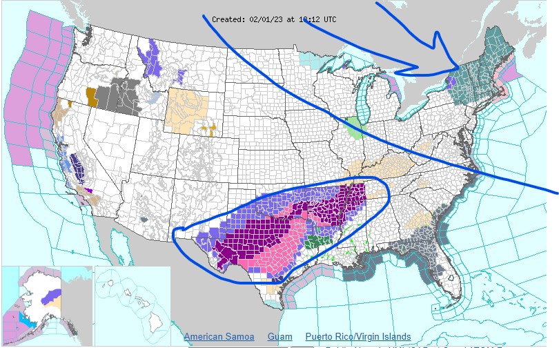
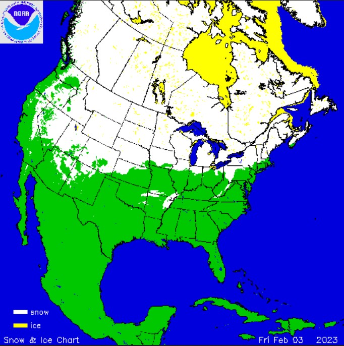
The next wave of Siberian cold is making its way south but for Cincinnati it will be a glancing blow to the northeast. New England will see lows this weekend of -15F to -30F with wind chills below -50F in spots. In the meantime, a stalled front to the south is producing a prolonged winter ice storm in Texas northeastward into western Tennessee.

Next week, another major thaw arrives in the east with much ABOVE normal temperatures but don’t think winter is over. We still have a full month of meteorological winter and even March can be bi-polar at times. For now, be thankful that the Ohio valley missed the extreme cold to the northeast and the ice storm to the southwest.

Temperature Probability

8 to 14 Day Outlook - Temperature Probability