
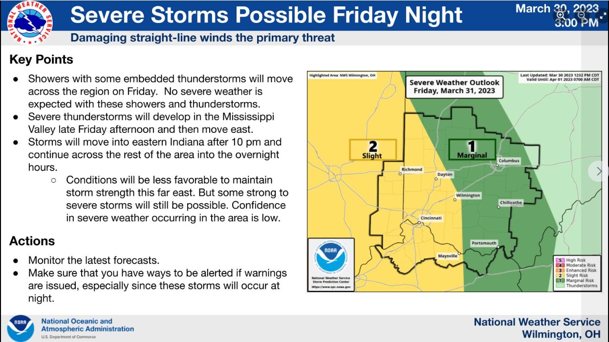
A robust system will move across the region Friday into Saturday. This will bring the potential for some strong to severe thunderstorms Friday night. Strong non-thunderstorms winds can be expected on Saturday.
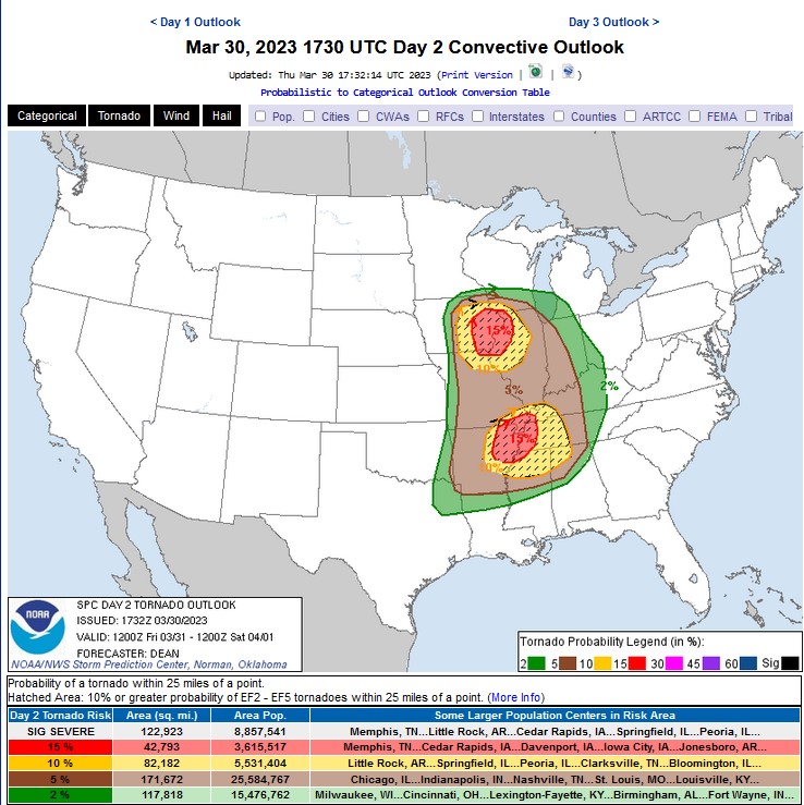
Hatched Area: 10% or greater probability of EF2 – EF5 tornadoes within 25 miles of a point.
Another widespread severe weather outbreak may occur next week.
The overall weather pattern this spring favors severe storms and tornadoes from the Great Plains through the Mississippi, Tennessee, and Ohio River valleys and the southeast US. We have already seen numerous destructive tornadoes this year in this weather pattern. With cold air to the northwest and a jet stream guiding storms northward in the plains, pulling up juicy warm air from the Gulf of Mexico, a near ideal pattern is in place for a series of storms with severe storm and tornado potential.