
Yet another outbreak of severe weather is forecast over the US beginning Tuesday, affecting many of the same areas ravaged on Friday.
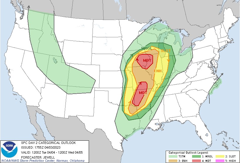
…THERE IS A MODERATE RISK OF SEVERE THUNDERSTORMS FROM EASTERN IOWA INTO NORTHWEST ILLINOIS…AND FROM SOUTHERN MISSOURI SOUTHWESTWARD TOWARD THE ARKLATEX….
…SUMMARY…
A large area of severe potential will exist from Tuesday afternoon
into Wednesday morning, from eastern portions of the Plains into the
Missouri and mid/upper Mississippi Valleys. Strong tornadoes and
particularly damaging winds are expected. Both afternoon and
overnight potential will exist across various regions, including the
risk of dangerous nighttime tornadoes.
The severe weather moves eastward Tuesday night and Wednesday and includes Cincinnati and the Ohio valley.
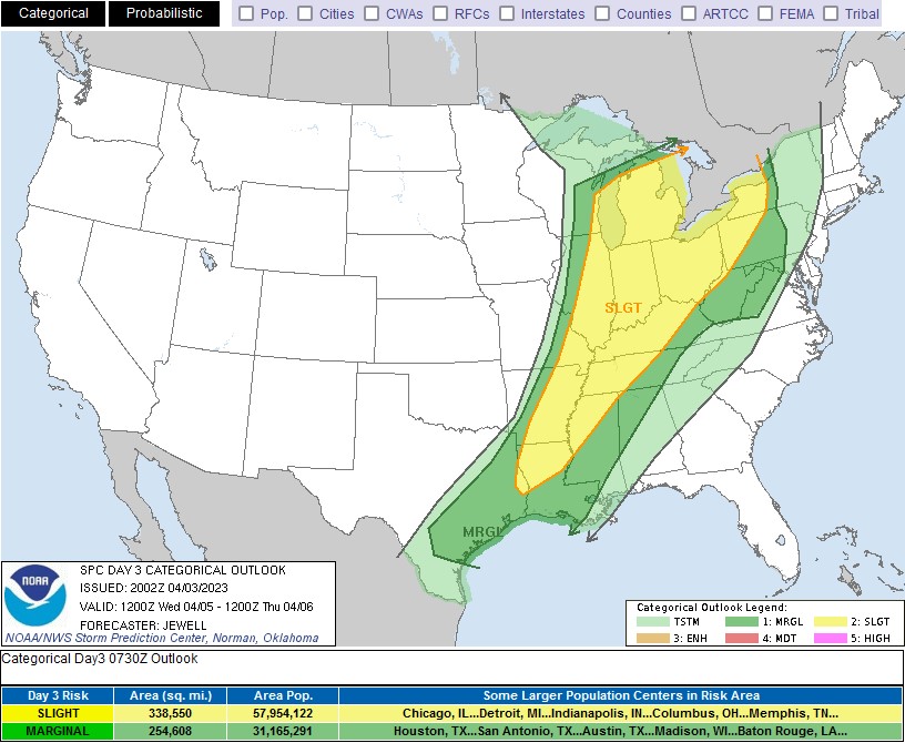
…THERE IS A SLIGHT RISK OF SEVERE THUNDERSTORMS WEDNESDAY FROM THE GREAT LAKES REGION AND OHIO VALLEY SOUTHWESTWARD INTO THE LOWER MISSISSIPPI VALLEY…
…SUMMARY…
Severe thunderstorms are possible over a large area from the Great
Lakes region southwestward to the Lower Mississippi Valley
Wednesday. This may include cells capable of producing tornadoes and
extensive wind damage, primarily north of the Ohio River, with other
severe storms expected into the lower Mississippi Valley.