

Temperature Probability |
Precipitation Probability (Experimental)  |
It appears the cold west vs. warm, wet east will continue for the rest of January at least.
Meteorological Winter 2019-2020 seems destined to go down as excessively warm and likely quite wet. December 2019 was 6 degrees F above normal and January so far is on the same track. Even if February turns cold, and that is not a sure thing, it will not offset the very warm conditions thus far.
Snowfall is running above normal in Cincinnati. With all this precipitation, it won’t take much for some cold air to sneak in and give us more snow. It just won’t last.
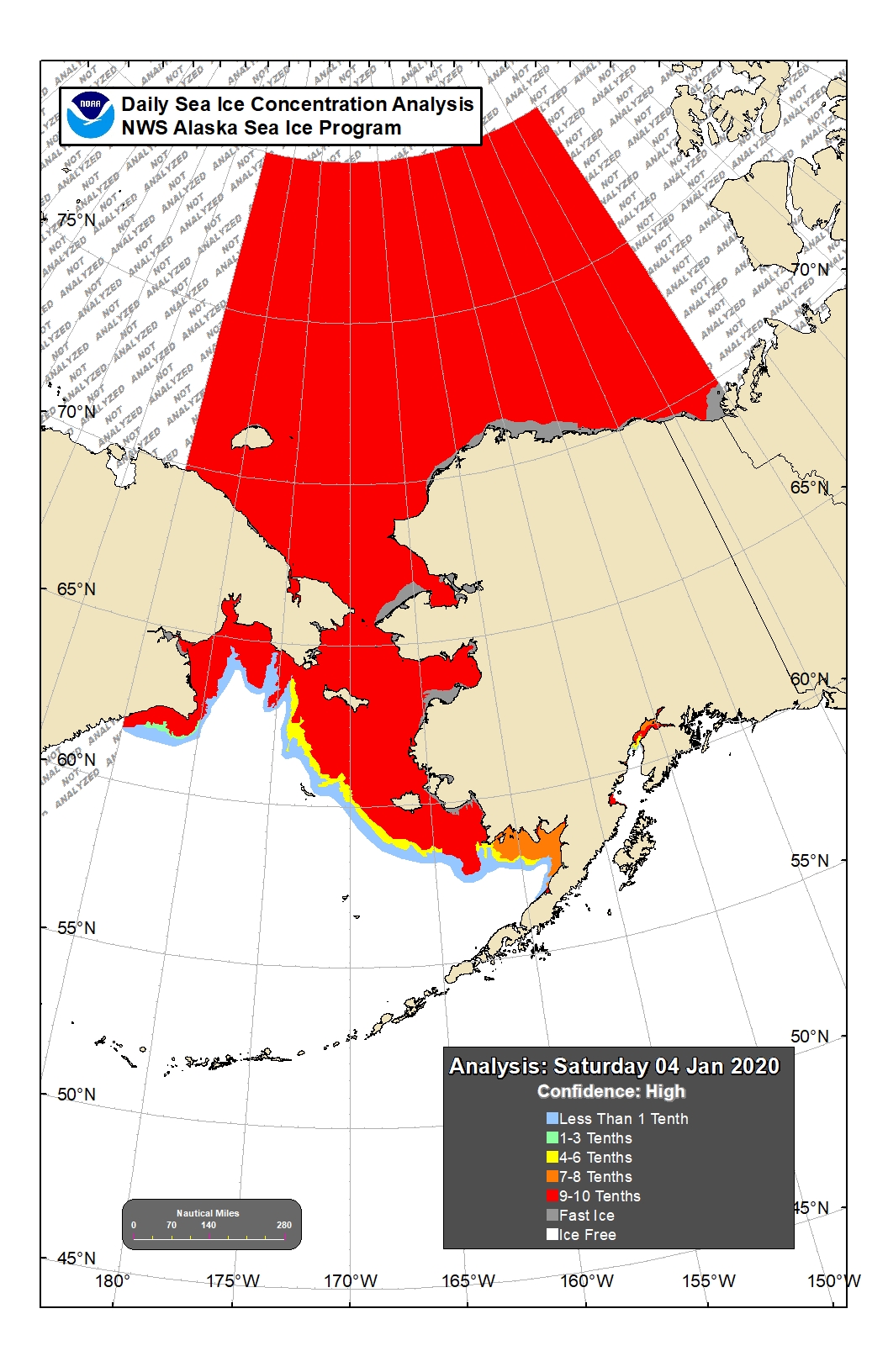
It is cold somewhere. Alaska has been in the deep freeze this winter, after a slow start, for the first winter in several years. This has allowed an impressive expansion of sea ice, that same sea ice many said would be gone by now. Extended cold also allows increases in the permafrost in Alaska which is needed.
Hydrologic Outlook
National Weather Service Louisville KY
637 AM EST Sun Jan 5 2020 /537 AM CST Sun Jan 5 2020/
…HEAVY RAINFALL AND FLOODING POSSIBLE BY LATE WEEK AND INTO NEXT WEEK…
The latest forecast models continue to indicate an increasing
threat of heavy rainfall and possible flooding issues later this
week and into next weekend. A cold front will approach the region
by late week and then is forecast to stall out across the area.
As this occurs, there is the possibility that multiple waves of
heavy rainfall and thunderstorms may transverse the region.
The latest forecast models suggest that an axis of heavy
precipitation will likely develop over portions of the region.
Within that heavy band as much as 3 to 5 inches with locally
higher amounts will be possible. At this time, there is
considerable uncertainty on where this heavy rainfall axis will
set up.
Currently, soil conditions are saturated across the region due to
recent rainfall events. With this additional rainfall expected
later this week, flooding problems are likely to develop, possibly
very quickly in some areas. The highest risk of flooding will be
in areas that are low-lying and have very poor drainage. In
addition, area low water crossings will be under the threat of
flooding.
Water levels on area rivers are high and are running above normal
winter pool levels. The additional rainfall expected later this
week will likely push these rivers higher and some forecast points
will likely go into flood as early as this weekend and then
continue next week.
As we move through the week, we will continue to monitor and
refine the precipitation forecasts. As we get more confident in
where the heavy precipitation will occur, flood watches may be
posted later this week for portions of the region.
Stay tuned to NOAA All Hazards Radio and your local media for the
latest on this potentially significant heavy rainfall and
flooding event.
Hydrologic Outlook
National Weather Service Paducah KY
355 AM CST Sun Jan 5 2020
…Heavy Rainfall and Flooding Concerns are Increasing for Thursday
through Saturday…
A stalled out frontal boundary will provide a focus for showers
and some thunderstorms with heavy rainfall Thursday, Friday and
possibly through Saturday. The 3 to 5 inches of rainfall currently
forecast represents a conservative estimate. The potential exists
for a narrower swath of 6 inches or more somewhere across the four
state region. The heaviest rains are likely Friday into Saturday.
With nearly saturated ground conditions expected at the beginning
of the event, flooding problems are likely to develop rather
quickly. At the very least, flooding of low-lying and poorly
drained areas, as well as low water crossings, can be expected.
Where the heaviest rains occur more significant flooding problems
may develop.
Water levels are already high on the Ohio River and some of its
tributaries, and the additional rainfall could lead to delayed
crests or higher crest levels. In addition, new river flooding
will be possible throughout the area.
Please stay tuned to the latest forecasts of this potentially
significant heavy rainfall and flooding event.