
Round 1 is tapering off from SW to NE for the latter part of the Monday morning commute, yielding less than an inch to isolated 2 inch amounts of snow. Yes, round 1 was not all that impressive but don’t be lulled into thinking we are out of the woods.
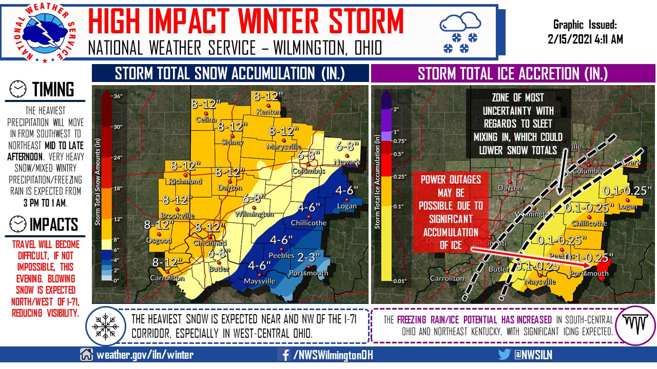
The second, and much more significant, round of precipitation will arrive middle to late afternoon (Tri-State area first, central Ohio an hour or two later). The latest data suggests that more freezing rain and sleet will mix in with the precipitation, with a potential for significant ice accumulations and possible power outages in south-central Ohio and northeast KY. The ice potential in these areas has INCREASED in south-central Ohio and northeast Kentucky. There may be a very sharp cutoff to significant snow totals with sleet mixing in southeast of I-71. Additionally, blowing snow will be possible in west-central Ohio and east-central Indiana this afternoon and this evening, making the visibility close to zero at times. Travel may be nearly impossible this evening across a wide portion of the local area. Avoid all travel later today, if possible.
Very cold arctic air will prevail behind this storm, slowing clean-up.
Another strong storm in forecast Wednesday night into Thursday. Details will need to be fine tuned but this storm could dump several more inches of snow. Mixed precipitation cannot be ruled out.
Temperatures will warm above freezing Sunday before another system moves through Monday. Details with this system are sketchy at this time but precipitation is more likely to be mixed, or even mix changing to rain.
Warmer weather overall will prevail for next week and possibly the balance of February. However, there is more arctic air waiting in the wings and there is a good chance winter will make a return in March, with spring having to wait until late in the month.