
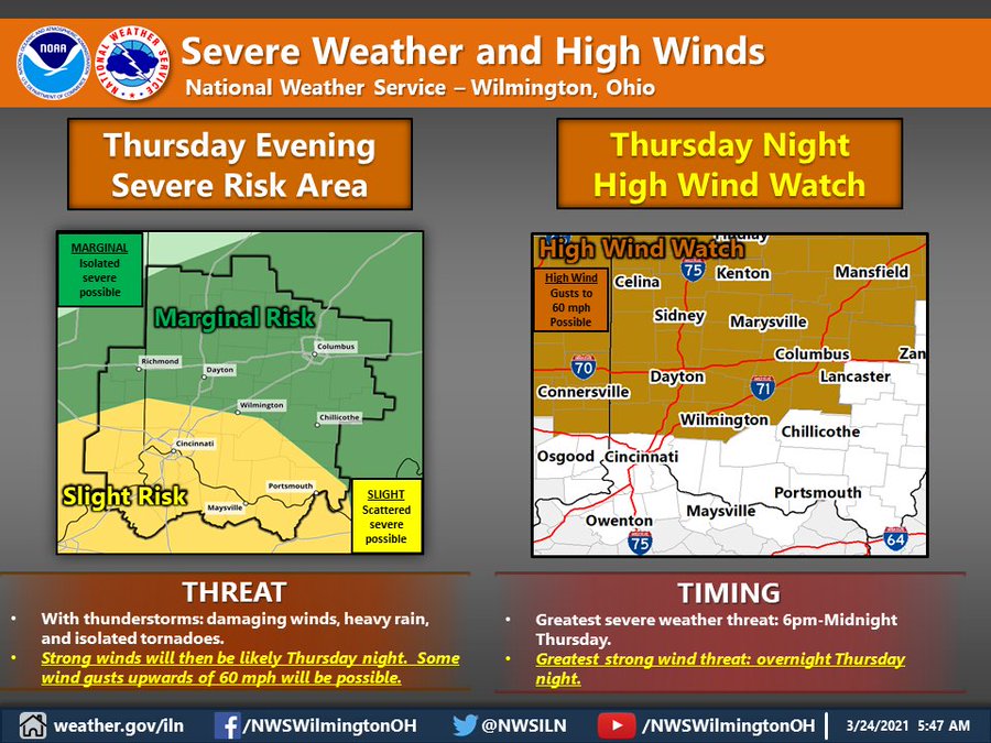
Severe thunderstorms will be possible late in the day on Thursday and into Thursday night. Damaging winds, isolated tornadoes, and locally heavy rain will all be possible. Strong winds Thursday night are expected and could gust 40 to 50 mph for a brief period of time.
This Hazardous Weather Outlook is for Southeast Indiana, Northeast
Kentucky, Northern Kentucky, Central Ohio, South Central Ohio and
Southwest Ohio.
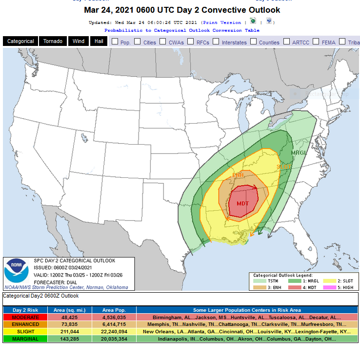
Day 2 Convective Outlook
NWS Storm Prediction Center Norman OK
0100 AM CDT Wed Mar 24 2021
Valid 251200Z – 261200Z
…THERE IS A MODERATE RISK OF SEVERE THUNDERSTORMS OVER A LARGE PART OF MISSISSIPPI…PORTIONS OF CENTRAL AND NORTHERN ALABAMA AND ADJACENT AREAS OF WESTERN AND MIDDLE TENNESSEE…
…SUMMARY…
A potential outbreak of severe storms including several long track
strong tornadoes, large hail and damaging wind will exist Thursday
into Thursday evening across a portion of the lower Mississippi
Valley and Southeast States.