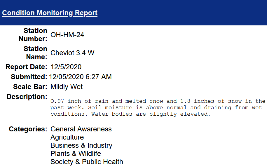
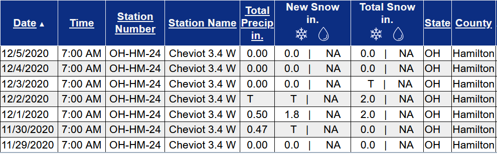
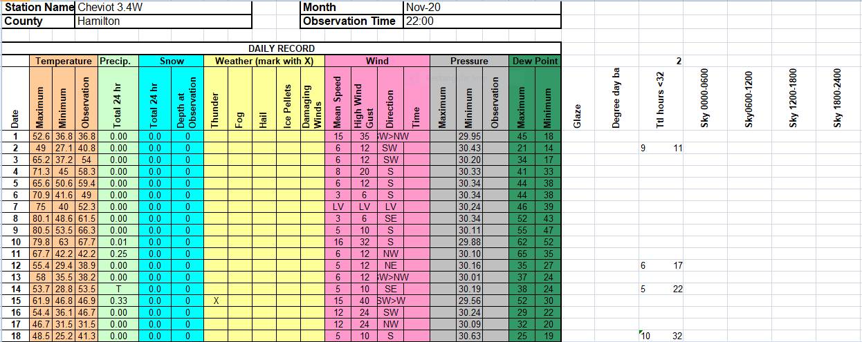
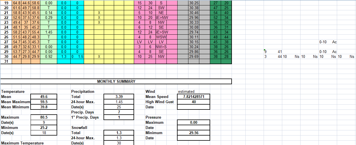
Soil Moisture Condition Monitoring Weekly Report for Cheviot OH 3.4W: Mildly Wet
–
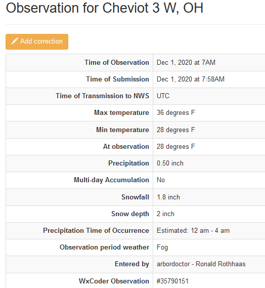
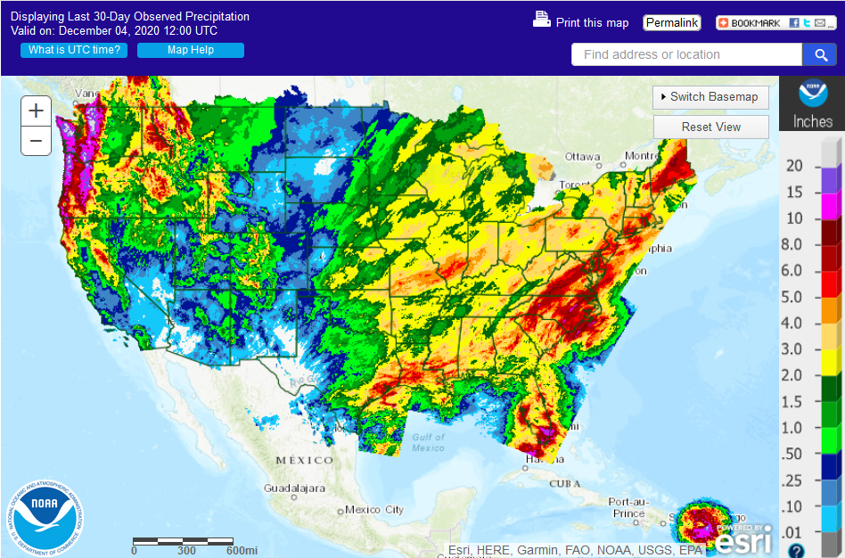
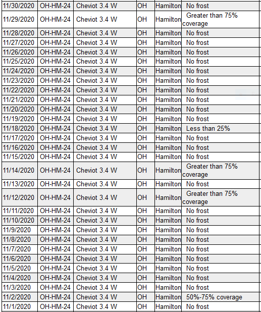
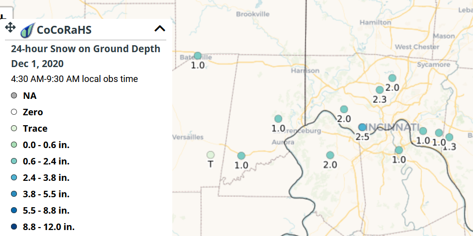
This report is specifically for the Arbor Doctor’s location 3.4 miles west of Cheviot, OH, in the western suburbs of Cincinnati in southwest Ohio. This location is also an official cooperative observation site for the National Weather Service listed as Cheviot 3W.
What is the Condition Monitoring Report? See these links for more information:
Explanation of scale bar>>>
Search condition monitoring reports for the entire US>>> 
Please remember to water…correctly!
Water once per week, one inch per week, under the entire branch spread, in the absence of rain, May through November. Either rainfall or your watering should equal the one inch per week. Put out a sprinkler and a straight sided soup can or rain gauge and measure one inch per week.
To the extent possible recycle falling leaves back into the soil around the trees and maintain mulch around the trees to a radius of at least 3-5 feet. Keep mulch off trunks. Use a coarse textured mulch. Avoid triple shredded mulch.
Drought: How Dry Seasons Affect Woody Plants >>>
>>>
1-inch capacity rain gauge >>>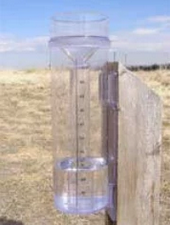
Taylor rain gauge >>>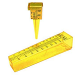
Watering: How and when>>>
Watering Trees and Shrubs>>>
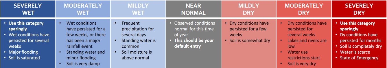
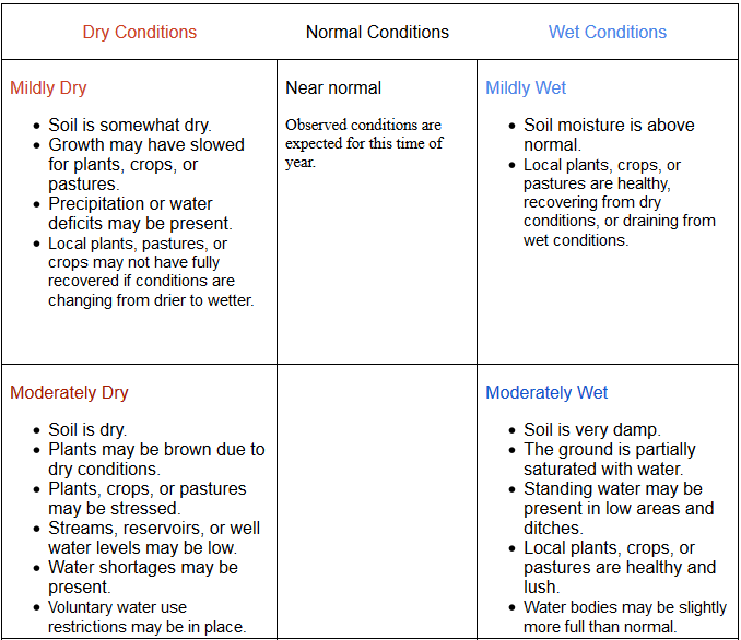
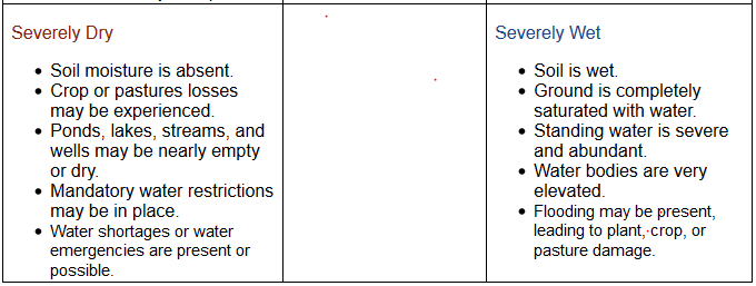
Soil Moisture Index:

Meteorological Versus Astronomical Seasons
Spring: March 1-May 31; Summer: June 1-August 31; Fall: September 1-November 30; Winter: December 1-February 28 (29)

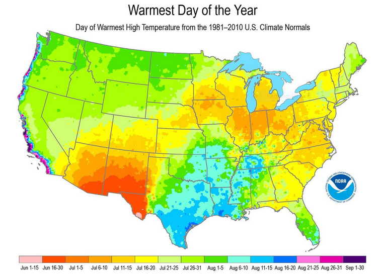
You may have noticed that Arbor Doctor, meteorologists and climatologists define seasons differently from “regular” or astronomical spring, summer, fall, and winter. So, why do meteorological and astronomical seasons begin and end at different times? Climatologically, the period July 14-21, the mid-point of meteorological summer, is the hottest week of the year and the period January 14-21, the mid-point of meteorological winter, is the coldest week of the year over much of the continental US including the Ohio valley.
–
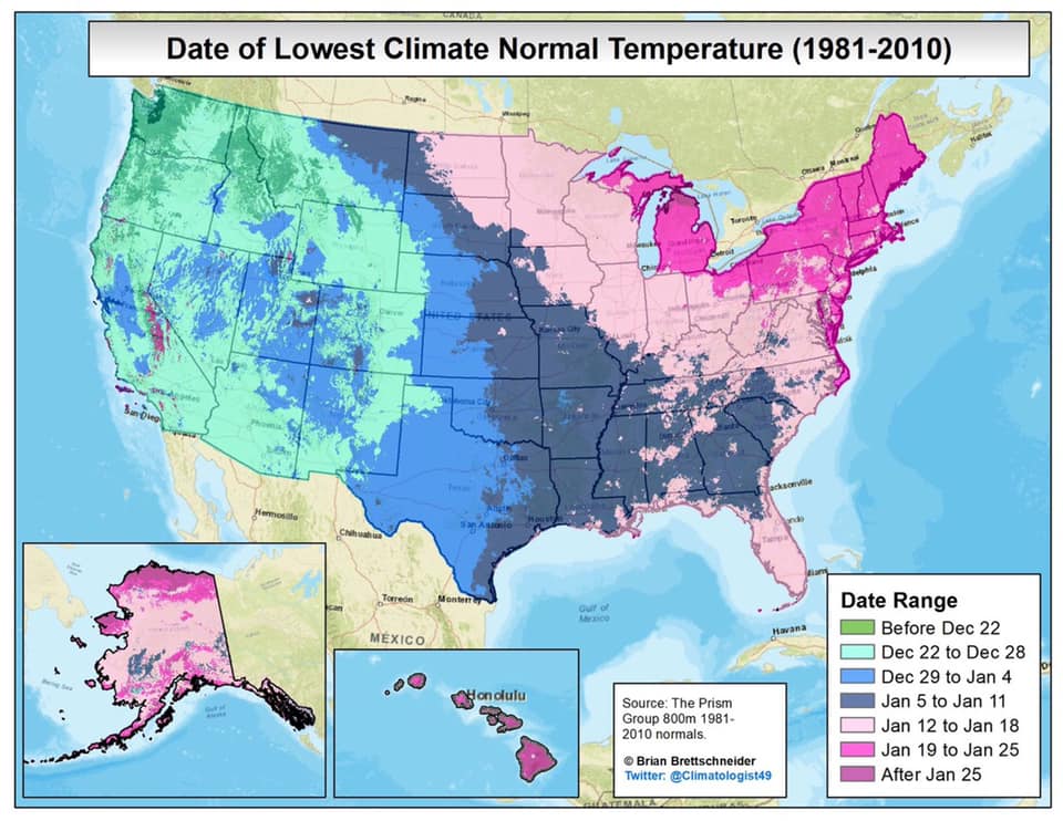
Nearly half the country has had its coldest day by the first day of calendar winter. That is why meteorological winter makes the most sense.

 define seasons differently from “regular” or astronomical spring, summer, fall, and winter. So, why do meteorological and astronomical seasons begin and end at different times? Climatologically, the period July 14-21, the mid-point of meteorological summer, is the hottest week of the year and the period January 14-21, the mid-point of meteorological winter, is the coldest week of the year over much of the continental US including the Ohio valley.