Soil Moisture Condition Monitoring Weekly Report: Severely Wet

Station Number: OH-HM-24
Station Name: Cheviot 3.4 W
Report Date: 3/16/2019
Submitted: 3/16/2019 8:24 AM
Scale Bar: Severely Wet

Description:

2.32 inches of rain in the past week. Ground is completely saturated with water. Standing water is severe and abundant. Water bodies are very elevated.

Categories:

General Awareness

Agriculture

Plants & Wildlife

This report is specifically for the Arbor Doctor’s location 3.4 miles west of Cheviot, OH, in the western suburbs of Cincinnati in southwest Ohio. This location is also an official cooperative observation site for the National Weather Service listed as Cheviot 3W.

What is the Condition Monitoring Report? See these links for more information:

Explanation of scale bar>>>

Search condition monitoring reports for the entire US>>>

In like a lion, out like a lamb. A kinder, gentler rest of March. Mostly.

After a wintry first week of March and a wild Thursday with multiple 
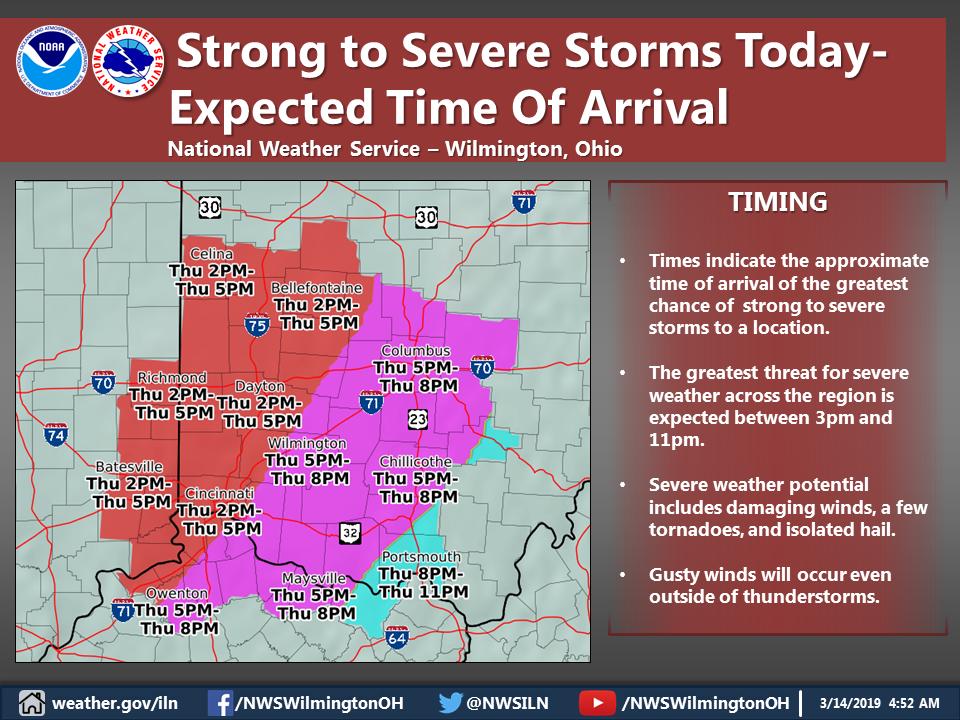
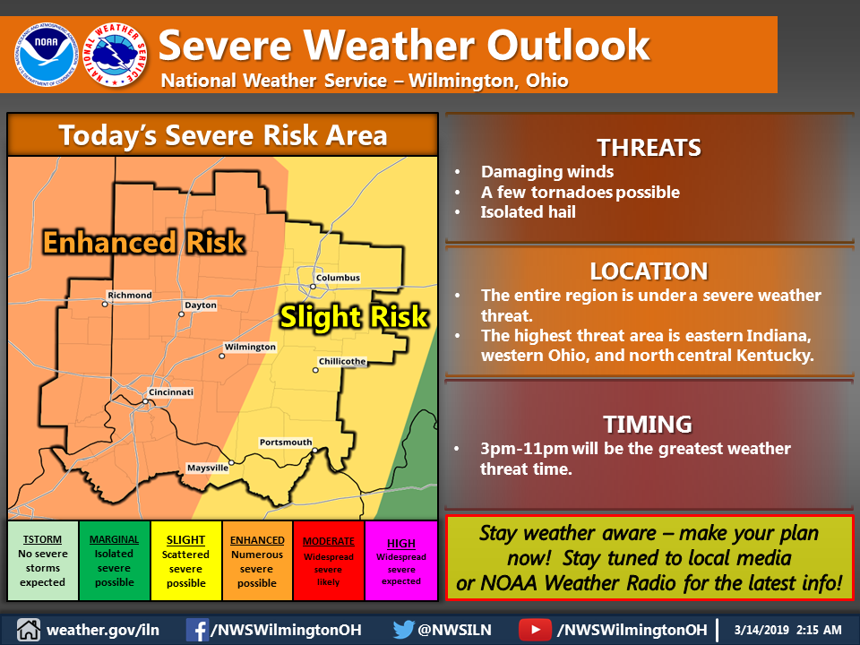
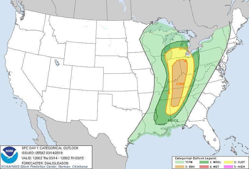
severe weather watches and warnings, wind damage, radar indicated tornadoes, and street flooding, we have a few cool days followed by a warm up and generally quiet weather for at least a week or so.

The first half of March was decidedly lion like in the Ohio valley while most of the last half of March will be more lamb like, and spring-like.


TORNADO THREAT THIS AFTERNOON AND EVENING, WIND ADVISORY.

There is an enhanced risk of tornadoes and severe storms this afternoon and evening. High winds are very likely. The main factor which could limit tornado formation is instability. The longer it stays cloudy and rainy, the less likely are tornadoes. Still, many other ingredients are in place. Pay attention today and take watches and warnings seriously.

—————————

This Hazardous Weather Outlook is for East Central Indiana, Southeast Indiana, Northern Kentucky, Central Ohio, South Central Ohio, Southwest Ohio and West Central Ohio.

.DAY ONE…Today and Tonight.

Please listen to NOAA Weather Radio or go to weather.gov on the
Internet for more information about the following hazards.

Wind Advisory.

Strong to severe storms are possible this afternoon into the early
evening. These storms will be capable of producing damaging
straight-line winds. In addition, a few tornadoes cannot be ruled
out.