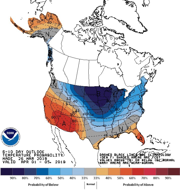
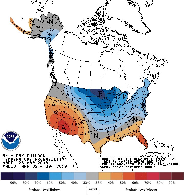
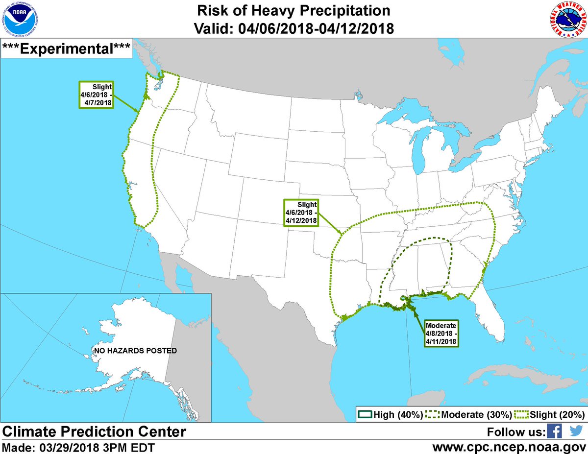
We are keeping an eye during April 6th through 12th on the potential for much below-normal temperatures from the Northern Plains through Midwest and heavy rains from the Mississippi River Delta through the Tennessee Valley. http://www.cpc.ncep.noaa.gov/products/predictions/threats/threats.php …
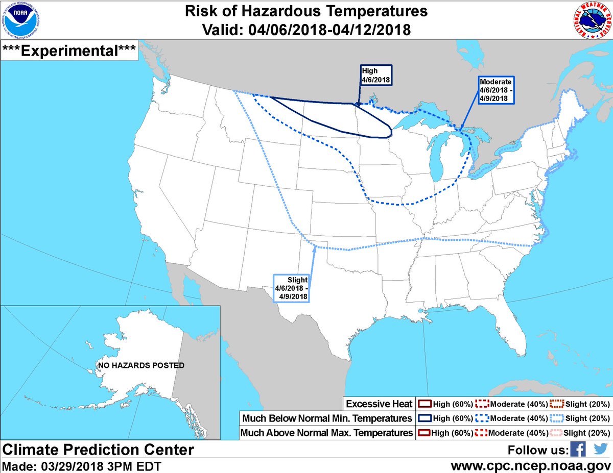
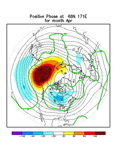
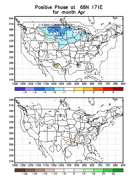
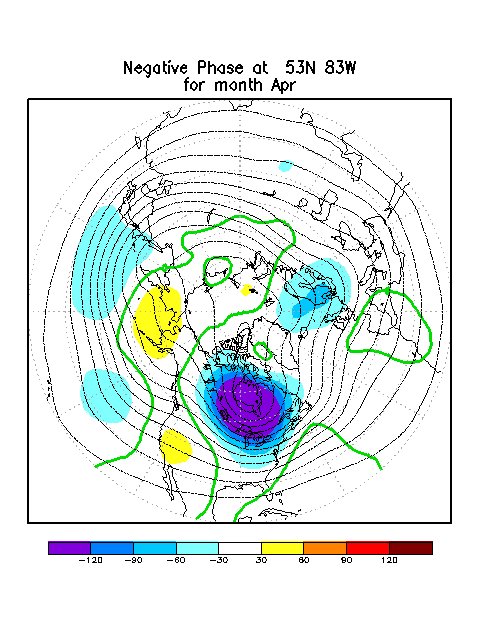
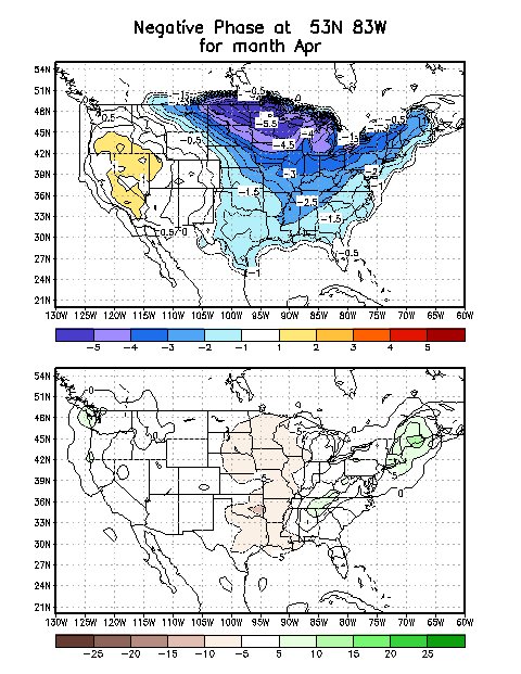
This potential #cold is related to anomalous 500-hPa ridging forecast over the Bering Sea and a downstream trough over Hudson Bay that will likely help drive Arctic air southward. Typically observed temperature anomalies from this ridge/trough combination are shown here. (2/2)