Arbor Doctor Storm total forecast (Hamilton Co.): 2-4 east to 3-5 west
Pavement forecast Hamilton County: Trace to 2 slushy inches. Given the warm ground temperatures, I don’t agree with the “impossible” wording below. Morning rush hour will be a challenge. Evening rush should be pretty good.
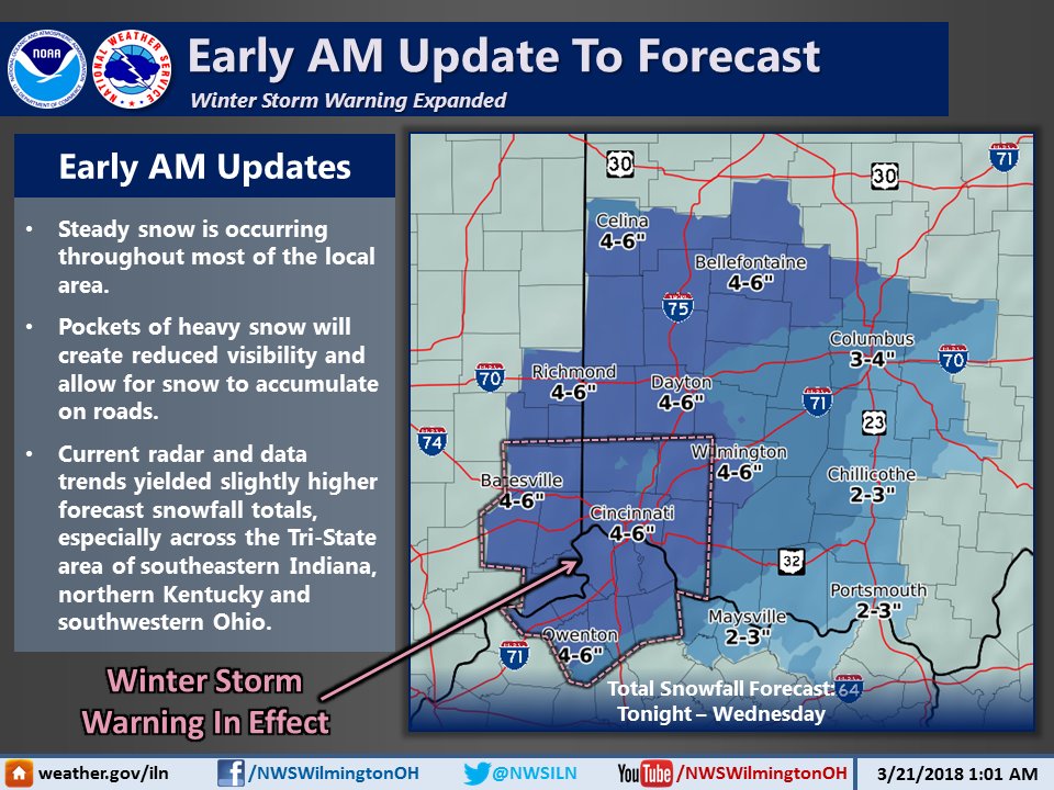
Winter Storm Warning
URGENT - WINTER WEATHER MESSAGE
National Weather Service Wilmington OH
407 AM EDT Wed Mar 21 2018

INZ066-073>075-080-KYZ089>096-OHZ070-071-077-078-211500-
/O.CON.KILN.WS.W.0003.000000T0000Z-180322T0000Z/
Franklin IN-Ripley-Dearborn-Ohio-Switzerland-Carroll-Gallatin-
Boone-Kenton-Campbell-Owen-Grant-Pendleton-Butler-Warren-Hamilton-
Clermont-
Including the cities of Brookville, Batesville, Milan,
Versailles, Lawrenceburg, Aurora, Rising Sun, Vevay, Carrollton,
Warsaw, Florence, Burlington, Oakbrook, Covington, Erlanger,
Independence, Newport, Alexandria, Owenton, Williamstown,
Crittenden, Dry Ridge, Falmouth, Butler, Hamilton, Middletown,
Fairfield, Oxford, Mason, Lebanon, Springboro, Cincinnati,
and Milford
407 AM EDT Wed Mar 21 2018

...WINTER STORM WARNING REMAINS IN EFFECT UNTIL 8 PM EDT THIS
EVENING...

* WHAT...Heavy snow continuing. Additional snow accumulations of
  1 to 3 inches are expected.

* WHERE...Portions of Southeast Indiana, Northern Kentucky and
  Southwest Ohio.

* WHEN...Until 8 PM EDT this evening.

* ADDITIONAL DETAILS...Plan on difficult travel conditions,
  including during the morning commute. Be prepared for
  significant reductions in visibility at times.

PRECAUTIONARY/PREPAREDNESS ACTIONS...

A Winter Storm Warning for snow means severe winter weather
conditions will make travel very hazardous or impossible. If you
must travel, keep an extra flashlight, food and water in your
vehicle in case of an emergency. Additional information can be
found at www.weather.gov/iln as well as on our Facebook and
Twitter pages.