
Severe Weather Summary – April 1, 2023>>>
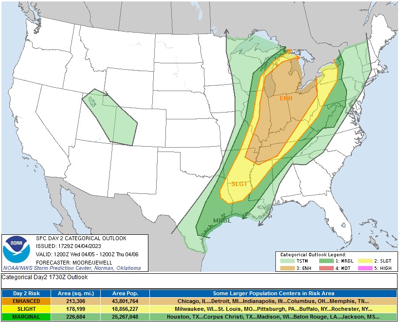
Severe Weather Summary – April 5, 2023>>>
Temperatures dropped below 18F on the morning of March 19 at Cheviot, OH 3W.
Regional Climate Summary – March 2023>>>
March 3, 2023 — Severe Weather, High Winds, and Tornadoes>>>
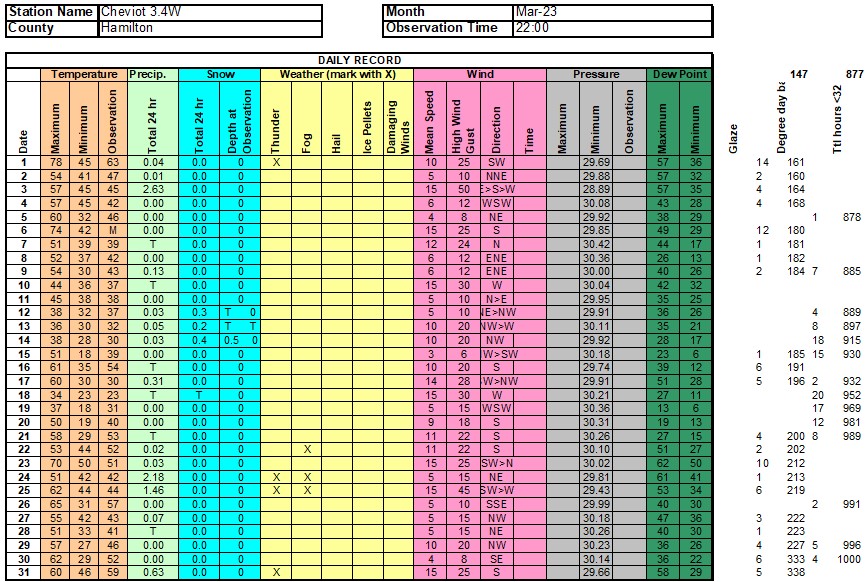
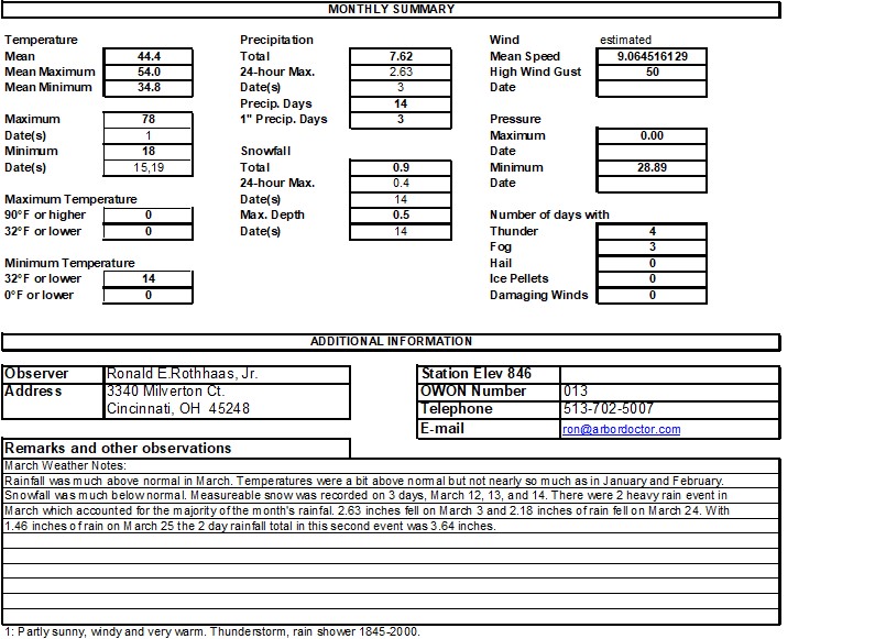
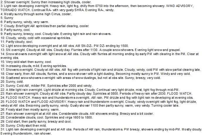

Mid-month cold smoked early blooming magnolias.

Drought damage began to show up on western arborvitae from the fall 2022 drought.

High wind events resulted in a number of uprooted trees, particularly evergreens.
Severe Storm Risk
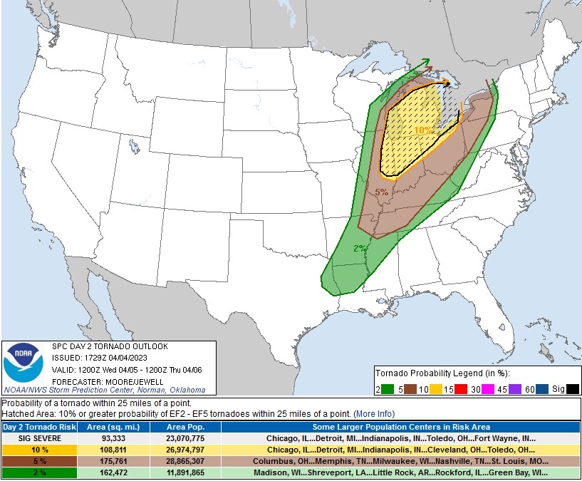
Tornado risk
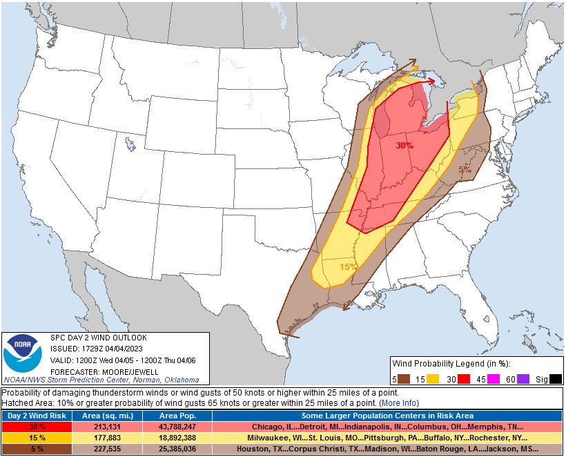
Damaging Wind Risk
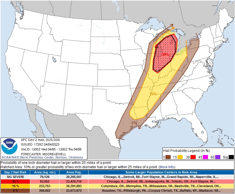
Large hail risk
…THERE IS AN ENHANCED RISK OF SEVERE THUNDERSTORMS FROM THE LOWER OHIO RIVER VALLEY TO THE GREAT LAKES REGION…
…SUMMARY…
Scattered severe storms posing a risk for strong tornadoes and large hail are expected in a corridor across eastern Illinois through Lower Michigan Wednesday, with organizing clusters or lines of storms accompanied by potentially damaging wind gusts, and a few tornadoes across the Ohio Valley vicinity.
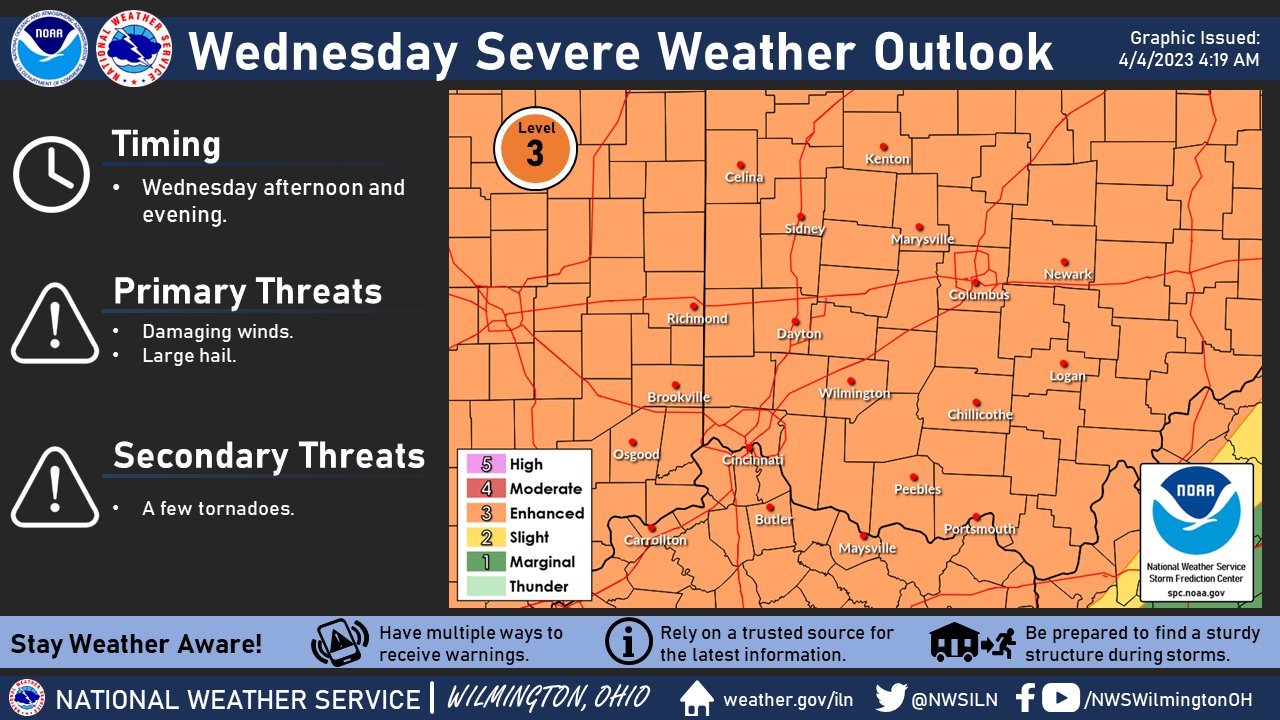
Potent low pressure and a cold front will provide the focus for severe thunderstorms on Wednesday. Best window for severe storms will be Wednesday afternoon and evening. Stay weather aware!
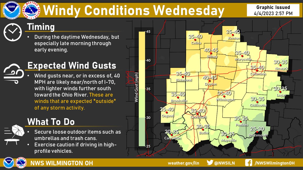
In addition to the potential for severe storms Wednesday, breezy to windy conditions are expected, with gusts near, or in excess of, 40 MPH likely at times. This is wind that is *not* associated with any storm activity.