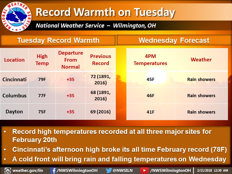
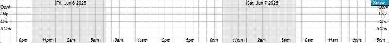
A special weather statement has been issued for snow Sunday on Cincinnati. I’m sure you’ve all seen it. Actually, I’m sure most haven’t seen it because few see special weather statements. Not a big storm but there may be slick driving at times, especially Sunday morning and later in the evening. It’s super bowl Sunday. I would have issued a winter weather advisory. Another complication is that pavement temperatures are cold but the air temperature will likely be above freezing for most of the event.
Special Weather Statement
National Weather Service Wilmington OH
508 AM EST Sat Feb 3 2018

INZ050-058-059-066-073>075-080-KYZ089>100-OHZ026-034-035-042>046-
051>056-060>065-070>074-077>082-088-032100-
Wayne-Fayette IN-Union IN-Franklin IN-Ripley-Dearborn-Ohio-
Switzerland-Carroll-Gallatin-Boone-Kenton-Campbell-Owen-Grant-
Pendleton-Bracken-Robertson-Mason-Lewis-Hardin-Mercer-Auglaize-
Darke-Shelby-Logan-Union OH-Delaware-Miami-Champaign-Clark-
Madison-Franklin OH-Licking-Preble-Montgomery-Greene-Fayette OH-
Pickaway-Fairfield-Butler-Warren-Clinton-Ross-Hocking-Hamilton-
Clermont-Brown-Highland-Adams-Pike-Scioto-
Including the cities of Richmond, Connersville, Liberty,
West College Corner, Brookville, Batesville, Milan, Versailles,
Lawrenceburg, Aurora, Rising Sun, Vevay, Carrollton, Warsaw,
Florence, Burlington, Oakbrook, Covington, Erlanger,
Independence, Newport, Alexandria, Owenton, Williamstown,
Crittenden, Dry Ridge, Falmouth, Butler, Augusta, Brooksville,
Mount Olivet, Maysville, Vanceburg, Tollesboro, Kenton, Ada,
Celina, Coldwater, Wapakoneta, St. Marys, Greenville, Sidney,
Bellefontaine, Marysville, Delaware, Troy, Piqua, Tipp City,
Urbana, Springfield, London, West Jefferson, Plain City,
Columbus, Newark, Eaton, Camden, Dayton, Kettering, Beavercreek,
Fairborn, Xenia, Washington Court House, Circleville, Lancaster,
Pickerington, Hamilton, Middletown, Fairfield, Oxford, Mason,
Lebanon, Springboro, Wilmington, Blanchester, Chillicothe, Logan,
Cincinnati, Milford, Georgetown, Mount Orab, Hillsboro,
Greenfield, West Union, Peebles, Waverly, Piketon, Portsmouth,
and Wheelersburg
508 AM EST Sat Feb 3 2018

..WINTER WEATHER TO IMPACT THE AREA LATE TONIGHT THROUGH
SUNDAY...

Snow will develop late tonight with up to an inch of accumulation
by Sunday morning. The snow will mix with rain Sunday morning,
mainly south of I-70. The precipitation will transition to all
snow Sunday afternoon with the passage of a cold front.

Storm total snow though Sunday night of 1 to 3 inches will be
possible along and north of I-70, with 1 to 2 inches south of
I-70.

The snow could create some slick spots on untreated roadways and
make travel difficult at times. Exercise caution if you plan on
traveling late tonight or Sunday. Allow extra time to reach your
destination.