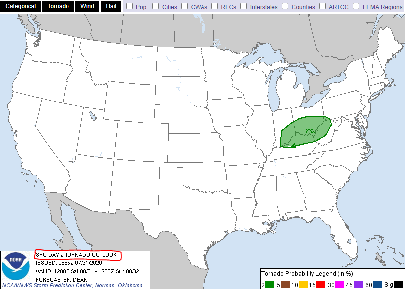
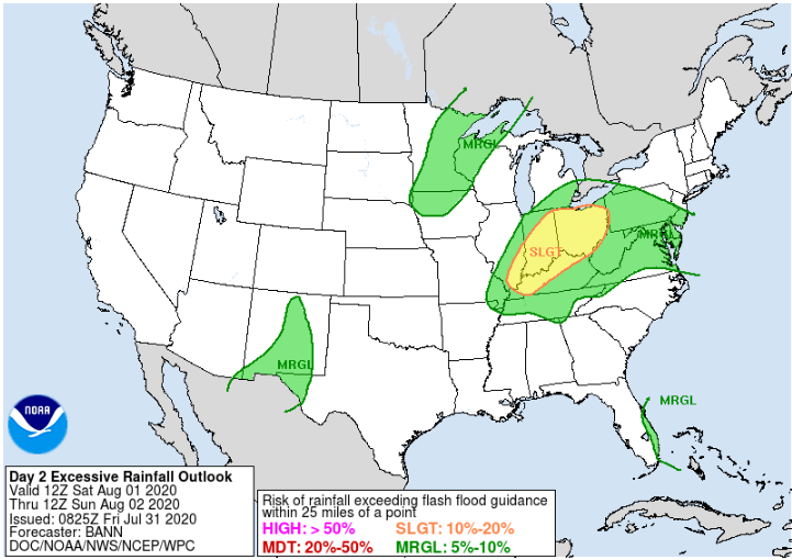
Thunderstorms expected Saturday in the Ohio valley with a few severe storms possible during the afternoon and evening. The main threat will be damaging winds. A tornado can not be ruled out. Also, heavy rain and localized flooding will be possible.

…THERE IS A MARGINAL RISK OF SEVERE THUNDERSTORMS FOR PORTIONS OF THE OH/TN VALLEYS INTO THE MID ATLANTIC…

…SUMMARY…
Strong thunderstorms may impact parts of the Ohio and Tennessee
Valleys Saturday afternoon and evening, accompanied by at least some
risk for damaging wind gusts and a couple of tornadoes. A few strong
storms capable of damaging wind will also be possible across parts
of the Mid Atlantic.


…FLASH FLOOD WATCH IN EFFECT THROUGH FRIDAY MORNING…

The National Weather Service in Wilmington has issued a

* Flash Flood Watch for portions of Southeast Indiana, Kentucky,
and Ohio, including the following areas, in Southeast Indiana,
Dearborn, Franklin IN, Ohio, Ripley, and Switzerland. In
Kentucky, Boone, Bracken, Campbell, Carroll, Gallatin, Grant,
Kenton, Lewis, Mason, Owen, Pendleton, and Robertson. In Ohio,
Adams, Brown, Butler, Clermont, Clinton, Hamilton, Highland,
Pike, Scioto, and Warren.

* Through Friday morning

* Multiple rounds of showers and thunderstorms are expected today
and tonight. Rainfall amounts of 1 to 3 inches can be expected
across the watch area by Friday morning, with isolated heavier
totals. This heavy rain will be capable of producing flash
flooding.

PRECAUTIONARY/PREPAREDNESS ACTIONS…

People in the watch area should keep an eye on the weather and be
prepared for immediate action should heavy rains and flooding
occur or a Flash Flood Warning be issued. Avoid low-lying areas,
and be careful when approaching highway dips and underpasses.

Satellite

NWS radar Loop from Wilmington, OH
Weather Radar:
Radar Status Message

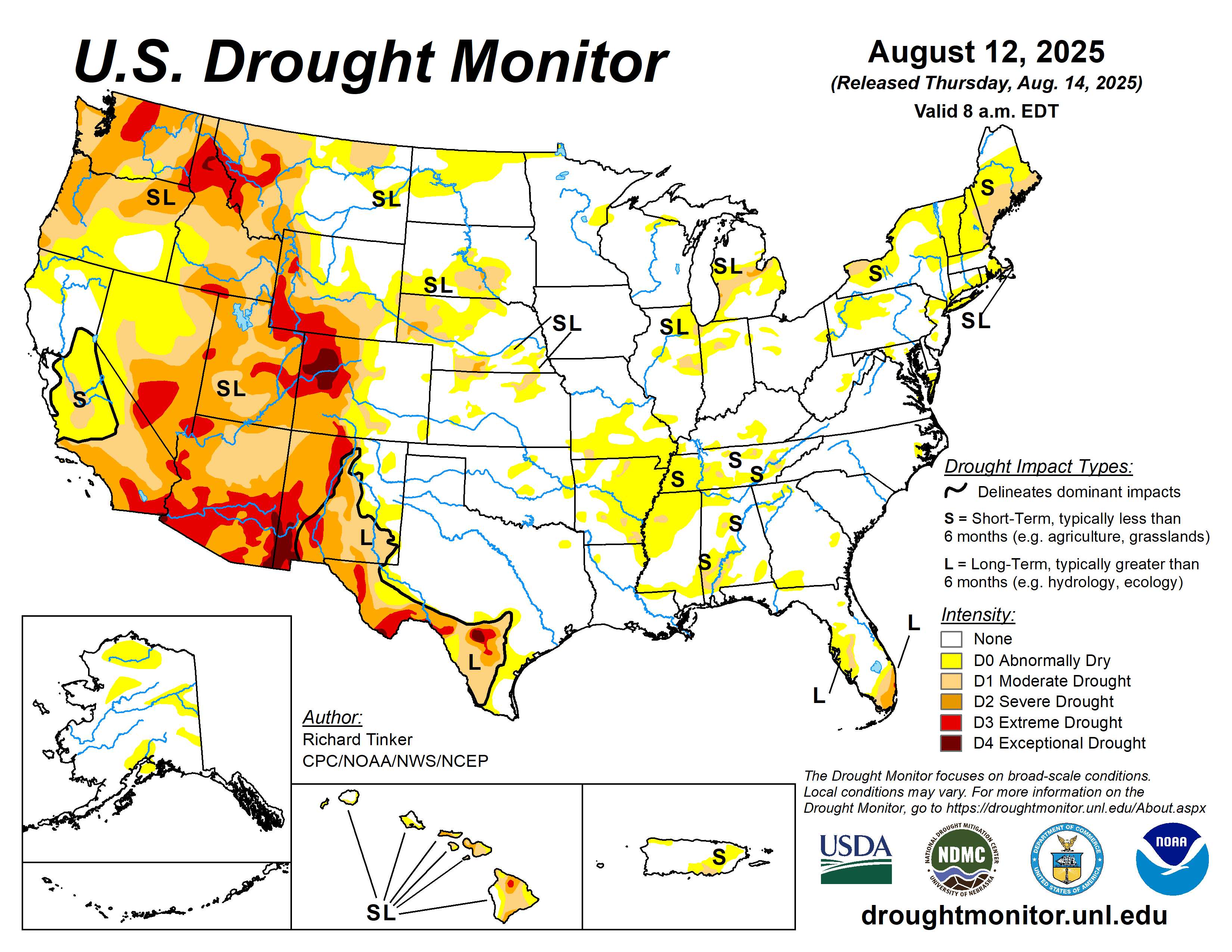
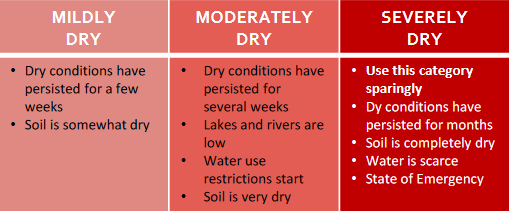
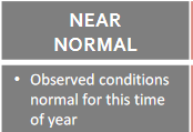
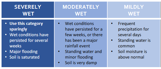
Soil Moisture Condition Monitoring Weekly Report: Near Normal here but very dry and even drought in parts of Ohio and Indiana

United States Drought Monitor

Station Number: OH-HM-24
Station Name: Cheviot 3.4 W
Report Date: 7/25/2020
Submitted: 7/25/2020 6:16 AM
Scale Bar: Near Normal
Description:

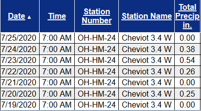
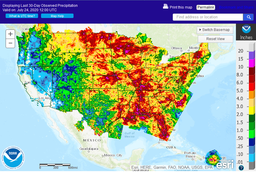
1.43 inches of rain in the past week on top of very dry ground. Rain fell in small to moderate amounts over several days so infiltration was good. Hot weather maintained high drying rates. Drought and heat stressed lawns and landscapes perked up. Rain this week was area wide but varied in amounts. Soil moisture is in the normal range but still on the dry side of normal. We have been able to ease up on watering here.

Categories:
General Awareness
Agriculture
Business & Industry
Plants & Wildlife
Society & Public Health

This report is specifically for the Arbor Doctor’s location 3.4 miles west of Cheviot, OH, in the western suburbs of Cincinnati in southwest Ohio. This location is also an official cooperative observation site for the National Weather Service listed as Cheviot 3W.

What is the Condition Monitoring Report? See these links for more information:

Explanation of scale bar>>>

Search condition monitoring reports for the entire US>>>  

CoCoRaHS Condition Monitoring Report Map>>> 


Please remember to water…correctly!

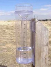
Water once per week, one inch per week, under the entire branch spread, in the absence of rain, May through November. Either rainfall or your watering should equal the one inch per week. Put out a sprinkler and a straight sided soup can or rain gauge and measure one inch per week.

11-inch capacity rain gauge  

Taylor rain gauge   

Watering: How and when>>>

Watering Trees and Shrubs>>>


Soil Moisture Index:

Meteorological Versus Astronomical Seasons. Summertime!

Spring: March 1-May 31; Summer: June 1-August 31; Fall: September 1-November 30; Winter: December 1-February 28 (29)


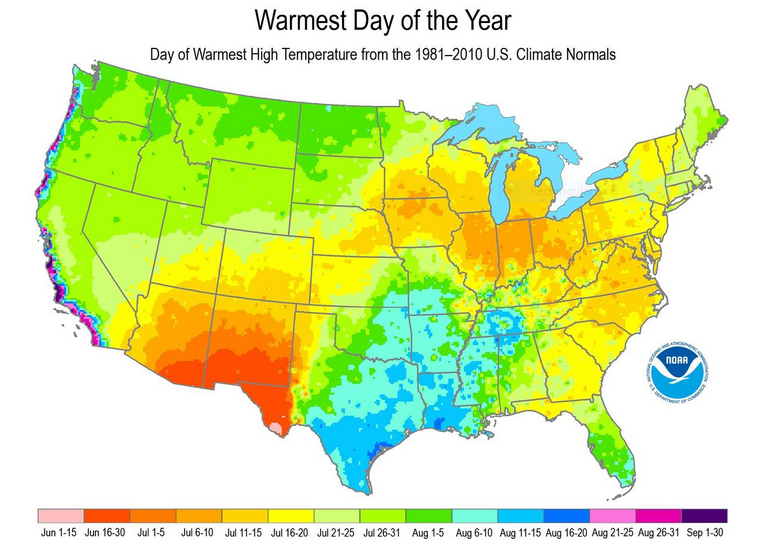
You may have noticed that Arbor Doctor, meteorologists and climatologists define seasons differently from “regular” or astronomical spring, summer, fall, and winter. So, why do  meteorological and astronomical seasons begin and end at different times? Climatologically, the period July 14-21, the mid-point of meteorological summer, is the hottest week of the year and the period January 14-21, the mid-point of meteorological winter, is the coldest week of the year over much of the continental US including the Ohio valley.

Read more here>>>