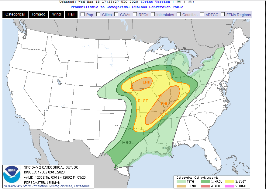
After earlier forecasts of an extremely wet pattern setting up in the Ohio valley, another system will bring some rain but shunt the heaviest rainfall to the south. Sorry, Tennessee. Some snow may even mix in in the Ohio valley with a light accumulation on grass possible north of the Ohio River Saturday night. Drier weather will then prevail until late week.
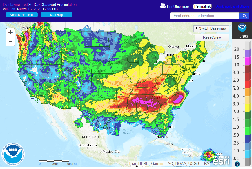
That bright spot in the California Sierra Nevadas is a much needed heavy snow pattern which comes after 2 months of very dry weather.
 The day 6-7 outlook shows heavy rain moving into the Ohio valley late next week. The pattern lately has been for these systems to sink southward with later model runs. We’ll have to see what happens next week but it looks like we’ll get a few dry days in the Ohio valley Monday-Wednesday.