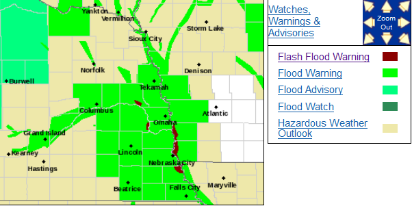
Catastrophic flooding is occurring in a large area of Nebraska, Iowa, Wisconsin, and South Dakota following the intense late winter storm system which dumped huge amounts of rain on top of snow pack and frozen ground.
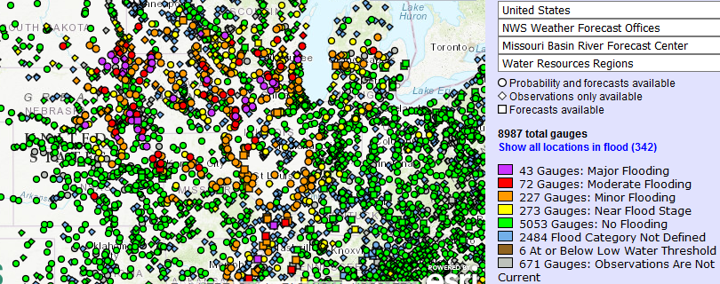
43 river gauges are at major flood levels.
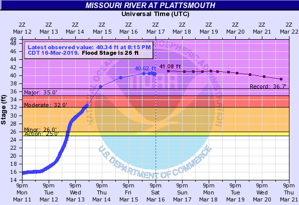
At a number of locations, river levels are higher than ever before seen, such as this river gauge at Plattsmouth, Nebraska, which Saturday evening stood at 4 feet over the historic record flood stage.
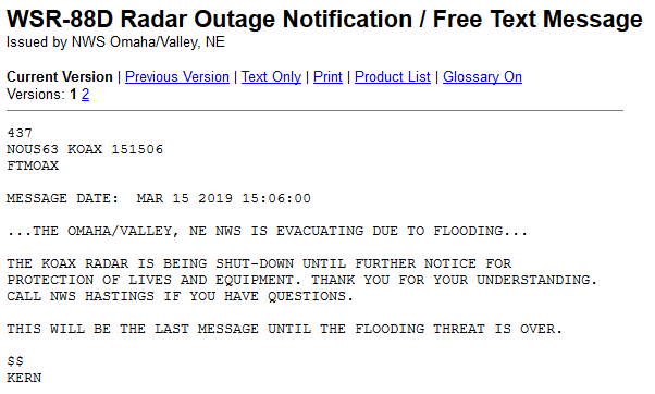
The National Weather Service Office at Omaha/Valley, Nebraska had to be shut down and evacuated when one of a number of levee breaks occurred resulting in widespread flooding and emergency evacuations. To my knowledge this is the first time a weather radar has been shut down and a National Weather Service office abandoned since Hurricane Maria devastated Puerto Rico.
A state of emergency has been declared in Nebraska. Hundreds of water rescues have been undertaken and some have died in the process.

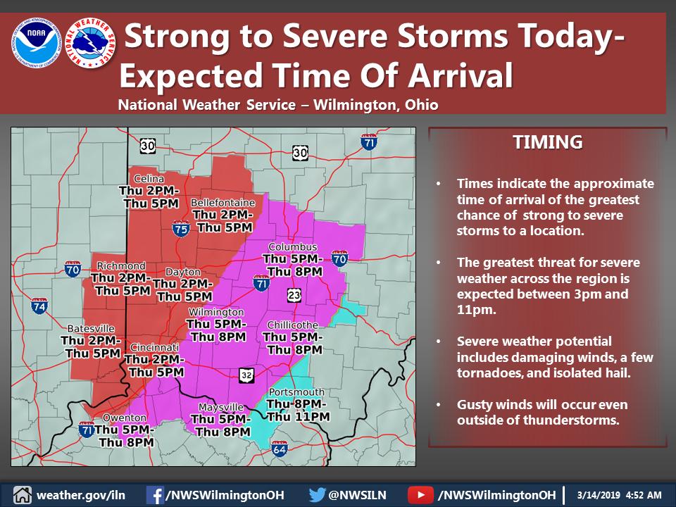
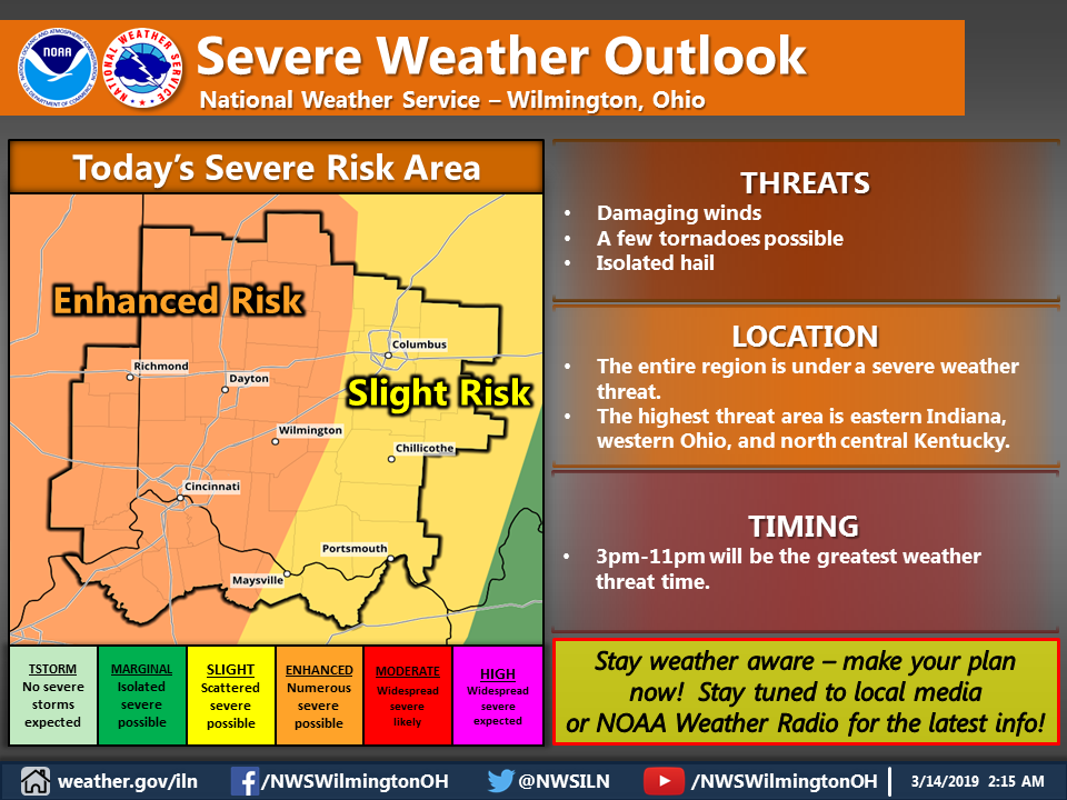
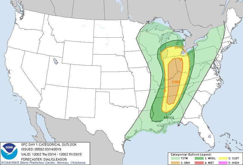
 severe weather watches and warnings, wind damage, radar indicated tornadoes, and street flooding, we have a few cool days followed by a warm up and generally quiet weather for at least a week or so.