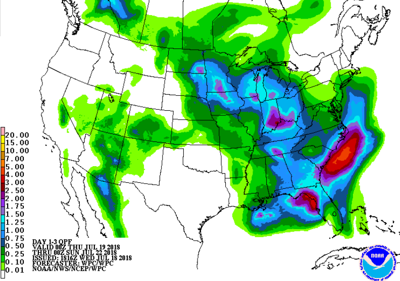
 Rainfall forecast through Sunday evening
Well, I’m kind of scared to say anything given how the last few weather systems pretty well fizzled over Cincinnati and left us parched and dry but it is looking increasingly likely that Cincinnati will see widespread, substantial rainfall this weekend. I hope so.
It is getting very dry out there. I have not gotten measurable rain at my official National Weather Service Cooperative Observer site for two weeks and I have only gotten 0.59 inches in July! I saw 5 foot tall, established oakleaf hydrangeas today, in the shade, completely wilted down. Forecast models have been consistent now for days showing a low pressure system moving into the Ohio valley Friday and then stalling for the weekend. This would result in periods of showers and thunderstorms Friday afternoon through early Monday, with chances possibly lingering into Tuesday.

Additional rainfall forecast Sunday evening through Tuesday evening
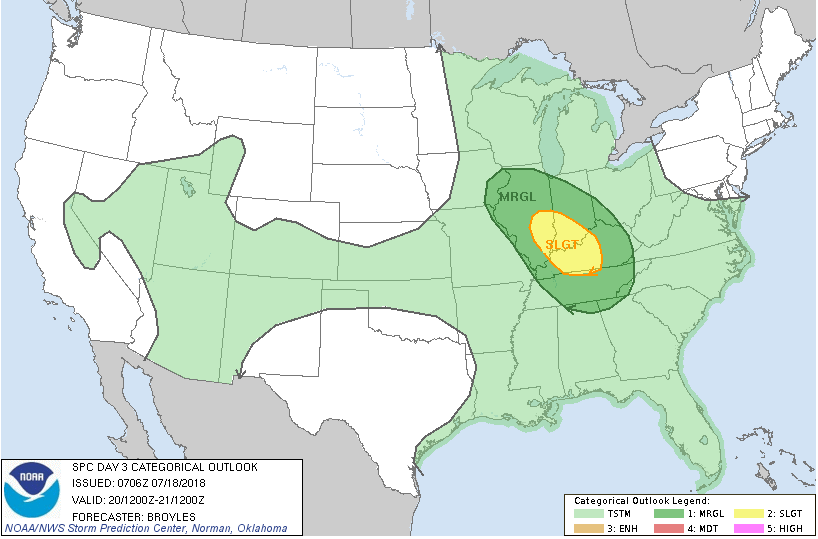
Given upper level dynamics with the stalled upper level low there will be a marginal to slight severe weather threat over Friday and over the weekend and I can’t rule out a tornado or two, especially southwest of Cincinnati.

Saturday Day 3 Severe Weather Outlook
There are also no 90’s foreseen in the 7 day forecast with below normal temperatures forecast for the next 14 days. It’s about time. For those of you who like torrid weather, the party’s over. For those of you who yearn for cooler, wetter weather, things are looking promising. Still, I am watering. I will believe it when it’s in my rain gauge.

Current 7 day rainfall projection shows 3-4 inch totals from Indianapolis southeast through Cincinnati to Maysville, KY. We’ll see…

After 3 months of brutal heat, can this be true? The 8-14 day outlook.
