Climate change itself is already in the process of definitively rebutting climate alarmists who think human use of fossil fuels is causing ultimately catastrophic global warming. That is because natural climate cycles have already turned from warming to cooling, global temperatures have already been declining for more than 10 years, and global temperatures will continue to decline for another two decades or more.
Historic and catastrophic flooding in Nebraska and the midwest ongoing

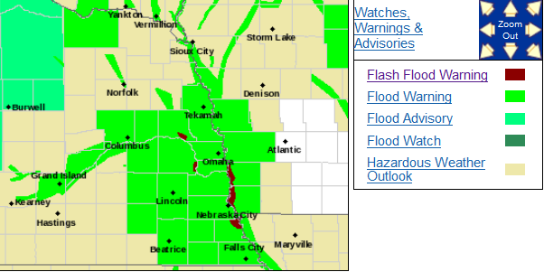
Catastrophic flooding is occurring in a large area of Nebraska, Iowa, Wisconsin, and South Dakota following the intense late winter storm system which dumped huge amounts of rain on top of snow pack and frozen ground.

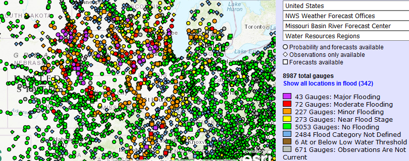
43 river gauges are at major flood levels.

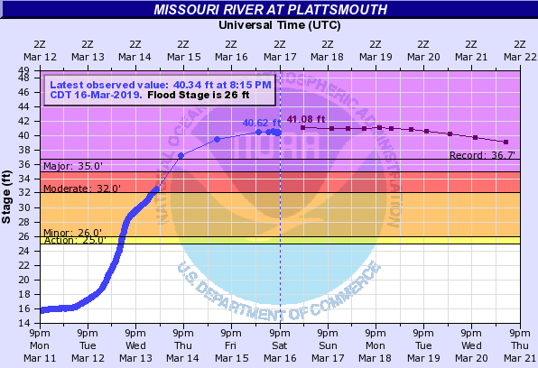
At a number of locations, river levels are higher than ever before seen, such as this river gauge at Plattsmouth, Nebraska, which Saturday evening stood at 4 feet over the historic record flood stage.

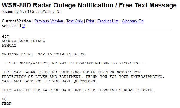
The National Weather Service Office at Omaha/Valley, Nebraska had to be shut down and evacuated when one of a number of levee breaks occurred resulting in widespread flooding and emergency evacuations. To my knowledge this is the first time a weather radar has been shut down and a National Weather Service office abandoned since Hurricane Maria devastated Puerto Rico.
A state of emergency has been declared in Nebraska. Hundreds of water rescues have been undertaken and some have died in the process.
Soil Moisture Condition Monitoring Weekly Report: Severely Wet
Station Number: OH-HM-24
Station Name: Cheviot 3.4 W
Report Date: 3/16/2019
Submitted: 3/16/2019 8:24 AM
Scale Bar: Severely Wet
Description:
2.32 inches of rain in the past week. Ground is completely saturated with water. Standing water is severe and abundant. Water bodies are very elevated.
Categories:
General Awareness
Agriculture
Plants & Wildlife
–
This report is specifically for the Arbor Doctor’s location 3.4 miles west of Cheviot, OH, in the western suburbs of Cincinnati in southwest Ohio. This location is also an official cooperative observation site for the National Weather Service listed as Cheviot 3W.
What is the Condition Monitoring Report? See these links for more information:

