A winter encore. Bitter cold is a sure thing, and snow is a good possibility. Snow amounts are to be determined.

6 to 10 Day Outlook - Temperature Probability

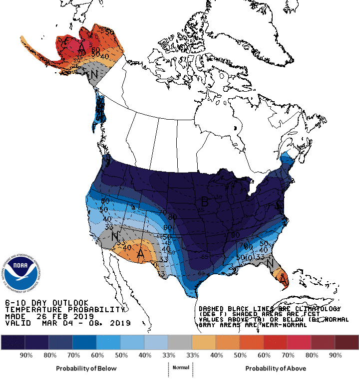
After we close out another very warm February, winter is definitely making an encore. I am already hearing talk of major snow Sunday. Well, hold on a minute. There is increasing confidence for snow Sunday, and heavy snow cannot be ruled out, but there are many other scenarios and it is way too early to be pinning down predictions.

A cold front moved through Cincinnati this evening, after a warm day, with wind and falling temperatures. The next couple days won’t be too bad, and Saturday could be nice again.

Sunday, a potentially impactful winter storm system will be moving in from the southwest. A band of of heavy snow is likely, Where that band will set up remains unknown. It is too early to tell and anyone who says they can this far out is guessing. Cincinnati is definitely in the potential target zone at this early time. It is best to be prepared because at the high end of possibilities this storm could be quite significant.

For now, be aware snow is possible Sunday which may be enough for salting or even plowing operations. Be ready for the worst, but a much lower snow total is still equally possible.

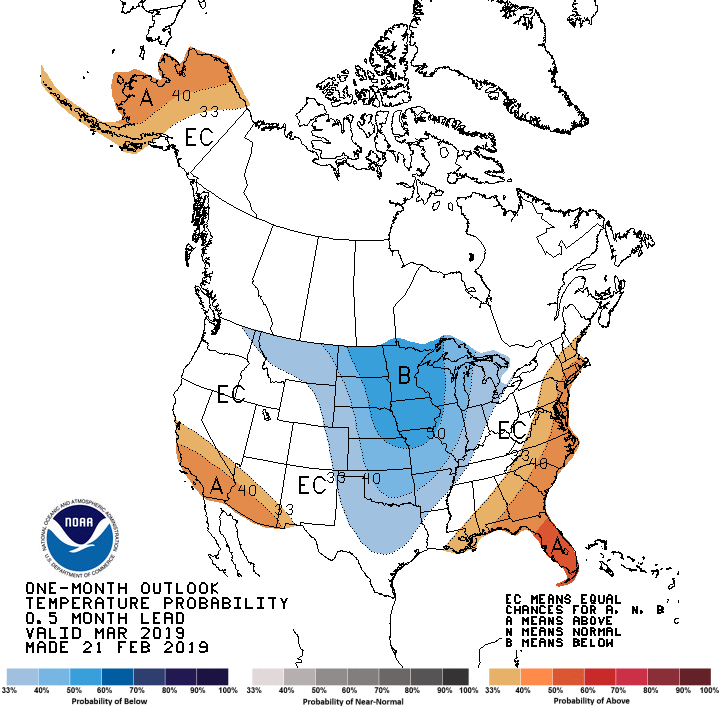
After Sunday, bitter cold arctic air will be moving down from the north. The thrill is gone, the chill is on. Highs next week could remain in the 20’s on several days, and lows in the single digits are certainly possible, even below zero if we get a few inches of snow cover.

This is a developing situation, so stay tuned.


Thursday AM update: A major, impactful winter storm will move through the Ohio valley Sunday. A band of of heavy snow is likely, Where that band will set up remains unknown. It is too early to tell and anyone who says they can this far out is guessing. Cincinnati is definitely in the potential target zone at this early time. It is best to be prepared because at the high end of possibilities this storm could be quite significant.

This Thursday AM Hazardous Weather Outlook is for East Central Indiana,
Southeast Indiana, Northern Kentucky, Central Ohio, South Central
Ohio, Southwest Ohio and West Central Ohio.

.DAY ONE…Today and Tonight.

Light mixed precipitation may cause slick spots on roads tonight.

.DAYS TWO THROUGH SEVEN…Friday through Wednesday.

A storm system passing south of the region has the potential to
bring significant accumulating snow Sunday. The exact path of the
system will determine how much snow the region will receive.

Mixed reviews for the groundhog. He looked pretty good in the Ohio valley in February, but egg on his face in early March as winter reasserts itself.

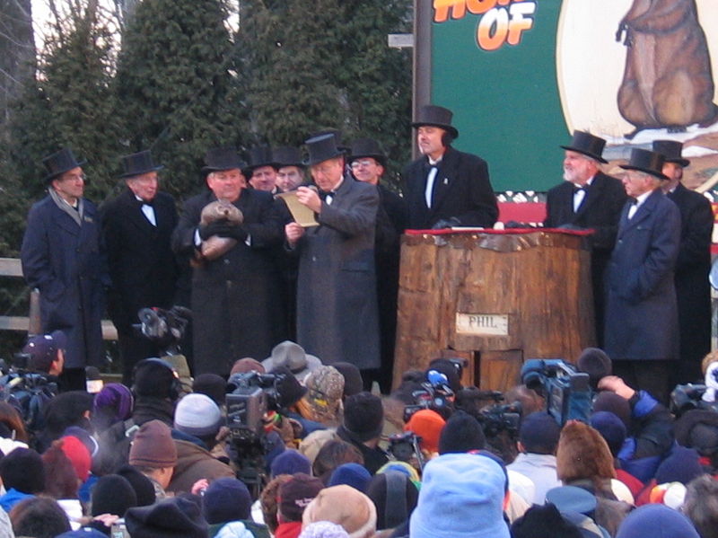
Neither meteorological prognosticators  and groundhogs Punxsutawney Phil nor Buckeye Chuck saw their shadow this year on February 2. According to legend, that meant we would not see 6 more weeks of winter. How is that going so far?

February has been a wild month with massive amounts of snow in the western mountains, a record snowfall in the higher elevations of Arizona, a massive Great Plains blizzard, and a  widespread wind storm which set a February record wind speed of 171 mph on top of Mt. Washington, New Hampshire. It even snowed in Burbank, California (flurries) and Las Vegas, Nevada. By those measures, we certainly had more winter in February.

However, Punxsutawney Phil and Buckeye Chuck are located in northwest Pennsylvania and central Ohio, respectively.  Those areas missed much of the mayhem as a strong Bermuda high dominated the southeast US and defected all the storms to the north. My Cheviot, Ohio 3W location has averaged 5 degrees above normal in February, the second warm Febuary in a row, and some trees are starting to bud out. Incredible rains fell along the boundary of the warm high and cold arctic air, and helped to fuel the blizzard and wind storm, but it made the groundhogs look pretty good in Ohio and northwestern Pennsylvania.

Meteorological winter ends Thursday, However, the 6 weeks does not end until the calendar says spring. So, how do those last few weeks look for the groundhog? Not good.

All that cold air is going to finally triumph over that stubborn high. Florida will likely be spared, but much of the rest of the east is in for a couple weeks of arctic cold before spring finally takes back over after March 10. Highs next week in Cincinnati will be in the 20’s on Monday and Tuesday, and likely very cold for most of the week. There will be some snow chances in the Ohio valley to go with the cold, but only chances. That picture is not clear yet. What is clear is that more storms will batter the west coast and California won’t be complaining about a lack of water anytime soon.

The groundhogs won’t be looking too good in early March as arctic cold re-asserts itself.

After March 10, spring should finally arrive in much of the east, certainly the southeast and Ohio valley. While we can’t promise there will be no more frost after that, prolonged cold does not look as likely this year in the spring as we had last year. However, that stubborn southeastern high will continue to deflect fronts. This type of set up favors a volatile spring, and severe storms and tornadoes may be a problem this year where the battles are fought.

The battle between cold to the west and the stubborn high in the southeast may favor severe storms and tornadoes when spring heats up. People in the north central US may wonder if spring will ever get here.

Meteorological Versus Astronomical Seasons

Spring: March 1-May 31; Summer: June 1-August 31; Fall: September 1-November 30; Winter: December 1-February 28 (29)

You may have noticed that Arbor Doctor, meteorologists and climatologists define seasons differently from “regular” or astronomical spring, summer, fall, and winter. So, why do meteorological and astronomical seasons begin and end at different times? Read more here>>>