
As
As we move into February, a battleground is setting up between a strong, Bermuda-type, high pressure system over the southeast US and very cold, wintry air to the northwest.
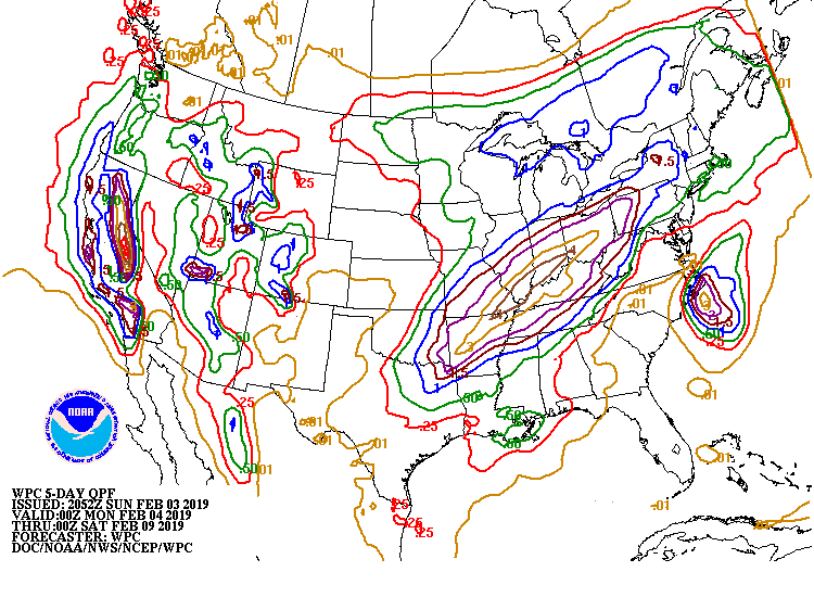
The battle lines appear to be lining up along the Ohio and mid-Mississippi valleys. This will result in a quasi-stationary frontal system dividing the very warm air (it was 66 degrees Sunday in Cincinnati) from the arctic air to the northwest. Snowstorms will likely develop well to the north of this boundary while very heavy rains repeatedly move up the Ohio River valley.
With soils already saturated, flooding could become a concern. The five day liquid precipitation map above shows up to 4 inches of rain from near Cincinnati southwestward, and there will be more storminess after that. At some point, if the front slips a little further south, the parade of rain storms could turn into ice or snow storms, but that would be a couple weeks down the line if it occurs.
In the meantime, start building an ark. You’re going to need it.
