
Condition Monitoring Report
Station Number: OH-HM-24
Station Name: Cheviot 3.4 W
Report Date: 1/19/2024
Submitted: 1/19/2024 6:50 PM
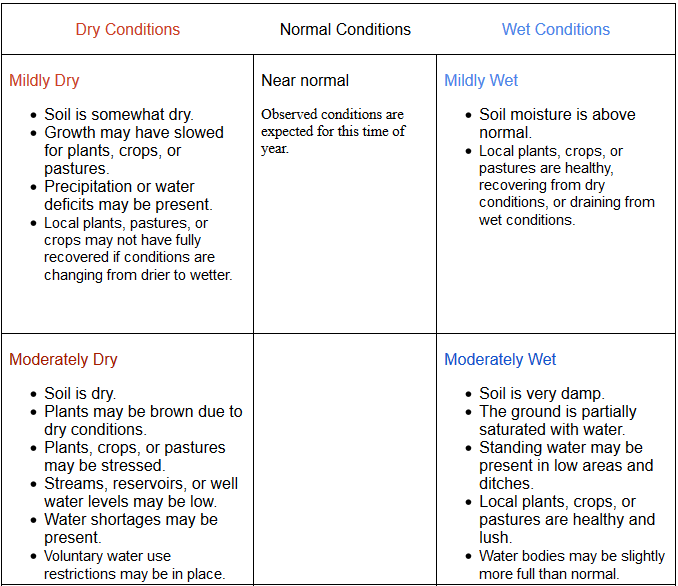
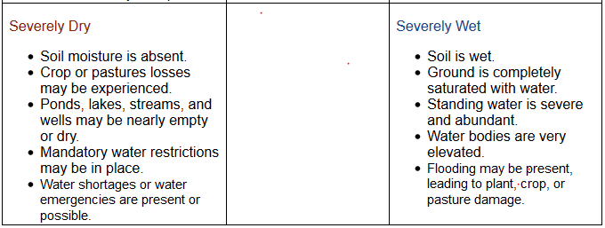
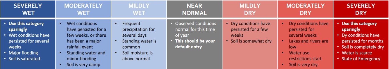
Scale Bar: Near Normal
Description:
At 3.07 inches, liquid and melted precipitation is running near normal for January after several months of dry and drought conditions. We accumulated only 0.26 inches in the past week as an arctic air mass descended on the area freezing the soggy ground and preventing any evaporation. 2.6 inches of snow fell today, melting down to 0.20 inch of liquid.
Categories: General Awareness
Agriculture
Plants & Wildlife
Society & Public Health
This report is specifically for the Arbor Doctor’s location 3.4 miles west of Cheviot, OH, in the western suburbs of Cincinnati in southwest Ohio. This location is also an official cooperative observation site for the National Weather Service listed as Cheviot 3W.
What is the Condition Monitoring Report? See these links for more information:
Explanation of scale bar>>>
Midwest U.S. Drought Monitor
30 Day Precipitation:
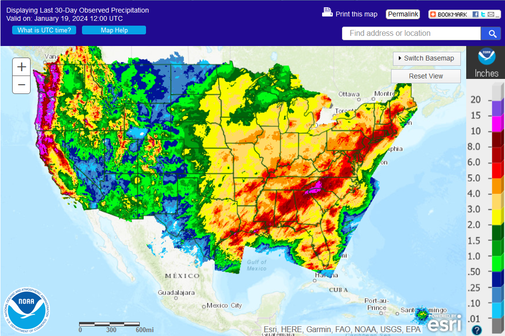
.
Ohio 30-Day Precipitation
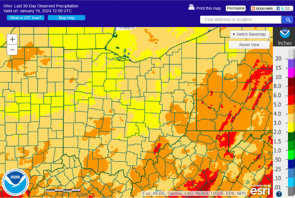
.
Weekly Weather and Crop Bulletin>>>
.
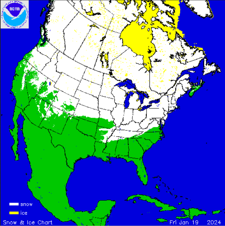
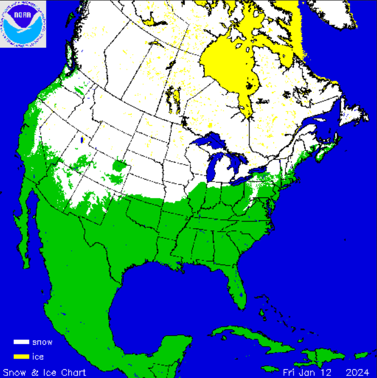
Snow Cover U.S. and Northern Hemisphere >>>
.
.
.
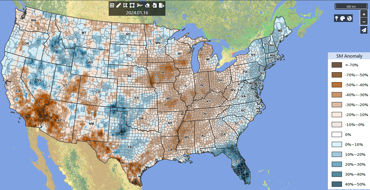
Crop Condition and Soil Moisture Analytics Map:

.
.
Search condition monitoring reports for the entire US>>>


Click on the title or the graphic (above) to access the
U.S. Weekly Drought MonitorPDF Version of Graphic

Click on the title or the graphic (above) to access the
U.S. Monthly Drought OutlookPDF Version of Graphic

Click on the title or the graphic (above) to access the
U.S. Seasonal Drought OutlookPDF Version of Graphic
Other Drought links:
- NWS Drought Fact Sheet
- North American Drought Monitor (NADM)
- National Integrated Drought Information System (NIDIS)
- National Drought Mitigation Center (NDMC)
- National drought summary>>>
Meteorological Versus Astronomical Seasons

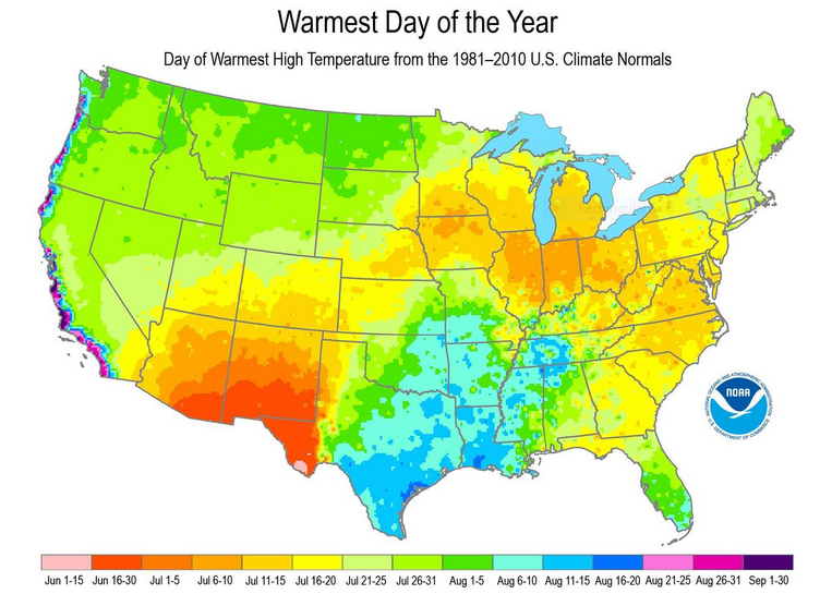
You may have noticed that Arbor Doctor, meteorologists and climatologists define seasons differently from “regular” or astronomical spring, summer, fall, and winter. So, why do meteorological and astronomical seasons begin and end at different times? Climatologically, the period July 14-21, the mid-point of meteorological summer, is the hottest week of the year and the period January 14-21, the mid-point of meteorological winter, is the coldest week of the year over much of the continental US including the Ohio valley.
–
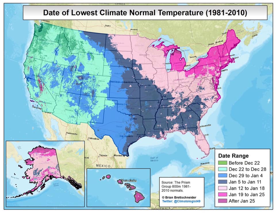
Nearly half the country has had its coldest day by the first day of calendar winter. That is why meteorological winter makes the most sense.