19th tornado confirmed in April 8-9 Ohio valley outbreak

The National Weather Service confirmed a 15th tornado in last week’s outbreak, and they may not be done yet. The 15th tornado started in Colerain Township and peaked in Mt. Healthy, Ohio.

The 14th tornado hit Indian Hill. Information and photos regarding this tornado were provided to the National Weather Service by Arbor Doctor Ron Rothhaas.

15 tornadoes is a remarkable number and illustrates why we were sounding the alarm last week.


Tornado Confirmations in chronological order

    1. 80-90 MPH Day Heights (Clermont Co) OH
    2. 70-80 MPH Highland County OH

Blog post containing photos and information I provided to the National Weather Service:

14th tornado confirmed in April 8-9 Ohio valley outbreak…with a little contribution from the Arbor Doctor

Summary of widespread severe storms and tornadoes of April 8-9, 2020 in the Ohio valley.

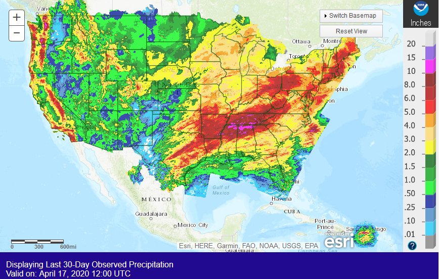
Soil Moisture Condition Monitoring Weekly Report: Mildly Wet

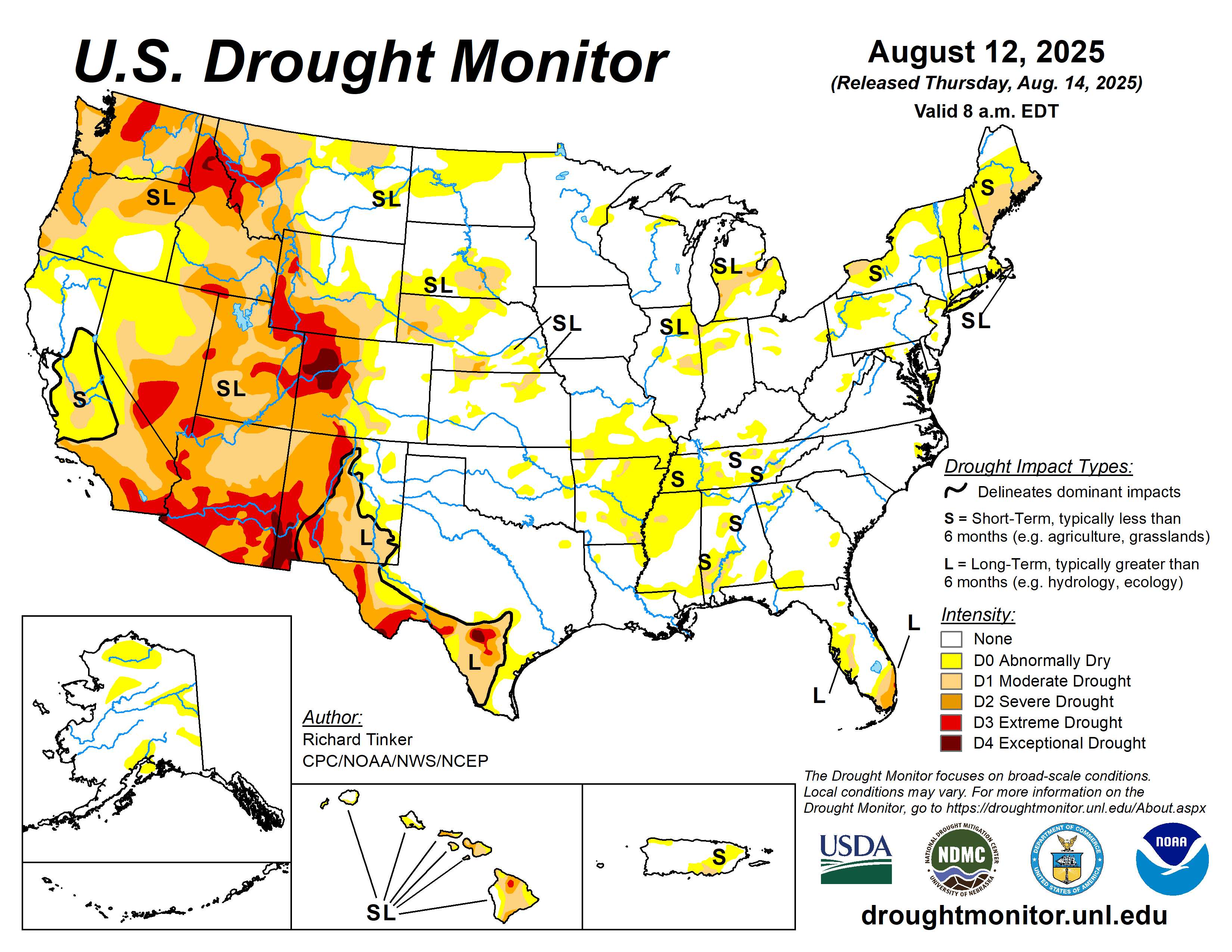
United States Drought Monitor

Station Number: OH-HM-24
Station Name: Cheviot 3.4 W
Report Date: 4/18/2020
Submitted: 4/18/2020 6:15 AM
Scale Bar: Mildly Wet
Description:

1.50 inches of rain in the past week. Soils are quite moist. Vegetation is lush.

Categories:
General Awareness
Agriculture
Plants & Wildlife

This report is specifically for the Arbor Doctor’s location 3.4 miles west of Cheviot, OH, in the western suburbs of Cincinnati in southwest Ohio. This location is also an official cooperative observation site for the National Weather Service listed as Cheviot 3W.

What is the Condition Monitoring Report? See these links for more information:

Explanation of scale bar>>>

Search condition monitoring reports for the entire US>>>  

CoCoRaHS Condition Monitoring Report Map>>> 


Soil Moisture Index:

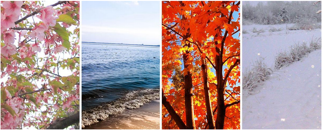
Meteorological Versus Astronomical Seasons. Spring is here!

Spring: March 1-May 31; Summer: June 1-August 31; Fall: September 1-November 30; Winter: December 1-February 28 (29)

You may have noticed that Arbor Doctor, meteorologists and climatologists define seasons differently from “regular” or astronomical spring, summer, fall, and winter. So, why do  meteorological and astronomical seasons begin and end at different times? Read more here>>>

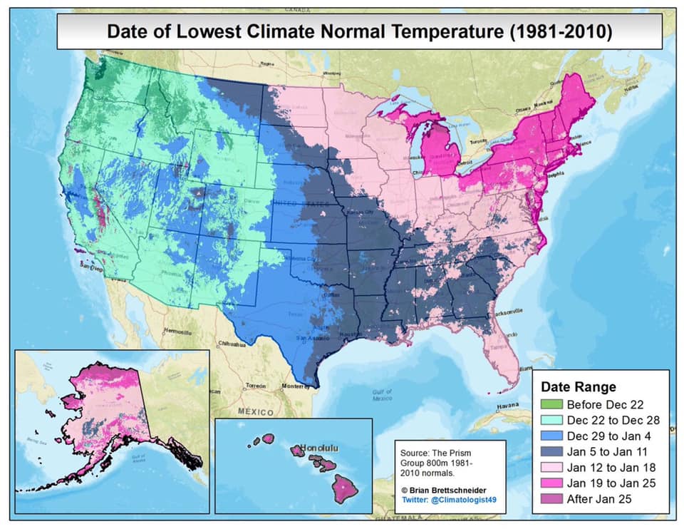
Nearly half the country has had its coldest day by the first day of calendar winter. That is why meteorological winter makes the most sense.

 Spring leaf out (click on map to enlarge):

Comparison of 2020 spring leaf out to average from 1981-2010

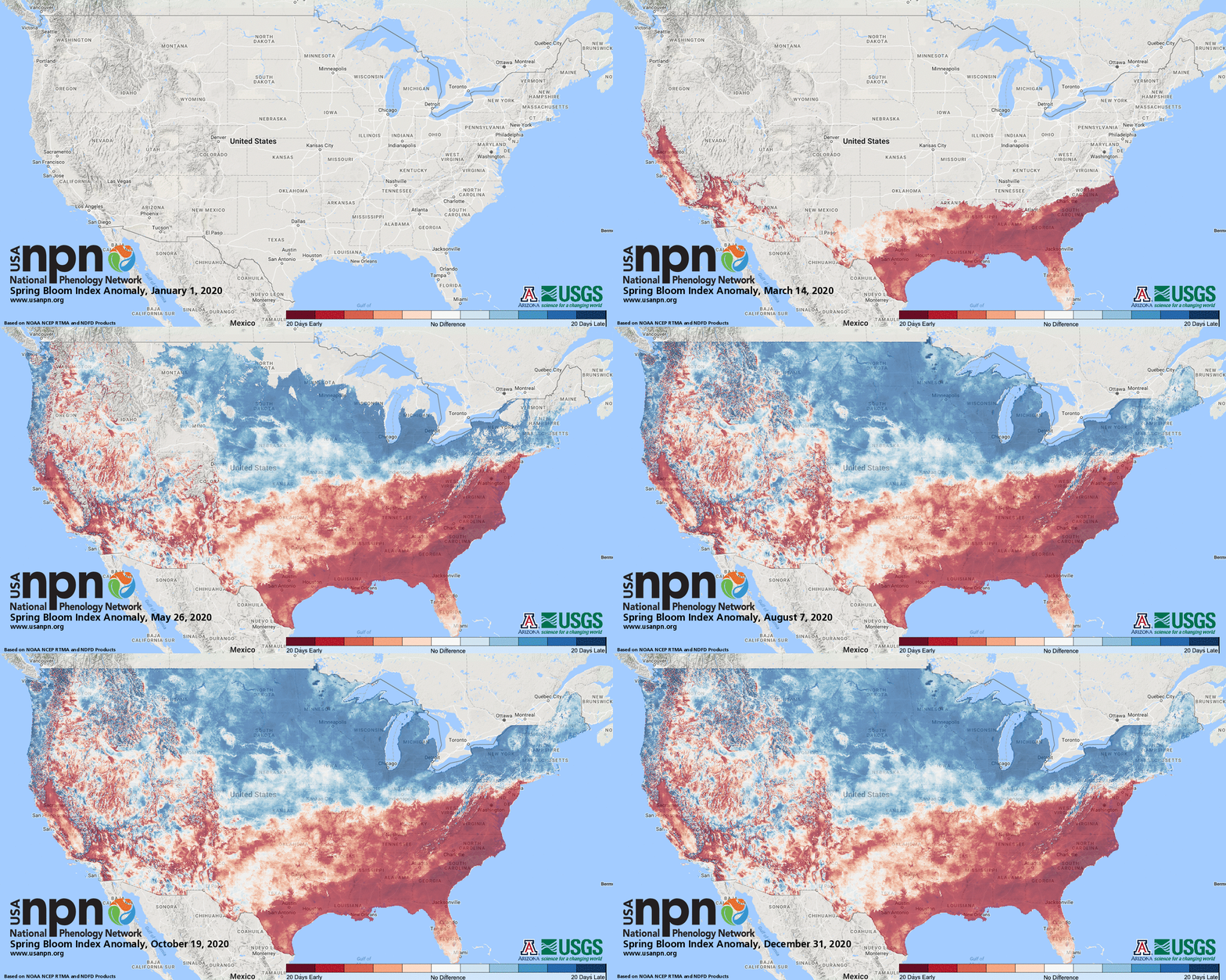
Spring bloom index (Click on map to enlarge):

Comparison of 2020 spring bloom to average from 1981-2010

Mid-spring deep freeze will be damaging to area landscapes. Just how damaging remains to be seen. Fall drought damage is an issue too.

7:00 AM reading at Cheviot OH 3W on April 16, 2020

As I write this, my National Weather Service issued thermometer reads 23.8 degrees Fahrenheit at Cheviot OH 3W after a low of 25.6 degrees Fahrenheit yesterday. This after I already accumulated 319 growing degree days and had gone 23 days since the last 32  degree Fahrenheit temperature.  All this adds up to what I expect will be significant damage horticulturally this year, short term and possibly long term for some plants.

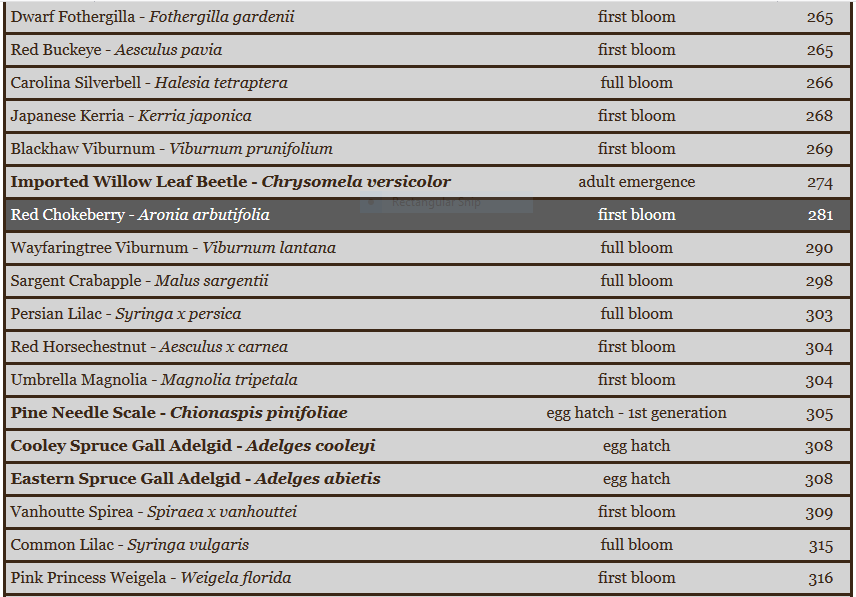
Phenology is the study of how plant progression and insect emergence is correlated to degree day accumulation. At 319 growing degree days, springtime is rocking and rolling and a deep freeze can be quite damaging.

Trees go through a hardening off process going from the warm growing season into winter. Cells dehydrate some and the trees go into a state where cells will not freeze and burst. As growing degree days accumulate in spring, those cells re-hydrate, sap flows, buds open and new growth commences. The problem is that the further plants progress along this spring progression the less able they are to tolerate cold and freezing temperatures.

When temperatures dip below freezing for an hour or two, there is not enough time for cells to freeze and be damaged. The longer the temperature is below freezing and the farther the temperature descends into the 20’s, the greater the potential for damage.

I would consider Japanese maple to be the most tender tree when it comes to these late freezes. Most Japanese maples had leafed out and commenced spring growth this spring. I saw damage yesterday and I expect more today as the temperature is actually colder this morning. The low this morning is actually close to normal for the coldest morning in mid-winter.

Nature is nature. It is hard to say for sure exactly how damaging this freeze will be. My white blooming crabapple turned brown yesterday morning. I doubt it will suffer more that aesthetic damage. I saw red maple shade trees which looked brown yesterday. That may just be frozen “helicopter” seeds. Some fruit trees had come into bloom. This freeze may freeze blossoms and decrease the summer harvest. We shall see. And woe to those who took the bait and planted tender summer annuals. Prepare to replace them.

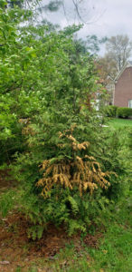
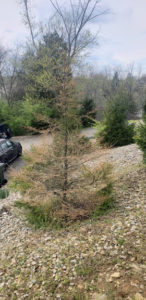
The other thing I am seeing this spring is dead Norway spruce trees and dead areas in arborvitae. Why? Remember the hottest September on record in 2019 and the hottest October day on record, along with a 30 day period with only 0.12 inches of rain? That heat and severe drought caused a lot of damage, some we are seeing and some which may subtly show up for years.

So, be aware when you see sickly looking plants that there is a reason, and the reason is likely at least in part meteorological.