The severe storms of April 8-9, 2020, prolifically produced tornadoes and straight line wind damage in the Cincinnati tri-state area. As of this writing, 12 tornadoes have been confirmed and areas of straight line wind damage have been identified.
Severe Weather Summary – April 8-9, 2020
- Straight Line Winds confirmed in Day Heights, Ohio
- Tornado confirmed near Newtonsville / Lake Lorelei, Ohio (EF0)
- Tornado confirmed near Edenton, Ohio (EF0)
- Tornado confirmed near Fayetteville, Ohio (EF0)
- Tornado confirmed near Blanchester, Ohio (EF0)
- Tornadoes confirmed in Gallatin and Grant Counties in Kentucky
- Tornado confirmed near Mount Olivet, Kentucky (EF0)
- Tornado confirmed near Mays Lick, Kentucky (EF0)
- Straight Line Winds confirmed in Highland County, Ohio
- Tornado confirmed near Versailles, Indiana (EF1)
- Tornado confirmed near Dillsboro, Indiana (EF0)
- Tornado confirmed near Falmouth, Kentucky (EF1)
- Tornado confirmed southeast of Dillsboro, IN (EF0)
- Tornado confirmed near Rising Sun, IN (EF0)
Additional areas of damage are still being looked at.
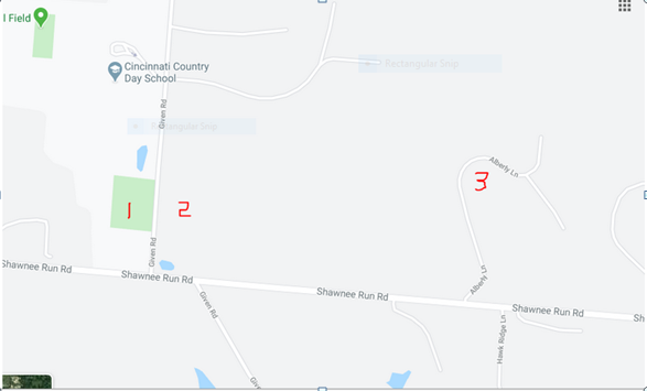
Over the past week, I have come across an area of extensive damage that stretches along the north side of Shawnee Run Road in the Village of Indian Hill, Hamilton County, Ohio. I have detailed 3 areas of known damage below. I included locations, photos, and my observations. I have not formed an opinion as to whether this is straight line wind or tornado damage. A colleague who did surveys of tree damage last year in the Dayton tornado related that, in his opinion as an ISA Board Certified Master Arborist, major tree damage seemed to begin in that tornado at wind speeds in excess of 90 mph. Of course, those tornadic winds were exerting twisting, torsion effects on those trees which are more severe biomechanically than a straight line wind would be.
Significant tree damage clean up is already underway.
My observations:

Map location 1: A farm on the west side of Given Road. A substantial barn suffered major structural damage with the roof partially removed and structural damage to the walls. Barn repair and clean up had not yet begun as of noon today. Nearby trees also suffered significant damage.
I was told Given Road was closed for several days due to downed trees, power lines, and downed and broken poles. The power lines have been restored.
Map location 2- East side of Given road. A number of trees down.
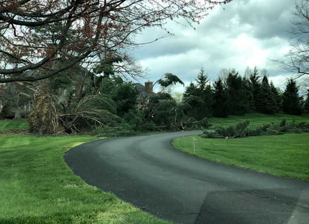
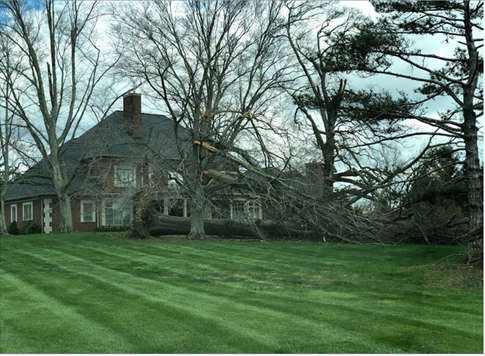
Map location 3- Multiple locations along Alberly Lane. Large trees uprooted, other trees snapped off above ground on several estates. I took the following photos along Alberly Lane last Friday. I believe much of this damage has now been cleaned up:

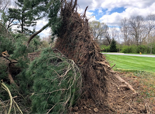
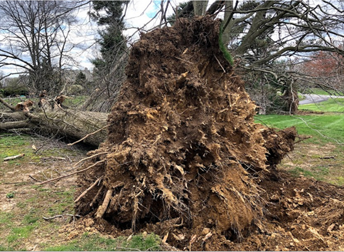
Large, apparently healthy white pine uprooted, taking with it a large volume of soil. Root system appeared well formed and healthy.

Close up of the root ball of the white pine. This was a massive, mature tree with a healthy root system. It took with it a large volume of soil.

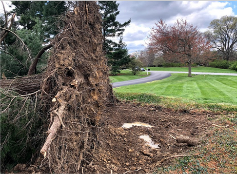
Another view of the soil pulled up by the uprooted pine. I did not measure it but it was over 20 feet across. Large, healthy roots were snapped.

Mature oak uprooted. Close examination of the root flare appeared to show a healthy root system with little apparent decay.

Close up of the root system of the uprooted oak. While pin and red oak commonly get root rot and decay in the tree base, I saw no signs of that in this tree. Many times these oaks fall over taking little soil with them. This tree took a large mass of soil. One root snapped which was over 4 inches in diameter.

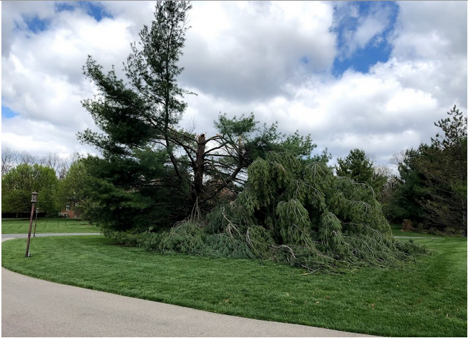
Mature white pine snapped off at about 20 feet above ground.
This article will be updated as additional information comes in.


