Hurricane Season 2020 is kicking into gear and Gulf of Mexico and Florida coasts may soon be under the gun.

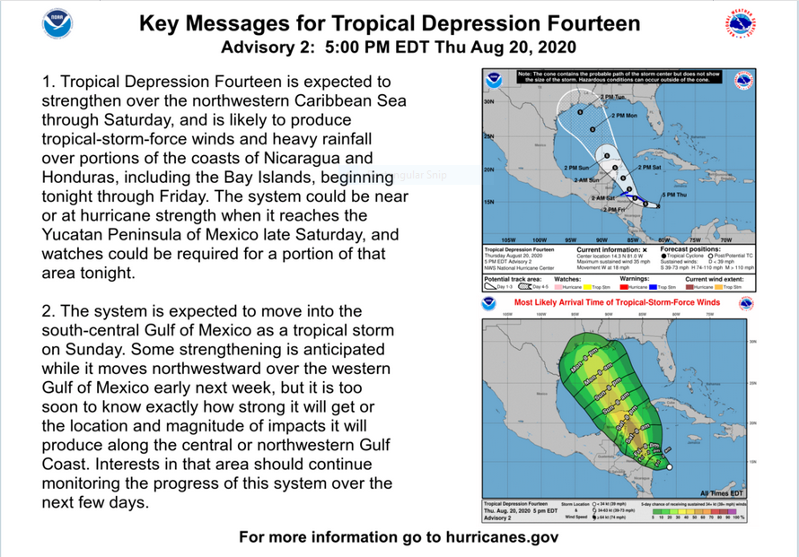
Late August and early September is the heart of hurricane season. This year the tropics are juiced and things are heating up. Tropical Depression 14 may be a hurricane as it approaches the Gulf Coast early next week.  Tropical Depression 13 has the potential to be menacing Florida and the Gulf Coast next week as well. And, there is more where those came from.

Hurricane season 2020 is on a record pace and the main show is just getting started. Not what many wanted to here but it’s just a fact.


Midwest Derecho – August 10, 2020. Maximum estimated winds were around 140 mph.

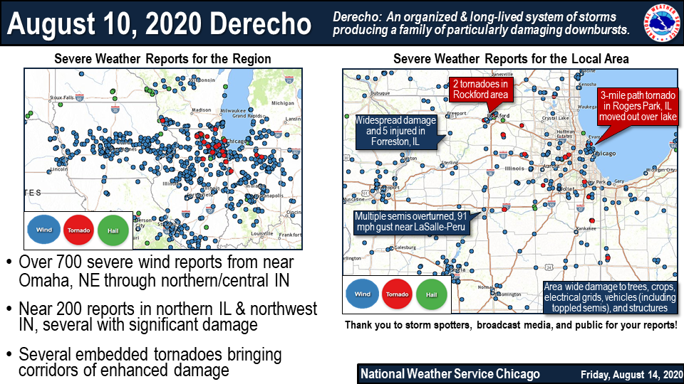
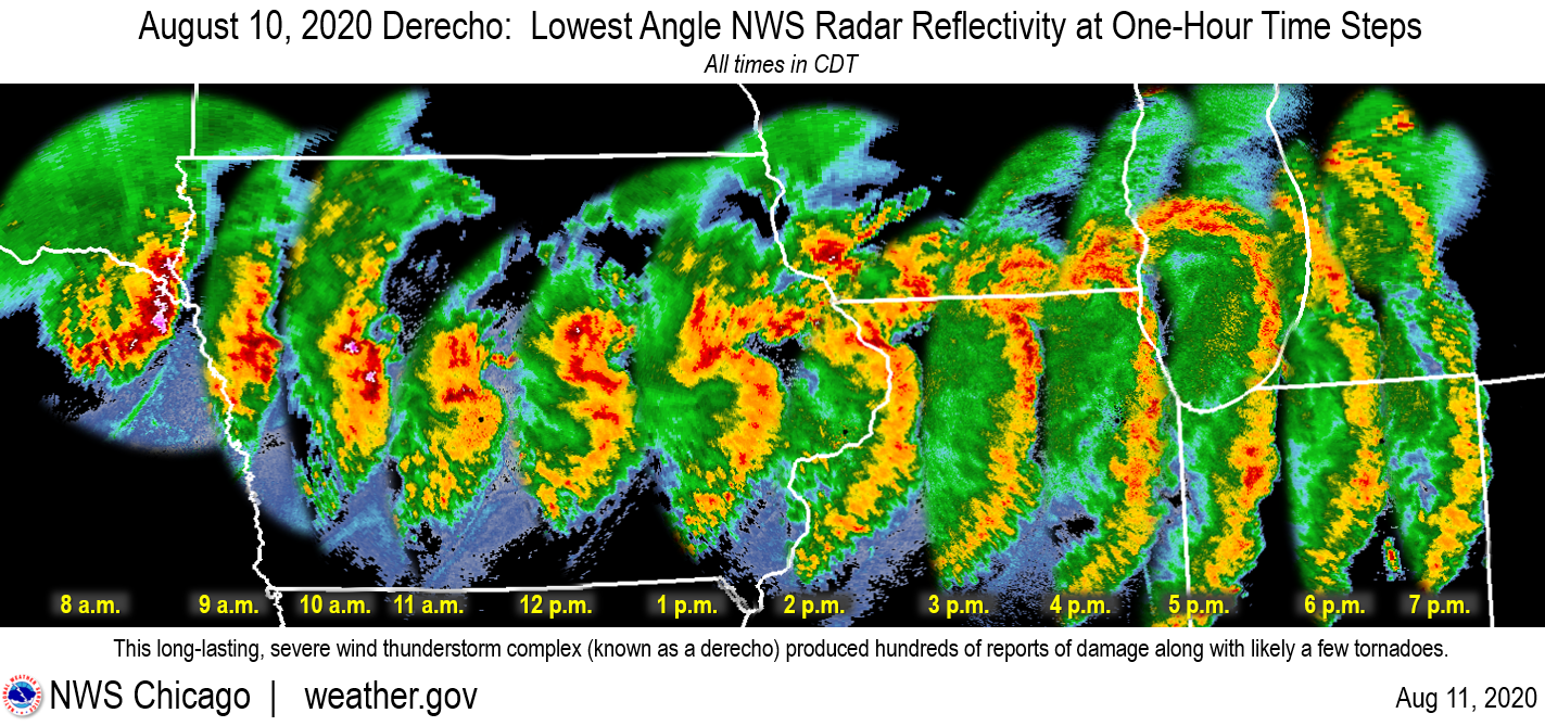
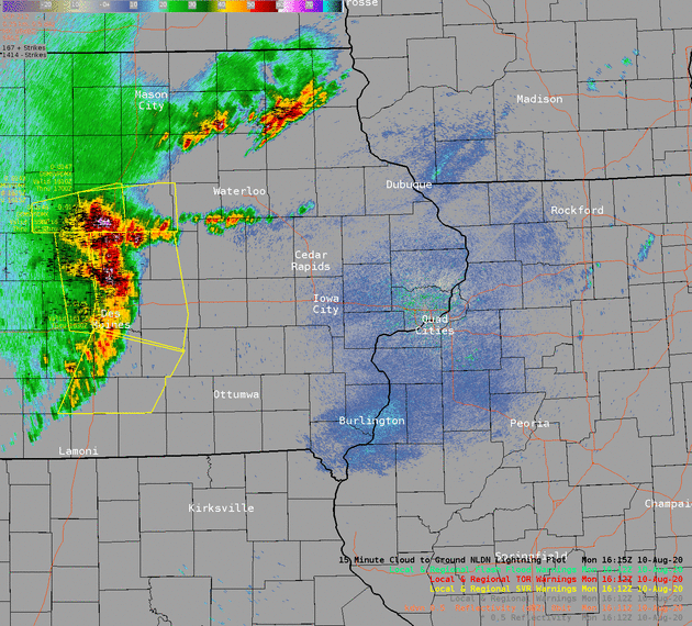
A powerful line of severe thunderstorms known as a “Derecho” tracked across eastern Iowa and northwest Illinois on the afternoon of Monday, August 10th producing widespread straight line wind damage. A swath of damage from Benton County, through portions of Linn, Jones, Cedar, and Clinton Counties, is consistent with intermittent straight line winds in the 100-130 mph range. Maximum estimated winds were around 140 mph, which caused extensive damage to an apartment complex in southwest Cedar Rapids, IA. Straight line winds of this magnitude are equivalent to an EF3 tornado. The maximum measured unofficial wind gust was 126 mph at Atkins, Iowa in Linn County.

Read more here>>>