
 –
–
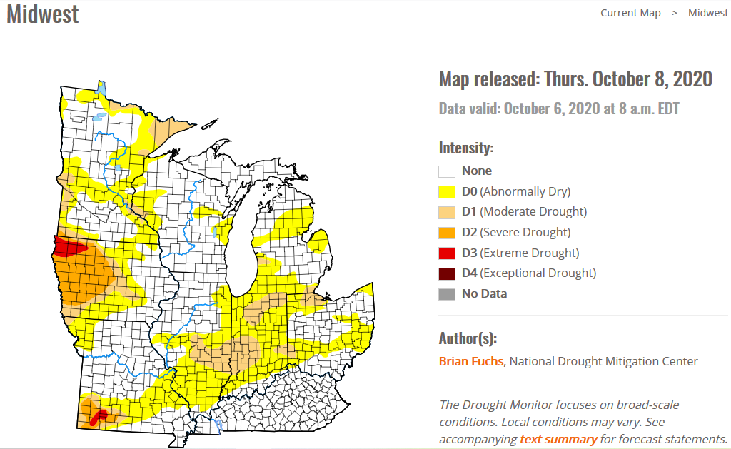
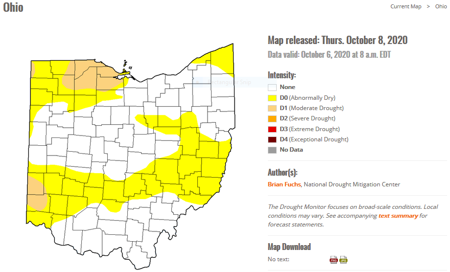
The latest drought monitor shows wide areas of drought in the western US, spreading eastward and encompassing parts of the midwest. There is serious drought in parts of New England. In Ohio, northwest Ohio has been in moderate drought and parts of southwest Ohio are now in moderate drought. National drought summary>>>
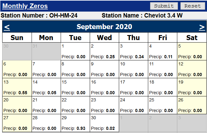
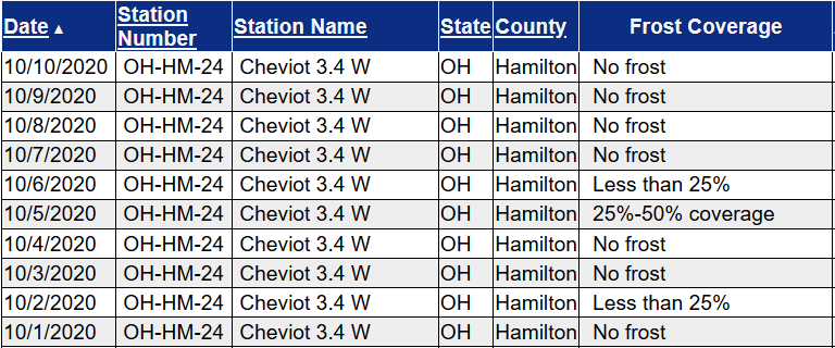
Station Number: OH-HM-24
Station Name: Cheviot 3.4 W
Report Date: 10/10/2020
Submitted: 10/10/2020 6:22 AM
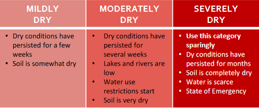
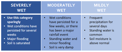
Scale Bar: Moderately Dry
Description:
Only 0.05 inches of rain to date in October. Soil here is dry and very dry in much of the area. Considerable drought stress in much of the area and worsening. Fall color is nearing peak in many locations, quite early. Rainfall here has been a bit more generous over the past couple months here than over much of the area. Despite that even here increasing drought stress is evident. Lawn here is still fairly green. Soil profile is dry. Dry conditions have persisted for weeks and drought conditions are becoming increasingly widespread. Lakes and rivers are low. Crops are brown or turning brown. Urgent need to provide supplemental water to landscape trees and shrubs, particularly in areas where rainfall was not as generous in the past few weeks.
Categories:
General Awareness
Agriculture
Business & Industry
Energy
Plants & Wildlife
Relief, Response & Restrictions
Society & Public Health
Water Supply & Quality
–
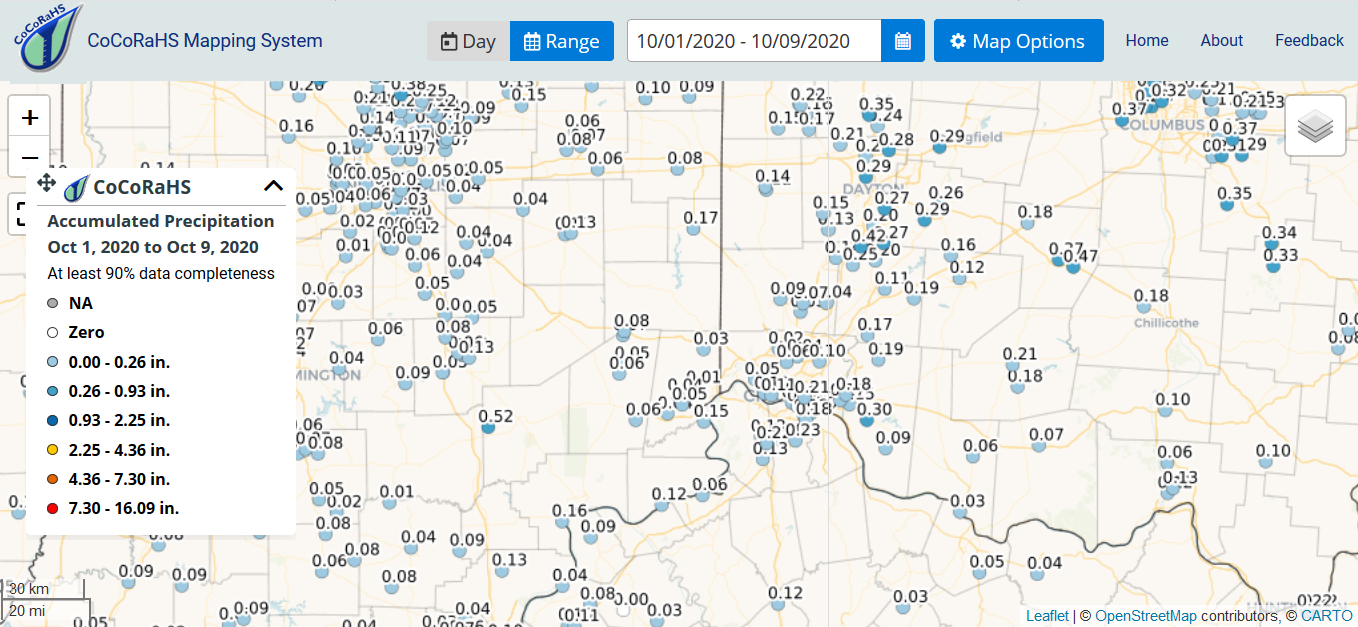
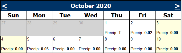
Map shows generally very low rainfall totals thus far in October in the mid-Ohio valley.
It’s dry and getting drier. Forecast calls for more dry weather in the coming weeks. Time to water! Please delay shutting down irrigation for the year.
–
–
This report is specifically for the Arbor Doctor’s location 3.4 miles west of Cheviot, OH, in the western suburbs of Cincinnati in southwest Ohio. This location is also an official cooperative observation site for the National Weather Service listed as Cheviot 3W.
What is the Condition Monitoring Report? See these links for more information:
Explanation of scale bar>>>
–
–
Search condition monitoring reports for the entire US>>> 
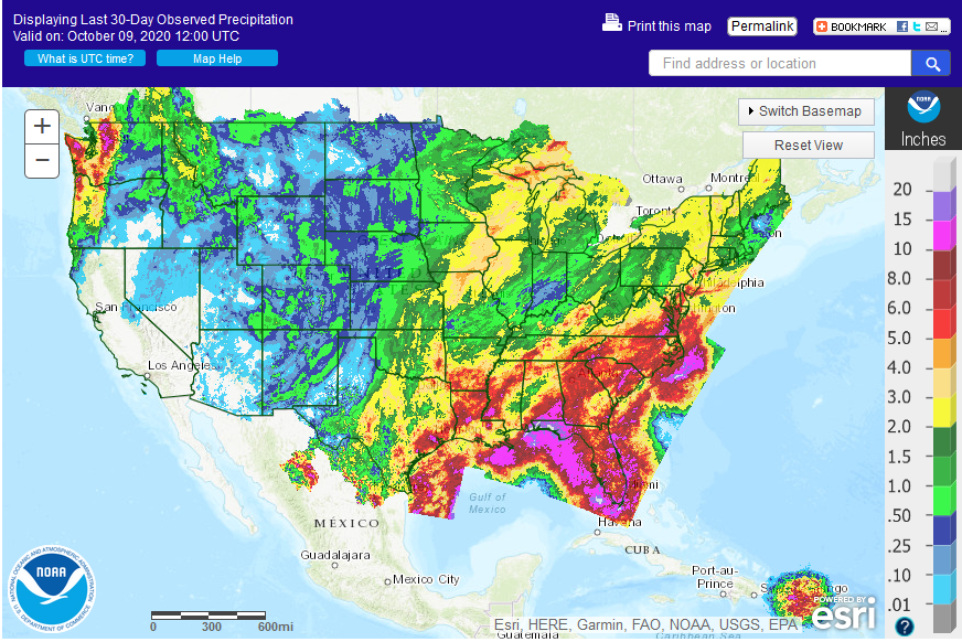
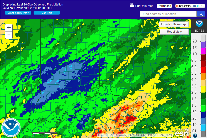
A large dry area has developed from southern Illinois into southwest and west central Ohio. Cincinnati/Hamilton County is in the center of this map.
Please remember to water…correctly!
Water once per week, one inch per week, under the entire branch spread, in the absence of rain, May through November. Either rainfall or your watering should equal the one inch per week. Put out a sprinkler and a straight sided soup can or rain gauge and measure one inch per week.
Drought: >>>
>>>
1-inch capacity rain gauge >>>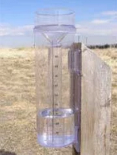
Taylor rain gauge >>>
Watering: How and when>>>
Watering Trees and Shrubs>>>
Soil Moisture Index:

Meteorological Versus Astronomical Seasons
Spring: March 1-May 31; Summer: June 1-August 31; Fall: September 1-November 30; Winter: December 1-February 28 (29)
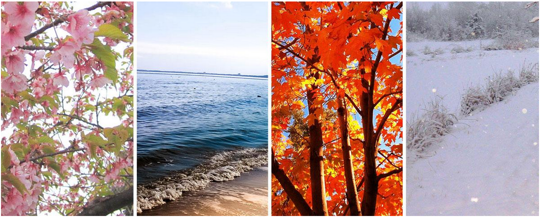
You may have noticed that Arbor Doctor, meteorologists and climatologists define seasons differently from “regular” or astronomical spring, summer, fall, and winter. So, why do meteorological and astronomical seasons begin and end at different times? Climatologically, the period July 14-21, the mid-point of meteorological summer, is the hottest week of the year and the period January 14-21, the mid-point of meteorological winter, is the coldest week of the year over much of the continental US including the Ohio valley.