
Station Number: OH-HM-24
Station Name: Cheviot 3.4 W
Report Date: 6/2/2018
Submitted: 6/02/2018 6:16 AM
Scale Bar: Near Normal
Description:
1.14 inches of rain in the past week, most in one thunderstorm. Temperatures much above normal with rapid drying rates and rapid growing degree day accumulation. Soil moisture trending toward dry early in the week before the rains came. Vegetation is lush and growing rapidly.
Categories: General Awareness
Agriculture
Plants & Wildlife
This report is specifically for the Arbor Doctor’s location 3.4 miles west of Cheviot, OH, in the western suburbs of Cincinnati in southwest Ohio. This location is also an official cooperative observation site for the National Weather Service listed as Cheviot 3W.
What is the Condition Monitoring Report? See these links for more information:
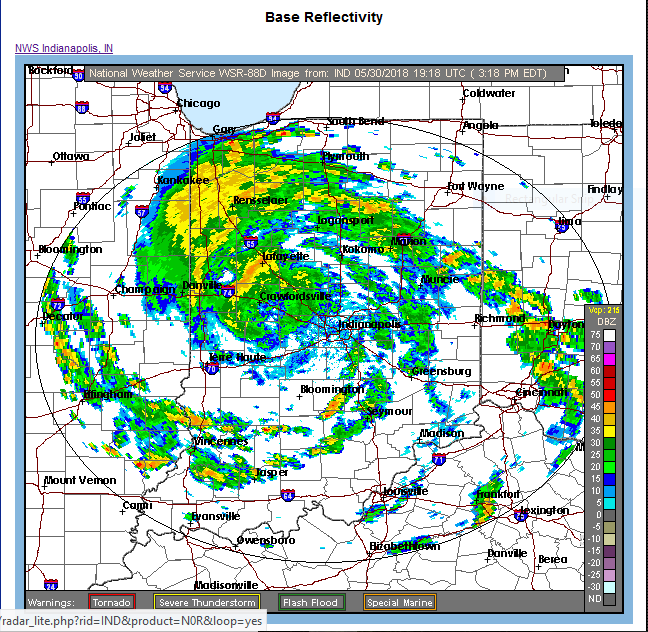
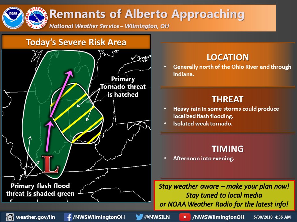

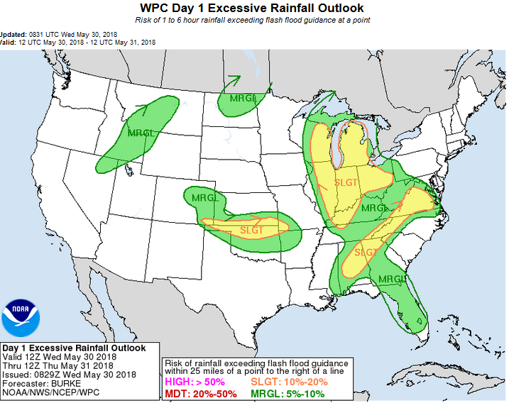 Today will not be a washout for most, but it could be in a few spots. Storms may fall repeatedly over the same spots, increasing flooding threats if that happens. The tornado threat, albeit slight, is real in this quadrant of an approaching tropical system, but any which develop should be weak and short lived.