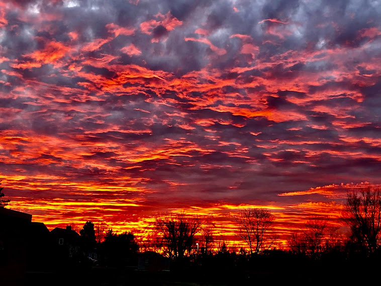
Spectacular December 27, 2020 sunset from Cheviot OH 3W
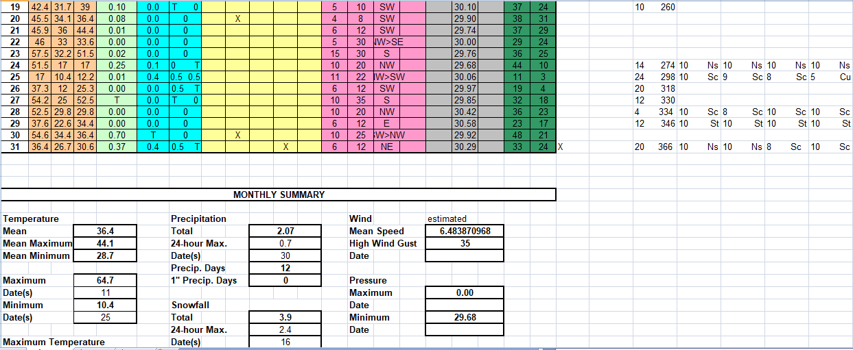
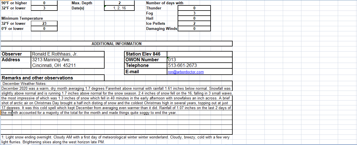
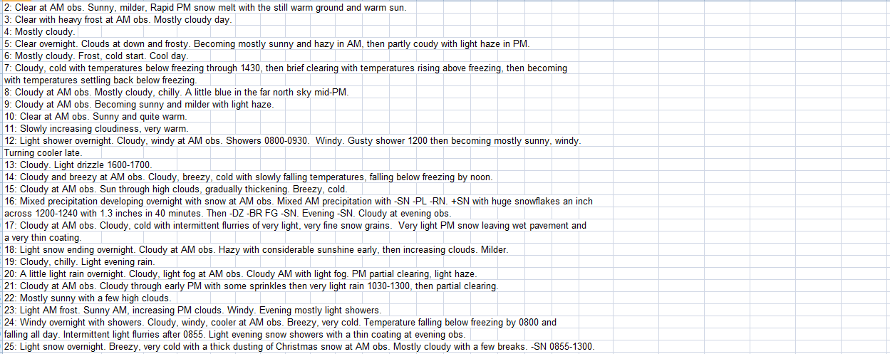
Regional Climate Report – December 2020>>>
December 24-25, 2020 — Christmas Eve/Day Snow>>>
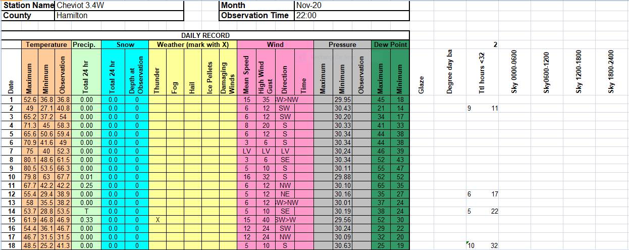
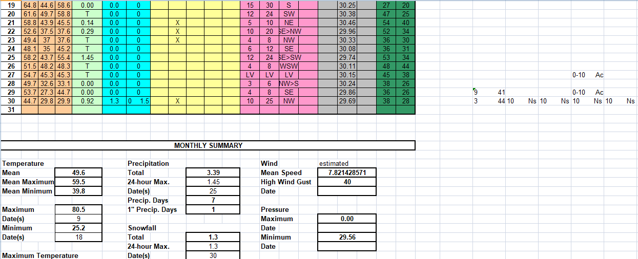
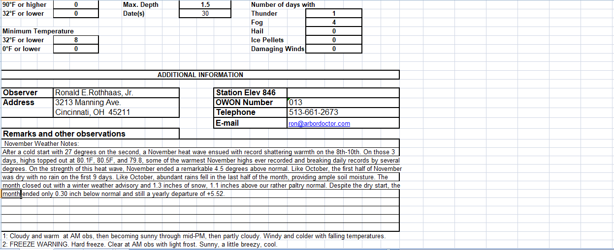
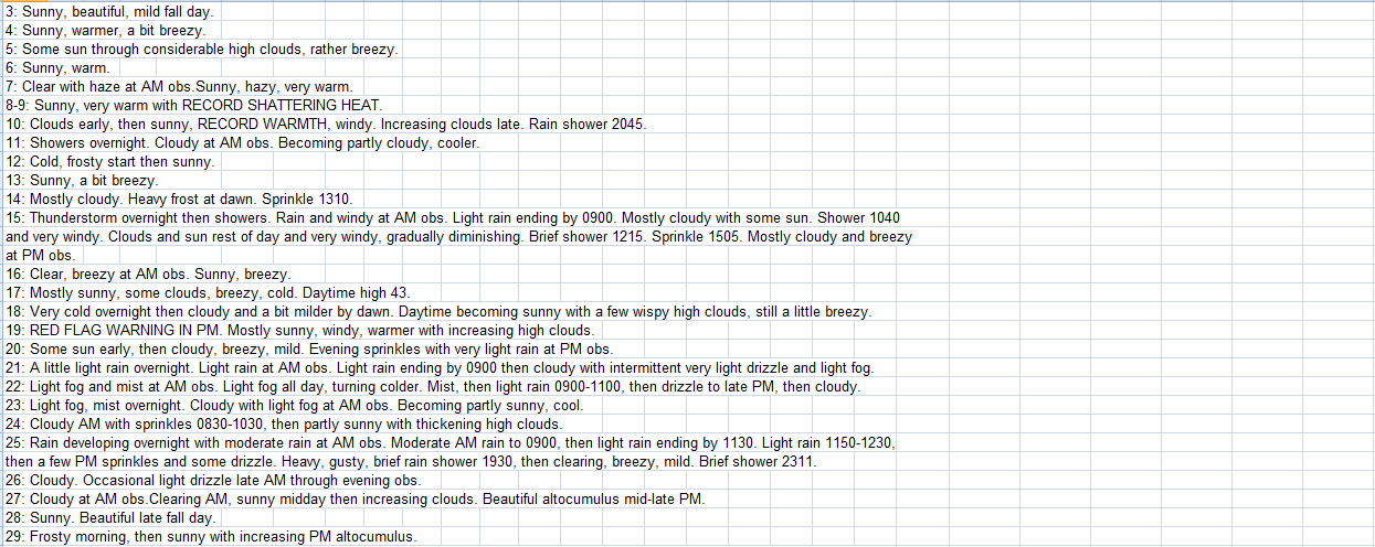
November 30 – December 1, 2020 — Early Season Snowfall>>>
A wet weather roller coaster as we say good riddance to 2020 and hello to 2021>>>
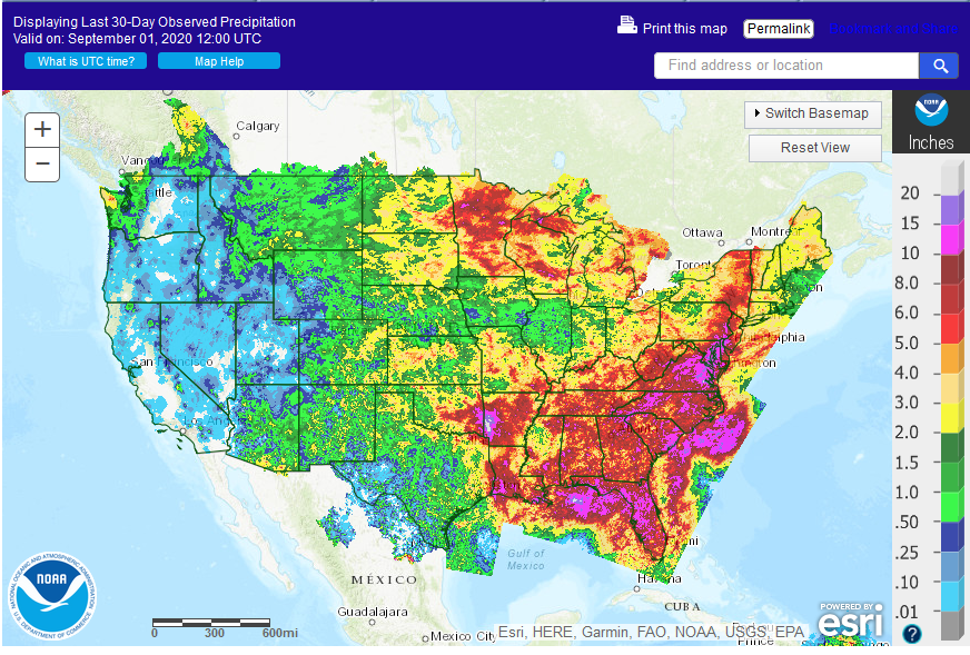
Soil Moisture, Drought, and Condition Monitoring. Western drought, drought in central Illinois and northwest Indiana, improving in much of the east. Near normal in Cincinnati>>>
Soil Moisture, Drought, and Condition Monitoring Western drought, drought in central Illinois and northwest Indiana, improving in much of the east. Near normal in Cincinnati>>>
Soil Moisture, Drought, and Condition Monitoring Worsening western drought, drought in central Illinois and northwest Indiana, improving in much of the east. Near normal in Cincinnati.>>>
Worsening western drought, improving in much of the east. Mildly wet at Cheviot OH 3.4W.>>>
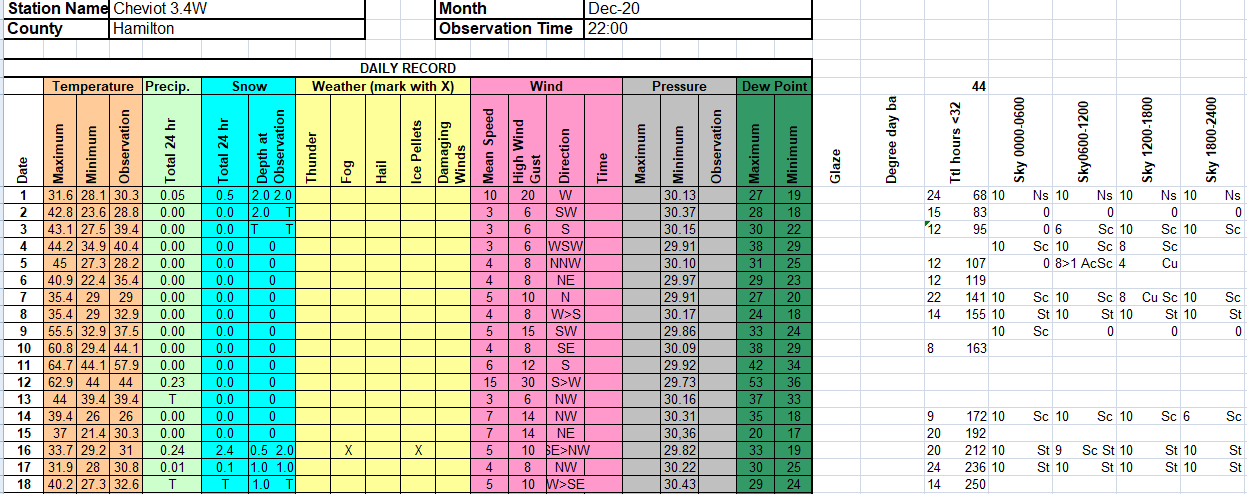

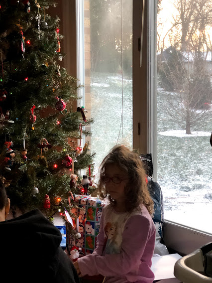 Opening gifts on Christmas morning with a half inch of Christmas snow on the ground and a temperature of 10 degrees Fahrenheit.
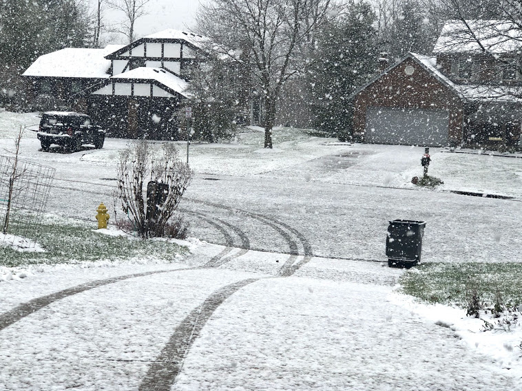
1.3 inches of snow fell in 40 minutes in the early afternoon of December 16 with snowflakes an inch across!
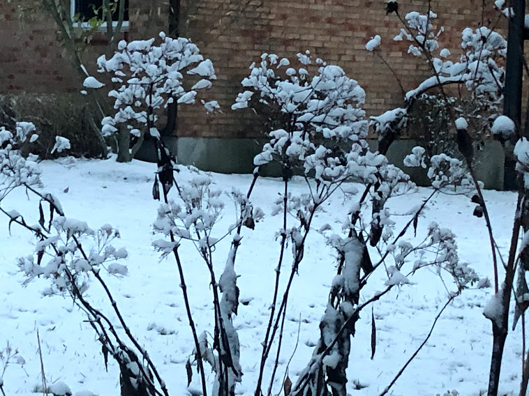 2 inches of snow covered the ground on the first day of meteorological winter, December 1.

