
It has been a warm and dry summer in much of Ohio. At my Cheviot, OH 3W National Weather Service Cooperative Observer location, June averaged 1.4 degrees Fahrenheit was above normal and July averaged 2.6 degrees Fahrenheit above normal. As of August 30, August was running 0.9 degrees Fahrenheit below normal. There have been 20 days of 90 degrees or higher at my location this summer, but only one in August.
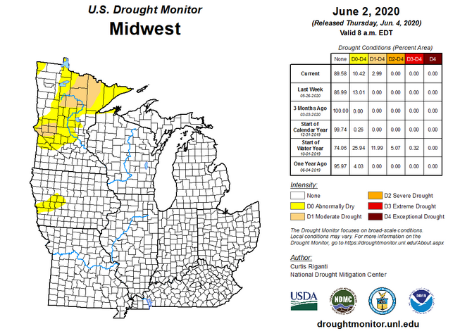
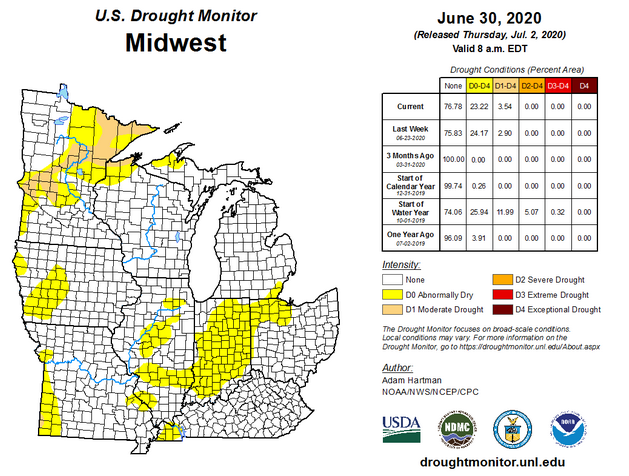
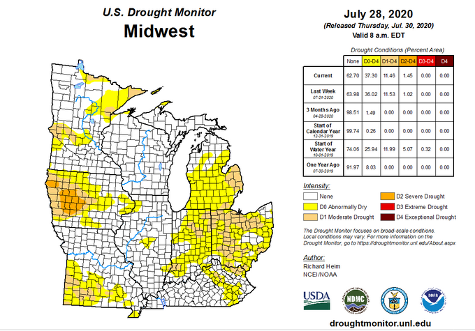
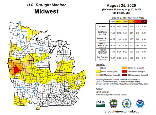
Meteorological summer started with very little drought over the midwest. Drought blossomed over parts of Ohio, Indiana and Iowa as the summer progressed, becoming extreme in western Iowa. A heavier rainfall pattern developed over the lower Ohio River valley keeping things pretty wet along and south of the Ohio River in Kentucky and southern Indiana in August. This was caused in part by cooler air masses which pushed into the Great Lakes and northern Ohio River valley, suppressing rain to the south but relieving the heat of July.
Looking ahead, it looks like a very active tropical season will continue the pattern, aiding in maintaining the pattern of spotty rain, more widespread in the south, and cooler temperatures at least over the first half of September in the Ohio valley. Areas with dry conditions or drought still appear to not be guaranteed relief.
Temperature Probability |