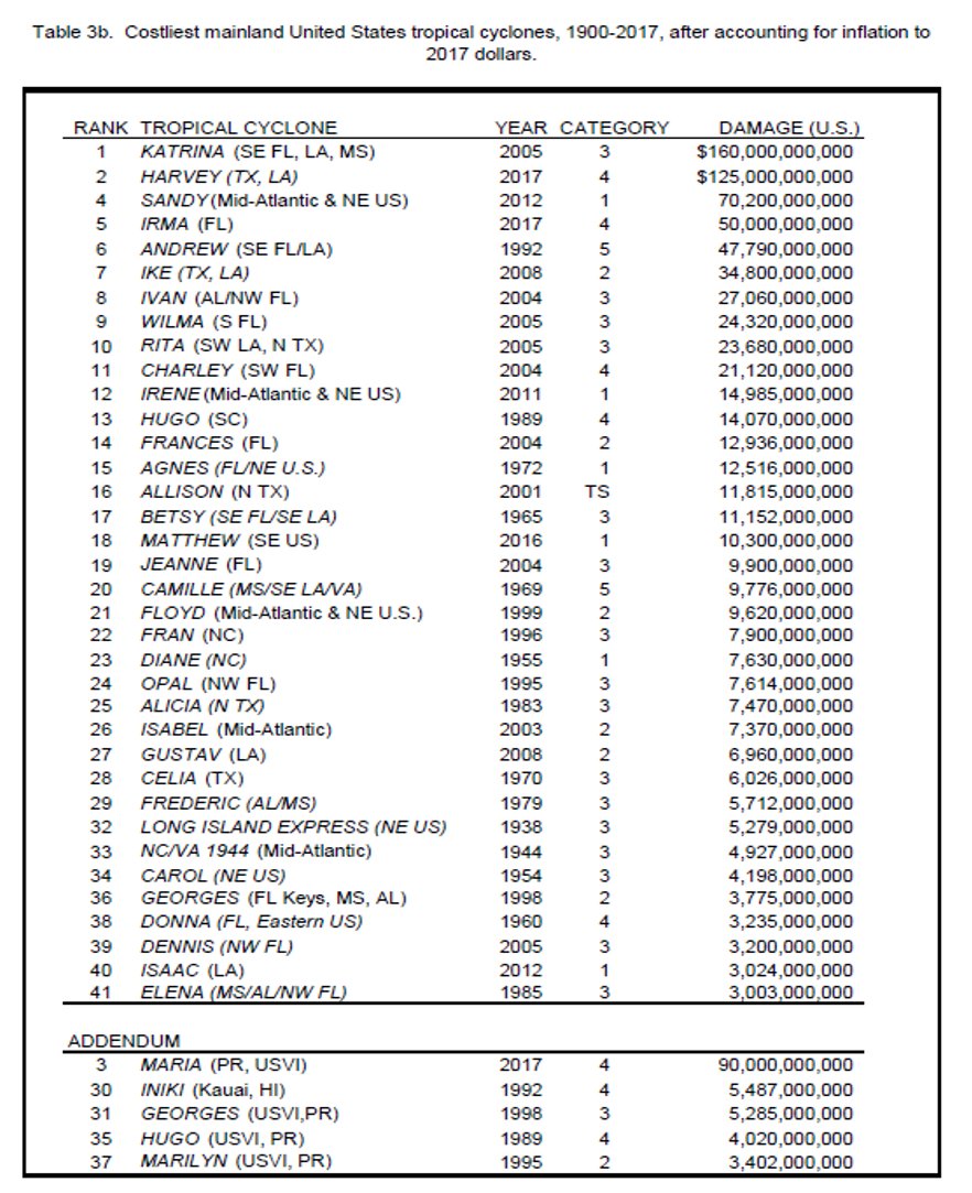
The @NOAANCEIclimate in collaboration with NHC has updated the listing of the costliest tropical cyclones to strike the U.S. with a new methodology through the 2017 #hurricane season. For more details see: https://www.nhc.noaa.gov/news/UpdatedCostliest.pdf … & https://www.ncdc.noaa.gov/billions/overview …
At first glance, it certainly appears that hurricanes are getting more destructive and costly in recent years. However, things are not always as they seem. Let’s look at it.
50 years ago, a hurricane making landfall had a pretty good shot at coming ashore on pretty undeveloped land. As the years have progressed, explosive development has occurred on our shorelines, and cities near the coasts have also blossomed and grown into huge metropolises. Therefore, the same hurricane, hitting the same desolate coastline 50 years ago, may very well be hitting a densely populated area today. It stands to reason that damage would be much higher today, and more costly with inflation.
Additionally, many poor decisions have been made by planners. Large areas of Houston which were always meant to flood in heavy rain were opened up to development. Not all of Houston flooded during this summer’s Harvey, but those developed flood areas sure did. The same goes for New Orleans. It is below sea level, and the dysfunctional government in that city did not take care of the infrastructure. The Weather Channel broadcast a what-if scenario several years before Katrina which pretty well simulated what happened.
None of this is to say that hurricanes absolutely are not getting stronger. They may be. They may not be. It is complicated. The only thing for sure is that those who claim it is settled science cannot be trusted.