Winter 2017-2018

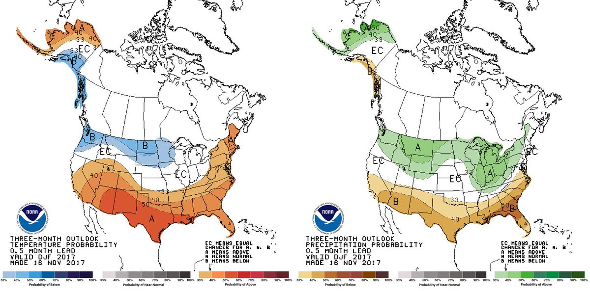
(This article was posted in December and is being kept up to see how we’re doing. As of early February, the beginning of the last month of meteorological winter, the temperature forecast is close, but with colder temperatures in the northeast. The precipitation forecast has not been as good. Yes, it has been dry in the south but the above normal precipitation in the Ohio valley is not verifying,)

Ready for ? Here is our latest and final DJF 2017-18 forecast. There are some subtle changes from previous months, but still heavily influenced by . Learn more…

Active Wintry Weather Pattern Continues This Week

From NOAA NWS Weather Prediction Center

The weather pattern across the U.S. will continue to be very active for the next 7 days as energetic low pressure systems will appear to march across the country one after another, thanks to a highly blocking pattern in the higher latitudes in the western hemisphere! The current storm which is bringing strong winds and heavy snow (even “thundersnow”) over the northern Plains to upper Midwest is expected to reach the East Coast on Wednesday and forecast to develop into another Nor’easter with significant impacts possible along the Mid-Atlantic coast into New England from late Wednesday into Thursday. Potential exists for heavy wet snow to fall along the coast along with high winds and storm surges! Looking further ahead, there is the potential for another Nor’easter forming near the East Coast late Sunday into early next week!

For latest updates: http://www.wpc.ncep.noaa.gov/#page=frt
Winter Weather Outlook: http://www.wpc.ncep.noaa.gov/pwpf/wwd_accum_probs.php

No automatic alt text available.