Meteorological winter is over. How’d we do?

Author:
March 22, 2018

I know it may seem a bit ridiculous to say that winter is over when the eastern half of the United States keeps getting repeatedly smacked by nor’easters. But from a meteorological perspective, winter lasts from December 1 – February 28. And it is over. Which can mean only one thing! It is time for the ENSO Blog’s annual post looking back at how NOAA’s Climate Prediction Center’s Winter Outlook did.

So for residents of the Northeast, I ask you to postpone shoveling out your car for 10 minutes, because it’s time to talk forecast verification. (I have an obsession, see here, here, here and here).  Read the blog post here>>>

Another Cold, Wet Period Likely In The East In Early April

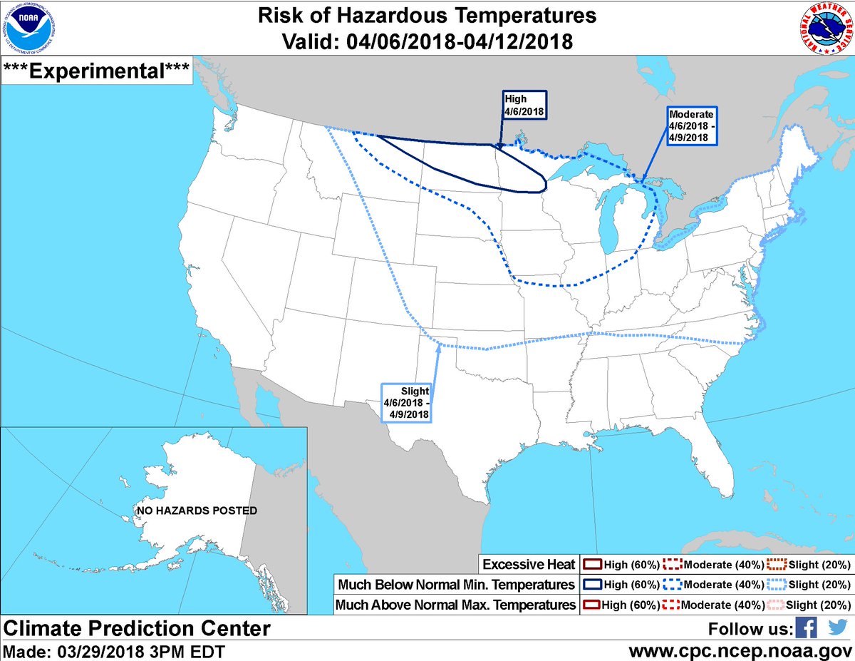
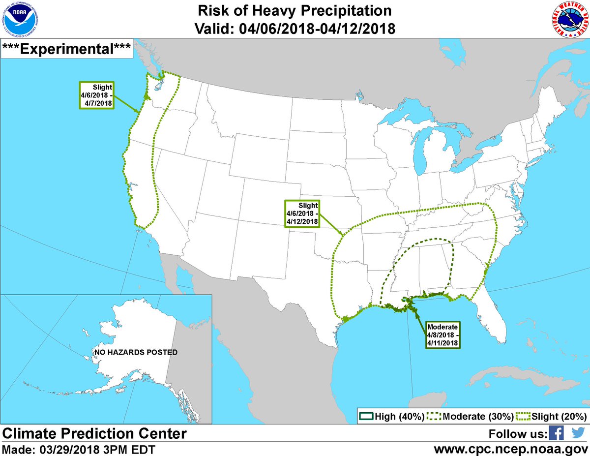
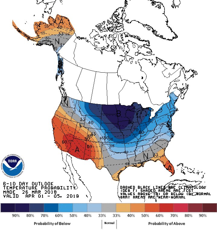
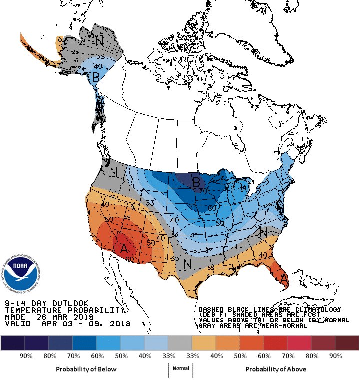
We are keeping an eye during April 6th through 12th on the potential for much below-normal temperatures from the Northern Plains through Midwest and heavy rains from the Mississippi River Delta through the Tennessee Valley.

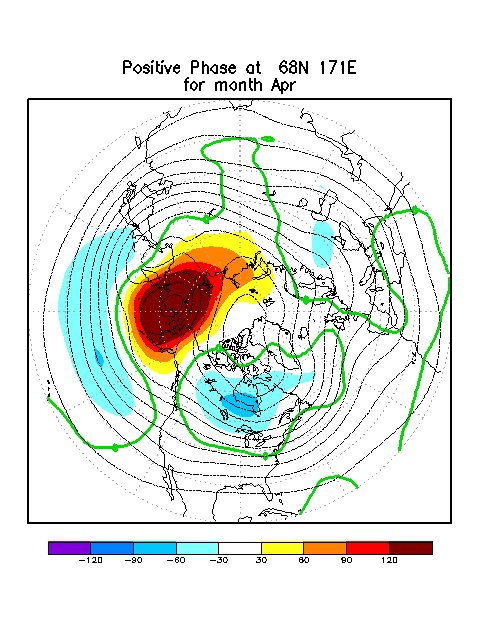
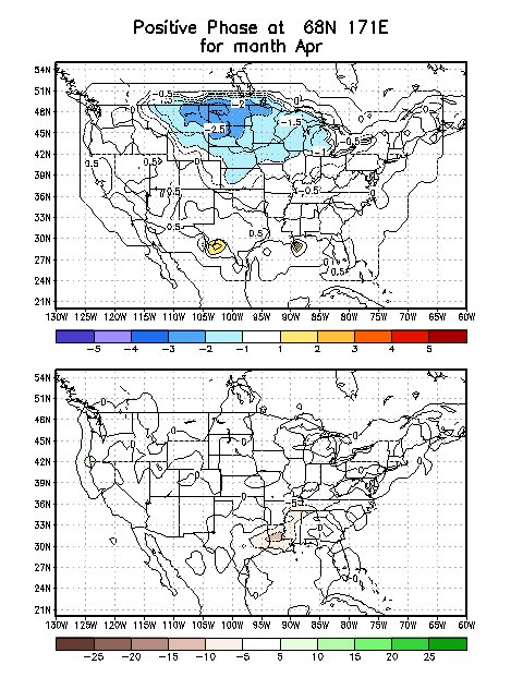
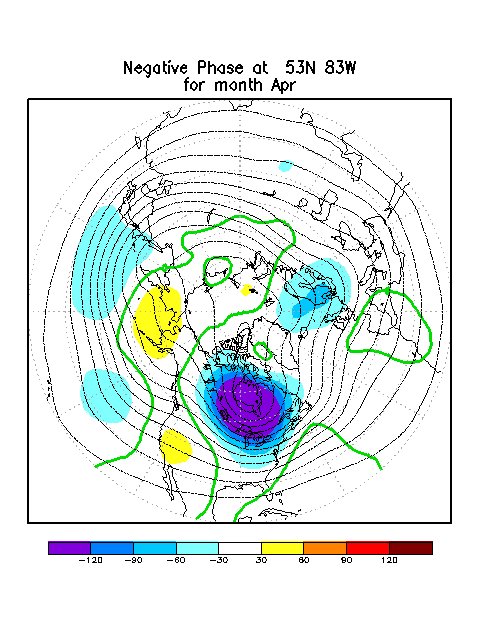
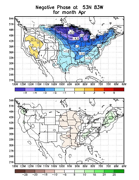
This potential is related to anomalous 500-hPa ridging forecast over the Bering Sea and a downstream trough over Hudson Bay that will likely help drive Arctic air southward. Typically observed temperature anomalies from this ridge/trough combination are shown here. (2/2)

We continue to favor below-normal temperatures and anticipate related -weather hazards stretching from the Northern Plains through Great Lakes during early April.

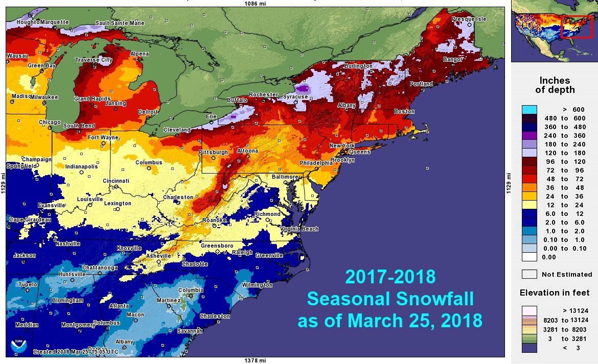
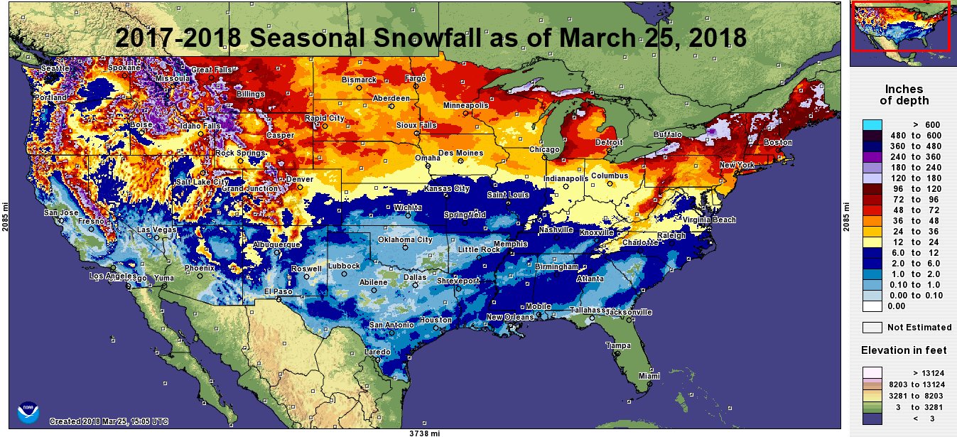
2017-2018 Eastern US Snowfall Totals as of March 25th

 We said Cincinnati would have snowfall which is closer to normal this winter but it would seem very snowy because the previous winter had so little snow. Looking closer at this winter’s snowfall, officially it was exactly normal in Cincinnati, thanks to a snowy March, but almost twice the snowfall of last winter!