
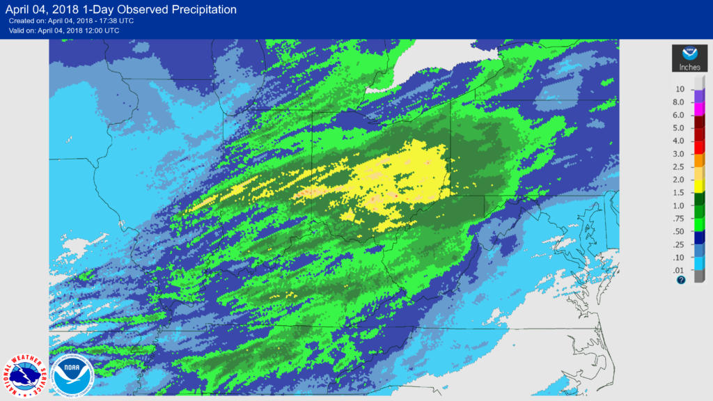
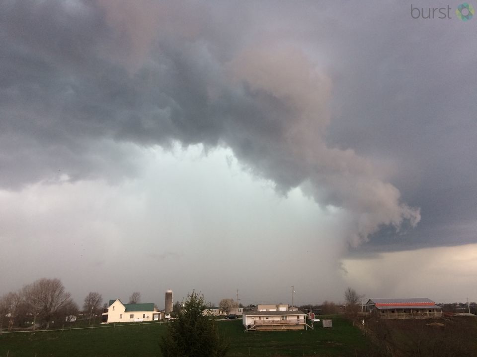
A weather system brought flooding rains, severe thunderstorms, damaging hail, and tornadoes to the Ohio valley on April 3, 2018. A summary from the Wilmington National Weather Service can be found here.
https://www.facebook.com/NWSWilmingtonOH/videos/1934814623256017/

[11:44 AM] Most of the area woke up on Monday with a fresh coating of snow on the ground. By Tuesday morning, rumbles of thunder likely woke some up as multiple rounds of heavy rain/thunderstorms created widespread flooding throughout parts of the area. By the afternoon, severe storms developed producing large hail, damaging winds, and even a few tornadoes. Last night and this morning, strong winds behind a cold front gusted in excess of 40 MPH and now much of the area is experiencing scattered snow showers with reduced visibility. Just another weather stretch in the Ohio Valley!
We’ve attached an animation of detected flashes from yesterday’s multiple rounds of storms — and as you can see, they were quite widespread and numerous. Lightning data is provided by Earth Networks and Vaisala.
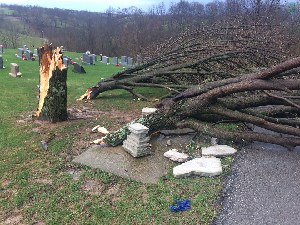


I see the typical wind damage to that pear tree. This particular type of pear tree breaks easily in the wind.
Pears do break easily. Arguably, whole tree destruction is more extreme than we typically see and would indicate a rather strong wind. The National Severe Storm Laboratory has an Enhanced Fujita scale (EF scale) review committee which now includes Dr. Bill Fountain of the University of Kentucky. Dr. Fountain is past vice president of the International Society of Arboriculture and is providing perspective on wind speed as it relates to breakage of different types of trees. Historically, the EF scale has just looked at hardwoods vs. conifers which is pretty general and does not account for variations such as you point out with pear.