Soil Moisture Condition Monitoring Weekly Report: Moderately Wet

Station Number: OH-HM-24
Station Name: Cheviot 3.4 W
Report Date: 9/15/2018
Submitted: 9/15/2018 6:18 AM
Scale Bar: Moderately Wet
Description:
 
3.78 inches of rain in the past 7 days, 9.27 inches in September.  No measurable rain in the past 4 days. Soil is still very damp. Ground is partially saturated with water. Standing water is finally drying up in low areas and ditches. Local plants, crops, or pastures are healthy and lush. Water bodies remain slightly more full than normal. Ohio River rose to within 5 feet of flood stage and, while it is now receding, it is still in the action stage category.
 
Categories: General Awareness
Agriculture
Plants & Wildlife

This report is specifically for the Arbor Doctor’s location 3.4 miles west of Cheviot, OH, in the western suburbs of Cincinnati in southwest Ohio. This location is also an official cooperative observation site for the National Weather Service listed as Cheviot 3W.

What is the Condition Monitoring Report? See these links for more information:

Explanation of scale bar>>>

Search condition monitoring reports for the entire US>>>

Soil Moisture Condition Monitoring Weekly Report: Severely Wet

Station Number: OH-HM-24
Station Name: Cheviot 3.4 W
Report Date: 9/8/2018
Submitted: 9/08/2018 7:43 AM
Scale Bar: Severely Wet
Description:
 
5.49 inches of rain in the first 8 days of September, 12.96 inches of rain since August 1. Ground is completely saturated with water. Standing water is severe and abundant. Water bodies are very elevated. Significant flash flooding over the past week in the area. Heavy rains are ongoing. Wettest I have ever seen in late summer/early meteorological fall. Flooding may be leading to plant, crop, or pasture damage.
 
Categories: General Awareness
Agriculture
Plants & Wildlife

This report is specifically for the Arbor Doctor’s location 3.4 miles west of Cheviot, OH, in the western suburbs of Cincinnati in southwest Ohio. This location is also an official cooperative observation site for the National Weather Service listed as Cheviot 3W.

What is the Condition Monitoring Report? See these links for more information:
Explanation of scale bar>>>

Search condition monitoring reports for the entire US>>>

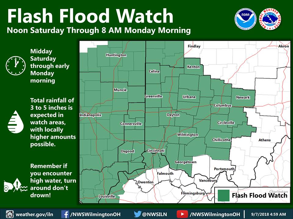
Flash Flood Watch. 3-5 Inch Deluge Forecast.

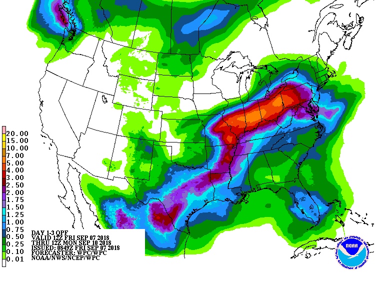
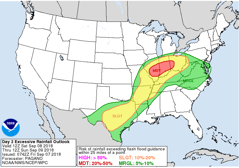
A flash flood watch has been issued for most of the local area (green-highlighted counties). Total rainfall of 3 to 5 inches will be possible in the watch area from Saturday through early Monday morning as remnants of Gordon track through the Ohio Valley. Rises on area creeks/streams/rivers are also expected this weekend into early next week!

Arbor Doctor Ron Rothhaas’s location of Cheviot OH 3W has had 12.00 inches of rain since August 1, as of 7:00 AM on Friday, September 7. The soil is already completely saturated and additional rainfall of this amount will likely cause significant runoff and flooding.